Around the Bizkartzun Redoubt

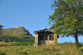
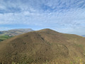
A circular route offering the chance to climb Bizkartzun, the iconic peak of the Saint-Jean-de-Luz hinterland, before exploring the hills and valleys near Saint-Pée-sur-Nivelle, which feature steep sections best tackled in dry weather. You can enjoy a beautiful view of Bizkartzun, followed by a peaceful atmosphere amidst a rolling, bucolic landscape.

Details

18088057
Creation:
Last update:
Last review:
  • Walking
    Activity: Walking
  • ↔
    Distance: 6.20 mi
  • ◔
    Average duration: 3h 45 
  • ▲
    Difficulty: Moderate

  • ⚐
    Back to start: Yes
  • ↗
    Ascent: + 991 ft
  • ↘
    Descent: - 984 ft

  • ▲
    Highest point: 751 ft
  • ▼
    Lowest point: 20 ft

Description of the walk

In the village of Ascain, park in the car park by the Roman bridge.

(S/E) Cross the bridge over the stream next to the car park and continue north-east along the ascending road, Route d’Errotenea. Follow it until you reach a right-angle bend and turn right. Then take thethird street on the left onto Chemin de Karrika Zaharra. Follow it until you reach a junction with the Chemin de Martikonea. Turn right and, about a hundred metres further on, you’ll come to the start of a footpath on your right.

(1) Continue along this path and cross the stream called Uzkaingo Erreka twice.

(2) Cross the stream again. Follow the path as it winds alongside the stream, cross it again a little further on, then continue uphill. Pass a path junction on the left and you’ll soon reach a crossroads.

(3) Turn left towards Birkatzun. Once at the summit, carry on straight ahead along the path that leads down.

(4) Turn off onto the path on the left towards Martinhaurrenborda farm, a building made of cut stone. Continue to the left for about a hundred metres, then turn right onto a wide path which, further on, makes a 90° bend to the right.

(5) Immediately afterwards, turn 180° to the left onto a path that runs alongside a fenced-off field. Continue to a junction.

(6) Carry on to the left. The path crosses the Uzkaingo Erreka stream, then bends to the left to run alongside it. Make sure you keep heading in the same direction, as close to the stream as possible.

(7) Turn left and continue alongside the stream, crossing it twice more before rejoining the original path.

(2) Turn left onto the path, heading in the opposite direction to the way out, and make your way back to the car park by crossing the Errotenea housing estate (S/E).

Waypoints

  1. S/E : mi 0 - alt. 20 ft - Car park by the Roman bridge
  2. 1 : mi 1.04 - alt. 89 ft - Start of the trail
  3. 2 : mi 1.28 - alt. 89 ft - Uzkaingo Erreka stream
  4. 3 : mi 1.65 - alt. 236 ft - Change of direction
  5. 4 : mi 2.2 - alt. 423 ft - Fork in the road, turn left – Esnaur
  6. 5 : mi 2.87 - alt. 751 ft - Turn left at the fork
  7. 6 : mi 3.49 - alt. 279 ft - Junction, turn left
  8. 7 : mi 4.45 - alt. 187 ft - Junction, turn left
  9. S/E : mi 6.2 - alt. 20 ft - Car park by the Roman bridge

Notes

There are a few steep sections that may be wet and slippery, particularly the path leading up to Bizkartzun and beyond (6). Take care if it has rained recently.

Worth a visit

Paths winding through secluded valleys.
There are still Pottoks living in the hills.

Reviews and comments

4.6 / 5
Based on 3 reviews

Reliability of the description
4.7 / 5
Ease of following the route
5 / 5
Route interest
4 / 5
User 5704894

Overall rating : 4.3 / 5

Date of your route : Aug 07, 2026
Reliability of the description : ★★★★☆ Good
Ease of following the route : ★★★★★ Very good
Route interest : ★★★★☆ Good
Very busy route : No

Hike undertaken on 7 August in bright sunshine.
No shade until the end of the route and a significant climb on the first ascent.
Point 5 was inaccessible due to brambles and other obstacles… so we extended the route by taking a path further on
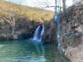
It’s a shame that the waterfall visible at the end
of the route wasn’t mentioned

Machine-translated

arskarm@livefr
arskarm@livefr

Overall rating : 4.7 / 5

Date of your route : Aug 12, 2024
Reliability of the description : ★★★★★ Very good
Ease of following the route : ★★★★★ Very good
Route interest : ★★★★☆ Good
Very busy route : No

A very difficult descent with a very steep gradient on earthy ground

Machine-translated

GERMAINY
GERMAINY

Hello Dreyg6
You’re right, the description doesn’t make it clear enough that there are some very steep slopes.
I’ll sort that out.
Thank you for your feedback
And I’ll change the difficulty rating from ‘easy’ to ‘moderate’ as a result.
Have a good day

Machine-translated

Dreyg6
Dreyg6

Overall rating : 4.7 / 5

Date of your route : Aug 08, 2022
Reliability of the description : ★★★★★ Very good
Ease of following the route : ★★★★★ Very good
Route interest : ★★★★☆ Good
Very busy route : No

This walk is classified as ‘easy’, but it’s not quite as straightforward as that. The elevation gain is minimal but is spread across three very steep climbs, so take care. Some of the descents are also very steep and difficult to navigate. We did this walk in dry weather, but the descents were still extremely slippery. We saw some walkers struggling. So even though the description suggests an easy walk (little elevation gain, few kilometres), be wary as some sections are quite technical and the ascents and descents, whilst few in number, are extremely steep.

Machine-translated

Other walks in the area

For more walks, use our search engine .

The GPS track and description are the property of this route's author. Please do not copy them without permission.