Country:

 City:
City:


Park in the car park in the village of Mussy-sous-Dun, which is located after the railway line on the right.
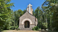
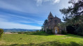
(S/E) Turn right towards the church. Go round the building by turning left and continue to a T-junction.
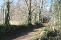
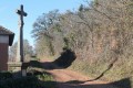
(1) Leave the tarmac and follow a steep path heading due north. After 300m, take a short detour to the left to admire the statue of the Madonna standing amongst the fir trees to the south-west.
(2) Turn back and continue the climb towards the junction at the 494m mark.
(3) Turn right onto the ridge, then left towards L’Aye, arriving at a junction (altitude 550m).
(4) Continue left, heading north then west, and enter the forest. Keep heading in this direction and reach the crossroads before the hamlet of Le Ry (view of the houses).
(5) At the T-junction, head north up the path on the right. Near the 614m mark, turn right (south-southeast) onto the ridge path. Ignore two turn-offs on the right and head towards Dunet.
(6) Turn left onto the tarmac road. Walk alongside the pond on the left and head for Borcelle du Haut (altitude 590m) by turning right.
(7) At the junction, turn right (north), walking behind the house and through the forest to reach Pierre-qui-Vire.
(8) Turn right into the Douglas fir forest (the entire southern section of which was felled in December 2017). Reach a fork in the hazel trees (altitude 690m).
(9) Turn left then right to visit Montagne de Dun (710m), with the Chapelle de Dun situated in the commune of Saint-Racho. You can also continue to the right then turn left to reach the summit.
(10) This former fortress, now in ruins, was the scene of epic battles. Take a moment to look at the two information boards before beginning the descent.
Turn right onto the fairly steep tarmac road (elevation 690m), heading south, and reach the Dunet crossroads.
(6) Head down towards the east (to the left) for about 300m to reach the forest track.
(11) Turn right onto it to reach the hamlet of L'Aye, which you passed through earlier.
(4) Go straight on to follow the route of the outward journey to the junction at elevation 494.
(3) Leave the outward route on your left and turn right. Then turn left to reach Les Mathys and the first junction.
(1) Complete the route by following the outward route back to the car park (S/E).



 Visorando Member

 Tourist office
 Easy
Easy