The ‘Sentier des Charmes’ trail in Saint-Sauveur de Bergerac

This walk allows you to explore one of the village’s walking routes, taking you through the forest, past the vineyards and along a quiet road. You can continue on to other routes from the Town Hall Square.
Yellow markings.

Details

n°18067921
Creation:
Last update:
Last review:
  • Walking
    Activity: Walking
  • ↔
    Distance: 1.90 mi
  • ◔
    Average duration: 1h 00 
  • ▲
    Difficulty: Easy

  • ⚐
    Back to start: Yes
  • ↗
    Ascent: + 108 ft
  • ↘
    Descent: - 108 ft

  • ▲
    Highest point: 404 ft
  • ▼
    Lowest point: 266 ft

Photos

Description of the walk

The route starts from the Place de la Mairie in the village centre, where parking is available.

(S/E) Go down the steps at the foot of the local information board, then turn left onto Rue Traversière. 50 metres further on, on the D21, turn right and continue for 300 metres.

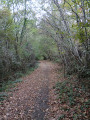
(1) Opposite the fire hydrant, turn right onto the forest track. You will be passing through private property and must not stray from the track. Continue straight on until you reach the Route de Gaffan.

(2) At the Route de Gaffan, turn left (be careful – at first glance, the signage may suggest turning right), then, after 30 metres, turn right, along the meadow, following a hedge.
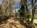
When you reach the edge of the forest, follow the path that branches off to the left.

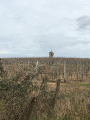
(3) At Chemin des Péyrières, turn right up the hill, then continue along Impasse du Terme de la Roque, pass the restored wayside cross and carry on straight ahead along the Route de Gaffan until you reach the village, which is visible. Pass the vineyards on your right.

(4) At the ‘give way’ sign at the entrance to the village, turn right and then immediately left onto the path leading to the Place de la Mairie (S/E).

Waypoints

  1. S/E : mi 0 - alt. 344 ft - Place de la Mairie
  2. 1 : mi 0.29 - alt. 384 ft - Fire hydrant
  3. 2 : mi 0.83 - alt. 354 ft - Route de Gaffan
  4. 3 : mi 1.28 - alt. 266 ft - Chemin des Péyrières
  5. 4 : mi 1.78 - alt. 328 ft - ‘Give way’ sign
  6. S/E : mi 1.9 - alt. 341 ft - Place de la Mairie

Notes

(S/E) Toilet facilities are available under the covered area on the Town Hall Square, with a running water tap.
A defibrillator is mounted on the wall of the village hall on the square.
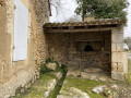
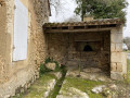
The covered courtyard provides shelter.

Worth a visit

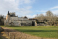
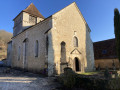
(S/E) The village church has been restored. It’s well worth a visit.
The Town Hall Square is beautifully decorated with flowers and features a huge tree.
The nearby restaurant is a good place to stop for a bite to eat.

(3) A restored wayside cross at the corner of the Route de Gaffan.
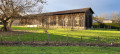
(4) There’s a lovely view of the vineyard-covered hillside and the dovecote.

Picnic tables are set up under the trees in front of the village school.

Reviews and comments

5 / 5
Based on 1 review

Reliability of the description
5 / 5
Ease of following the route
5 / 5
Route interest
5 / 5
Michelg78
Michelg78

Overall rating : 5 / 5

Date of your route : Sep 16, 2022
Reliability of the description : ★★★★★ Very good
Ease of following the route : ★★★★★ Very good
Route interest : ★★★★★ Very good
Very busy route : Yes

Perfect. A very enjoyable route.

Machine-translated

Other walks in the area

For more walks, use our search engine .

The GPS track and description are the property of this route's author. Please do not copy them without permission.