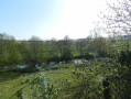
The Upper Parish at La Renaudière

Starting from La Renaudière, set off into the heart of nature along pleasant, shaded paths.
As you wander the paths, discover a rich and varied natural heritage and the hidden treasures of rural cultural heritage.

Details

34944996
Creation:
Last update:
Last review:
  • Walking
    Activity: Walking
  • ↔
    Distance: 11.22 mi
  • ◔
    Average duration: 5h 20 
  • ▲
    Difficulty: Moderate

  • ⚐
    Back to start: Yes
  • ↗
    Ascent: + 167 ft
  • ↘
    Descent: - 167 ft

  • ▲
    Highest point: 358 ft
  • ▼
    Lowest point: 289 ft
  • ⚐ Country: France
  • ⚐ City: La Renaudière (49450)
  • ⚑
    Start/End: N 47.122027° / W 1.063102°
  • ❏
    IGN map(s): Ref. 1323SB, 1324SB, 1423SB, 1424SB
  • Hour-by-hour weather

Photos

Description of the walk

From Sèvremoine, take the D63 towards Tillières, then the D147 towards La Renaudière. Park in the car park at the Étang des Noues.

Green signposting

(S/E) Leave the car park and head right towards Rue du Stade. Turn right and walk until you reach the junction with the RD63.

(1) Carefully first turn right then left onto the Chemin de la Gagnerie until you reach a bend.

(2) Carry on straight ahead onto a path that descends through the woodland and leads to a junction.

(3) Carry on straight ahead, then turn left for 200 metres, then right across the fields, until you reach the Landreau industrial buildings on your left.

(4) Turn left onto Rue du Landreau, then left again at the ‘give way’ sign. At the next ‘Stop’ sign, cross the road and continue to the Chapelle Saint-Joseph du Chêne.

(5) Turn left at the chapel. Turn left onto the first street (Rue de la Faucherie). At the roundabout, turn left, then, opposite, take the second roundabout. You’ll come to a meadow.

(6) Turn right. At the end of the field, veer left and head into the woods. Then take the path on the right to reach the Case d’Enfer. Carry on straight ahead until you reach the next tarmac road, called La Bonne Marie, then you’ll come to a junction with the path called La Petite Bellevue.

(7) Outside the hunting season, turn left, then right 200 metres further on, at La Louisiane. Carry on straight ahead (ignore any paths to the left or right) until you reach the village of La Nouzillerie, whose houses are situated beyond a wood. (During the hunting season, turn right and continue for about 950 m, then take the small dirt track on the right, opposite the isolated house after the Route de l’Aulnay Martin).

(8) Turn right and follow this path to the Étang de la Thévinière. At the next T-junction, turn right again to cross a stream.

(9) Continue straight on until you reach La Foye Moreau. When you reach the street of the same name, keep to the right until it ends.

(10) Turn left onto Route la Mailladière to reach the village of Villedieu-la-Blouère. Stay on this road until you reach the sports centre. Pass the first junction and you’ll come to a second one with Rue Johannes.

(11) Turn left, then carry on straight ahead along Rue du Christ Roi, at the junction marked by a cross. Where the street ends at the D762, take the small path opposite, heading towards the lake, and carry on straight ahead.

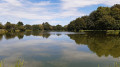
(12) Walk round the Étang des Lavandières, skirting its northern and eastern sides, then follow a second pond, continuing straight on along the same bank. At the junction on the other side, turn right and join a street. Keep left here, then continue straight ahead. Go straight on at the first two junctions, then turn left at the third to reach Rue du Grand Chêne and follow it to the right until you reach Rue des Mauges.

(13) Turn left, then right after the ‘La Genoise’ factory onto Rue des Brosses. Ignore the first cul-de-sac on the left, then you’ll come to a T-junction.

(14) Turn onto the track leading away from the houses and follow it to rejoin the path you took on the way there, at Landreau.

(4) Turn left and return to (3) via the same route you took on the way there.

(3) Turn left and go round the lake to reach the hamlet of La Bondussière. On leaving the village, turn left until you reach the T-junction.

(15) Turn right to join the RD63.

(16) Turn right and walk carefully along the road before taking the first path on the left, which will take you back to the Étang des Noues car park (S/E).

Waypoints

  1. S/E : mi 0 - alt. 308 ft - Étang des Noues car park
  2. 1 : mi 0.61 - alt. 344 ft - D63
  3. 2 : mi 0.81 - alt. 351 ft - The village of La Gagnerie
  4. 3 : mi 1.1 - alt. 305 ft - Junction at the first circular loop
  5. 4 : mi 1.71 - alt. 351 ft - Junction, second circular loop
  6. 5 : mi 2.07 - alt. 341 ft - St Joseph-du-Chêne Chapel
  7. 6 : mi 2.33 - alt. 318 ft - The House of Hell. Towards the - Sanguèze (rivière) à finaliser
  8. 7 : mi 3.32 - alt. 351 ft - La Petite Bellevue
  9. 8 : mi 4.72 - alt. 325 ft - La Nouzillerie
  10. 9 : mi 5.35 - alt. 289 ft - Étang de la Thévinière
  11. 10 : mi 5.97 - alt. 328 ft - Maillardiaire Road
  12. 11 : mi 6.79 - alt. 335 ft - Rue Johannes
  13. 12 : mi 7.52 - alt. 292 ft - Étang des Lavandières
  14. 13 : mi 8.06 - alt. 325 ft - Rue des Mauges
  15. 14 : mi 8.21 - alt. 338 ft - Y-junction
  16. 15 : mi 10.04 - alt. 328 ft - X-shaped junction
  17. 16 : mi 10.5 - alt. 331 ft - RD63
  18. S/E : mi 11.22 - alt. 308 ft - Étang des Noues car park

Worth a visit

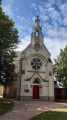
(S/E) Notre-Dame-du-Plantis Church: (a 3-minute walk from the start of the walk)
Built from pink granite from the Chevallerie quarry in La Renaudière, the church was constructed in 1854–1855 on the site of the former cemetery and the vicarage garden. Designed by Mr Simon, an architect from Cholet, and built under the supervision of Canon Berthelot, it features three pointed-arch naves and houses an 18th-century terracotta statue of the Virgin and Child, restored by the Friends of Nantes Cathedral.

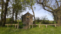
(5) Saint-Joseph-du-Chêne Chapel

Le Plantis
From the 12th to the 15th centuries, two parishes fell under the jurisdiction of La Renaudière: Notre-Dame du Plantis, known as the ‘upper parish’, to the north-west of the town, and Notre-Dame de La Renaudière, to the east. The Upper Parish was annexed to the parish of Notre-Dame de La Renaudière in 1420 at the request of the Lord of La Thévinière.
Weddings and funerals continued to be held there until 1789. The parish priest of La Renaudière remained obliged, by agreement with the Lord of Gesté, to come and say Mass on the four major feast days of the year, until 1789. Today, very little remains of the chapel: a small plinth in a façade wall and a granite holy water font near a barn.

Clandestine Lathrée
Lathraea clandestina
You can spot it at the start of the season, at the foot of the trees, near the Bondussière pond. This beautiful parasitic plant does not harm its host tree, unlike other sap-sucking parasites such as mistletoe.

Reviews and comments

3.7 / 5
Based on 3 reviews

Reliability of the description
4.3 / 5
Ease of following the route
3.5 / 5
Route interest
3.3 / 5
Richard49
Richard49

Overall rating : 2.5 / 5

Date of your route : Mar 22, 2026
Reliability of the description : ★★★★☆ Good
Ease of following the route : Not used / Not applicable
Route interest : ★☆☆☆☆ Very disappointing
Very busy route : No

This is just my personal opinion.
Hike completed in March 2026

I won’t comment on the signposting as I use a navigation app on my phone.

Dangerous start between S/E and just after 1: tarmac road with quite a few cars and, above all, the short stretch on the D63.
Very muddy section between 2 and 3.
At 6, I advise you to continue straight on to the end of Rue du Petit Pont, turn left towards the roundabout, take the first exit onto the D762, then the first left to reach La Case d’Enfer. Otherwise, the path leading to La Sanguèze is virtually non-existent and impassable.
Muddy section between 8 and 9.
After 16, another dangerous section on the D63

30% shade

Very easy walk, extremely flat.
Very muddy sections: not to be attempted after a period of heavy rain.
Too much tarmac for my liking, even though the roads are fairly quiet. That said, the two sections on the D63 are a deal-breaker for me.
No points of interest really worth mentioning apart from the ponds at Villedieu.

Conclusion: best done in the cool of the day in May or June, with the option of a picnic at the start/finish point, for people who enjoy walking but don’t like steep climbs. Take care on the sections along the D63

Machine-translated

Domimar
Domimar

Overall rating : 3.7 / 5

Date of your route : Feb 06, 2025
Reliability of the description : ★★★★☆ Good
Ease of following the route : ★★★☆☆ Average
Route interest : ★★★★☆ Good
Very busy route : Yes

A lovely route, but a very muddy section in the small woodland; the signposting needs reviewing – we got lost twice. Otherwise, a lovely route combining country paths and a circular loop through town!

Machine-translated

manuuher
manuuher

Overall rating : 4.7 / 5

Date of your route : Aug 20, 2023
Reliability of the description : ★★★★★ Very good
Ease of following the route : ★★★★☆ Good
Route interest : ★★★★★ Very good
Very busy route : No

A lovely walk that takes you past some beautiful ponds and a magnificent chapel.
What’s more, the route takes you along a section that’s the same on both the outward and return journeys – quite an original touch.
Given the length and the few stretches of road, I preferred to do it on a mountain bike. It’s a really smooth ride.

Machine-translated

Other walks in the area

For more walks, use our search engine .

The GPS track and description are the property of this route's author. Please do not copy them without permission.