The Avresne at Saint-Macaire-en-Mauges

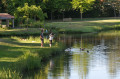
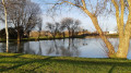
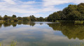
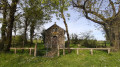
This pleasant walk will allow you to discover the area’s natural treasures, including the various streams, fields, lakes and the historical heritage of the new municipality of Sèvremoine.

Details

n°35595879
Creation:
Last update:
Last review:
  • Walking
    Activity: Walking
  • ↔
    Distance: 11.98 mi
  • ◔
    Average duration: 5h 45 
  • ▲
    Difficulty: Moderate

  • ⚐
    Back to start: Yes
  • ↗
    Ascent: + 302 ft
  • ↘
    Descent: - 308 ft

  • ▲
    Highest point: 367 ft
  • ▼
    Lowest point: 233 ft

Description of the walk

From Cholet, take the N249 towards Nantes. Take exit 6 and park at the Green Cross Étang in Saint-Macaire-en-Mauges.

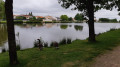
(S/E) Take the path leading on from the car park. Walk round the pond on the right, ignoring two wide paths. Carry on to the next junction, just before the playground.

(1) Turn right. Then follow the Allée des Écureuils to the D63 (Boulevard du 8 Mai 1945).

(2) Cross the boulevard and head straight on along Rue le Corbusier. At the first roundabout, go straight on; do the same at the second, and continue until you reach Rue du Commerce and the church.

(3) Pass between the car park on your left and Saint-Macaire Church on your right, following Rue du Prieuré. At the next junction, turn left onto Rue du Docteur Schweitzer, then turn right onto Rue Jules Verne, passing the swimming pool. Continue to the roundabout at Boulevard de l’Égalité.

(4) Take the second exit on the right to stay on Boulevard de l’Égalité. Turn right after the cemetery onto Rue Marie Madeleine Fourcade and continue to the junction at the end of the street.

(5) Turn left onto Route de la Felixière, cross the Avresne and carry on along the road until you reach the next cross at Les Petites Landes.

(6) When you reach the Croix Saint-Jean, take the path on the right, then ignore any paths branching off to the right or left. Further on, the track turns into a small road. Pass through the hamlets of Les Chupelleries and Le Bordage, and continue on your way to the Carrefour des Saules.

(7) Take the left-hand road at the junction. Pass through the various localities, then continue along the track. At the crossroads (elevation 104), turn left and carry on straight ahead until you reach the next junction.

(8) At this point, turn right, then left 200 metres further on. Follow this path to the road. Turn right, then take the first track on the left. Stay on this track, which bends to the right once to run alongside a stream, then bends again to reach the Petite Moncouallière.

(9) At the silos, turn right and follow the path as it bends to the right and then to the left, continuing to its end. Turn left to join Route Saint-Macaire.

(10) Head right for 200 m, then left. Continue towards La Biottière and follow the path straight ahead. Cross the Avresne and carry on to the end of the track at La Maison Neuve.

(11) Cross the road and head straight on towards Chêne Souche. After passing three ponds on your left, turn left at the next junction and carry on to the next one.

(12) Turn right and head towards the cross at the junction with the D63.

(13) Cross the road carefully and continue straight ahead. Stay on this path, keeping the recycling centre on your left, and carry on to the T-junction after the hamlet of Garrot.

(14) Head straight on to reach La Chalouère (the next hamlet on the right).

(15) At this point, turn left to reach the Green Cross leisure park, 1 km away.

(16) Take the path on the left to go round the lake.

(1) Carry on straight ahead, then head back to the car park (S/E).

Waypoints

  1. S/E : mi 0 - alt. 331 ft - Étang Green Cross car park
  2. 1 : mi 0.22 - alt. 331 ft - Play area
  3. 2 : mi 0.44 - alt. 351 ft - Boulevard du 8 Mai 1945
  4. 3 : mi 0.76 - alt. 325 ft - Saint-Macaire Church
  5. 4 : mi 1.1 - alt. 305 ft - Boulevard de l’Egalité
  6. 5 : mi 1.65 - alt. 269 ft - Avresne (cours d'eau) - Affluent de l'Evre
  7. 6 : mi 2.42 - alt. 348 ft - St John’s Cross
  8. 7 : mi 3.71 - alt. 364 ft - Carrefour des Saules (Beaupréau-en-Mauges)
  9. 8 : mi 5.09 - alt. 361 ft - Intersection
  10. 9 : mi 6.41 - alt. 312 ft - La Petite Moncouallière
  11. 10 : mi 6.92 - alt. 325 ft - Route Saint-Macaire
  12. 11 : mi 8.14 - alt. 328 ft - Road
  13. 12 : mi 8.92 - alt. 348 ft - Intersection
  14. 13 : mi 9.19 - alt. 335 ft - D63, cross
  15. 14 : mi 10.2 - alt. 295 ft - Garrot
  16. 15 : mi 10.66 - alt. 338 ft - The Chalouère
  17. 16 : mi 11.33 - alt. 331 ft - Green Cross lake and leisure park
  18. S/E : mi 11.98 - alt. 331 ft - Étang Green Cross car park

Worth a visit

In the centre of Saint-Macaire-en-Mauges: Workers’ and industrialists’ houses situated between Rue Montmartre and Rue Jeanne d’Arc.

(3) Church – Gloton organ:

Built to plans by the architect Liberge of Nantes between 1857 and 1862, the church dedicated to Saint-Macaire is constructed from pink granite sourced from the Bois Girard quarry in Saint-Macaire and tuffeau stone from Saumur. The granite used for the spire of the bell tower comes from Montfaucon-Montigné. Its organ, built by Georges Gloton, was installed on the initiative of René Viau (a footwear manufacturer) in 1925. It is a rare instrument due to its original state of preservation (pipes, windchests, action and blower) and its status as a Romantic organ. It is unique in having a fully tubular pneumatic action, for both the keyboard and the stops.

Blue Hawker:
Aeshna cyanea is one of the largest dragonflies found in our region. It likes to patrol along hedgerows to guard its hunting territory. It can be recognised by the arrangement of blue spots at the tip of its abdomen. Only the male is green/black/blue; the female has no blue.

Dyer’s Serratula:
Serratula tinctoria: this perennial plant was once used in dyeing because its leaves contain a substance used to produce a yellow dye.

Reviews and comments

3.8 / 5
Based on 2 reviews

Reliability of the description
4 / 5
Ease of following the route
3.5 / 5
Route interest
4 / 5
User 2754209

Overall rating : 3.7 / 5

Date of your route : Apr 02, 2026
Reliability of the description : ★★★★☆ Good
Ease of following the route : ★★★☆☆ Average
Route interest : ★★★★☆ Good
Very busy route : Yes

I have reported the issues with the signage to the relevant staff. Signage missing; needs reviewing

Machine-translated

gelinoto
gelinoto

Overall rating : 4 / 5

Date of your route : Feb 03, 2026
Reliability of the description : ★★★★☆ Good
Ease of following the route : ★★★★☆ Good
Route interest : ★★★★☆ Good
Very busy route : Yes

lovely walk

Machine-translated

Other walks in the area

For more walks, use our search engine .

The GPS track and description are the property of this route's author. Please do not copy them without permission.