The ‘circular tour of Bornéo’ in the commune of Roussay

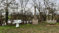
The island of Borneo, its tropical forests, its white sandy beaches, the South China Sea. But why this name in our Mauges countryside? Borneo was the name once given to a section of this path. Perhaps the name is derived from ‘bornage’ (boundary marking), as this section marks the boundary between Torfou and Montfaucon-Montigné.

Details

2628569
Creation:
Last update:
Last review:
  • Walking
    Activity: Walking
  • ↔
    Distance: 8.52 mi
  • ◔
    Average duration: 4h 10 
  • ▲
    Difficulty: Moderate

  • ⚐
    Back to start: Yes
  • ↗
    Ascent: + 282 ft
  • ↘
    Descent: - 305 ft

  • ▲
    Highest point: 413 ft
  • ▼
    Lowest point: 118 ft
  • ⚐ Country: France
  • ⚐ City: Roussay (49450)
  • ⚑
    Start/End: N 47.091269° / W 1.06539°
  • ❏
    IGN map(s): Ref. 1324SB, 1424SB
  • Hour-by-hour weather

Photos

Description of the walk

Park in the square by Roussay church.

(S/E) Facing the church, head to the left, then carry on straight ahead at the junction onto the main road. At the end of the road, before the T-junction with the D146, take the path on the right that runs alongside the road. This leads to a small road. Carry on straight ahead, passing the Bastille, where the Ferme d’Activité des Mauges is located

(1) Carry on along this road and soon take the path on the right. You will arrive at the Ferme des Rabottières. Walk past the livestock building until you reach the junction where a road meets a path.

(2) Turn left and follow the track. Go round the old village of La Baconnière, passing the old La Baconnière uranium quarry on your left. The track continues along a tarmac section until it reaches the RD64.

(3) Take care when crossing. Continue to the hamlet of La Malécotière, pass through it and take the track to the left of the houses. Follow the track uphill until you reach a junction. Turn left to reach the crossroads with the road leading to La Papinière and La Turmelière. This crossroads has five different directions.

(4) Cross the road and take the road on the right leading to La Petit Cherpaie. Continue for 400 metres until you reach another road. Cross it and take the path on the right towards La Cherpraie. Follow a wide circular path, keeping to the right at all times. You are now on the section of path formerly known as Bornéo. Stay on this path, keeping to the right, to reach the village of La Turmelière.

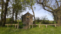
(5) At the chapel, take the road on the left for about 150 metres and, at the next junction, turn right. A little further on, take the dirt track on the left, leaving the road leading to the hamlet of L’Humeau on your right. Pass a second chapel, L’Humeau. Continue along this track until you reach the junction with the Chemin des Justices.

(6) Turn right. At the RD64, cross carefully and turn right. Walk along the left-hand side of the road, then leave it to turn left onto the path towards La Basse Boissière. Once in the hamlet, head straight on along the path that descends towards La Moine. You will reach the Ruisseau de la Baconnière.

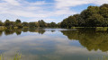
(7) Follow the stream to the left, cross the small bridges, then reach Normandeau by turning slightly to the right.
Continue along the path which climbs back up to the hamlet of La Chaise.

(8) Stay on the road to reach the village of Roussay and the church square (S/E).

Waypoints

  1. S/E : mi 0 - alt. 289 ft - Car park at Roussay Church
  2. 1 : mi 0.7 - alt. 295 ft - La Bastille
  3. 2 : mi 1.33 - alt. 279 ft - The Rabottières Farm
  4. 3 : mi 2.55 - alt. 295 ft - Crossing the RD64
  5. 4 : mi 3.24 - alt. 410 ft - Five-way junction
  6. 5 : mi 4.54 - alt. 348 ft - La Turmelière
  7. 6 : mi 5.33 - alt. 328 ft - Chemin des Justices
  8. 7 : mi 6.91 - alt. 161 ft - The Baconnière Stream
  9. 8 : mi 7.65 - alt. 213 ft - La Chaise
  10. S/E : mi 8.52 - alt. 289 ft - Car park at Roussay Church

Worth a visit

The Mauges Activity Farm (near La Bastille)
A residential care home on the farm established in 2008, this facility cares for people with intellectual disabilities, particularly those with Fragile X syndrome. Every autumn, the Mauges Activity Farm benefits from the proceeds of the Fête des Cucurbitacées, held in the village of La Chaise in Roussay.

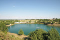
The Baconnière Quarry: A former uranium mine with several open-cast pits and underground tunnels, it was in operation from 1976 to 1981. Over 500 tonnes of uranium were extracted and processed at the SIMO plant in L’Écarpière, Gétigné. Nearby, the former Anjougerie quarry has been converted into a diving centre.

La Turmelière Chapel: The château and chapel were built around 1860 by the Baudry family. Monsignor Baudry, Bishop of Périgueux, had the chapel added. It is owned and maintained by all the property owners in the village of La Turmelière (private chapel).

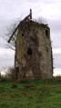
The Normandeau Watermill: this mill at Normandeau stands on the north bank of the River Moine; a submersible causeway partially blocks the riverbed. This mill was coupled with a windmill in themid-18th century. It was decommissioned in 1856 and then, from 1902, used by the Aumon-Martin factory (Roussay) to generate the electricity required for this textile mill. Following the electrification of Roussay, the watermill was used as a flour mill until 1946. It was subsequently abandoned and later converted into a dwelling.

Reviews and comments

4 / 5
Based on 4 reviews

Reliability of the description
4.3 / 5
Ease of following the route
3.8 / 5
Route interest
4 / 5
surfy
surfy

Overall rating : 4.3 / 5

Date of your route : Mar 30, 2026
Reliability of the description : ★★★★★ Very good
Ease of following the route : ★★★★☆ Good
Route interest : ★★★★☆ Good
Very busy route : No

A lovely circular route with plenty of variety and some lovely cross-country paths. You pass close to the old uranium mine, which has been converted into a field of solar panels. At a leisurely pace, it takes a good 3½ to 4 hours.

Machine-translated

User 7057104

Overall rating : 4.3 / 5

Date of your route : Nov 03, 2025
Reliability of the description : ★★★★☆ Good
Ease of following the route : ★★★★★ Very good
Route interest : ★★★★☆ Good
Very busy route : No

Hello
Date of hike: 23 October 2025
Very well-marked hike: an example to follow
Beautiful, well-maintained trails
A lovely surprise at the Humeau chapel, where the gate invites us to enter: the chapel is open, very clean, decorated with flowers (three natural rosebuds). Thank you to the people who keep this little chapel alive.

Machine-translated

Bobylapointe49
Bobylapointe49

Overall rating : 3.3 / 5

Date of your route : Jul 23, 2024
Reliability of the description : ★★★★☆ Good
Ease of following the route : ★★☆☆☆ Disappointing
Route interest : ★★★★☆ Good
Very busy route : No

Machine-translated

Ôsez Mauges
Ôsez Mauges

Hello,
Thank you for your feedback. For your information, the signposting for the Borneo walk is scheduled for week 20 (between 13 and 17 May 2024).
Kind regards,
Marie on behalf of the Ôsez Mauges team

Machine-translated

manuuher
manuuher

Overall rating : 4 / 5

Date of your route : Apr 15, 2024
Reliability of the description : ★★★★☆ Good
Ease of following the route : ★★★★☆ Good
Route interest : ★★★★☆ Good
Very busy route : No

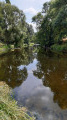
The signposting isn’t actually very visible; you have to follow what look like arrows with a red tip (except at point (6) if I remember correctly), with no markings, or if there are any, they’re barely visible. I followed the route and used the app as usual. The route is nice but nothing special. There are a few stretches of road which aren’t necessarily very pleasant, especially the last one leading back to the village. The best bit is undoubtedly between the points (7) and (8) along the stream. It’s very picturesque.
I’d recommend, near the Normandeau cave (which is a bit run-down), crossing the Moine (there’s a footbridge) to get to the old mill just on the other side (which also looks abandoned) – from there you can admire a lovely spot by the water’s edge (see the photos I’ve posted).

Machine-translated

chemin
chemin
• Edited:

We went to check out this walk; the blue markings are faded or non-existent up to the halfway point. The signposts are not very visible or are missing.

Machine-translated

Other walks in the area

For more walks, use our search engine .

The GPS track and description are the property of this route's author. Please do not copy them without permission.