The Robat Mills between Saint-Germain-sur-Moine and Montfaucon

A walk that takes you along the Way of St James for a few kilometres. It is an easy route through the Sèvremoine countryside, passing through hamlets where old mills stand proudly.

Details

n°2229236
Creation:
Last update:
Last review:
  • Walking
    Activity: Walking
  • ↔
    Distance: 7.65 mi
  • ◔
    Average duration: 3h 50 
  • ▲
    Difficulty: Moderate

  • ⚐
    Back to start: Yes
  • ↗
    Ascent: + 318 ft
  • ↘
    Descent: - 331 ft

  • ▲
    Highest point: 312 ft
  • ▼
    Lowest point: 138 ft

Photos

Description of the walk

Park in the car park behind the town hall in Saint-Germain-sur-Moine.
Follow the green signposts throughout the walk. This route shares a section with the Way of St James.

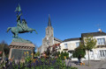
(S/E) Opposite the town hall, take the street to the right. At the Place du Château de Mondement, you will see the barometer and the statue of Joan of Arc in front of you.
Turn left into Rue du Docteur Raffegeau and continue straight on for 500 metres.

(1) Turn right just before the cemetery and carry on to the tunnel passing under the RN249.

(2) Turn right just before the tunnel. Continue for about 250 metres before turning right. Go straight on for about 700 metres until you reach the RD147.

(3) Carry on straight ahead and, at the next junction, continue straight on again. Walk straight through the hamlet known as ‘Le Puteau’ along the footpath until you reach Moulin Neuf.

(4) At the end of the small path, by the stagecoach wayside shrine, turn right then left onto the path as you leave the village. Continue for 600 metres towards Saint-Gilles. Carry straight on along the road until you reach the Bon-Secours chapel (on your left).

(5) This section is shared with the Way of St James until the finish. At this point, carry on straight ahead, leaving the chapel on your left. Turn right onto Rue Saint Jean (RD762) and, 100 metres further on, turn left onto Rue secondaire de la Frairie. Continue straight on along Rue Alexandre Dumas and cross the Ruisseau de l’Hubeau.

(6) At the wayside cross (Croix Marie Papin), take the path on the right and walk alongside the small wood on your right. Turn right 350 metres further on (you can visit the Robat watermill about 90 metres to the right) then follow the path uphill

(7) Cross the road and continue along the path towards the village of La Davière.

(8) Just after the village, at the Y-junction, turn left and, a few metres further on, turn left again towards the Robat windmill. Take the path that runs alongside it to the right. Turn left at the next junction to follow the path, then cross the Ruisseau de l’Hubeau again and carry on straight ahead until you reach the hamlet of Marquet. At the road, carry on straight ahead.

(9) At the bend, follow Allée des Fougères then Allée des Lys to the right, cross Rue des Mauges and continue along the road straight ahead. Turn right onto Rue Bon Secours.

(5) When you reach the Chapelle Bon-Secours, turn left onto Rue Saint-Gilles and carry on until the next junction.

(10) Cross Rue des Aulneaux and follow Rue du Bourg Hardy opposite. After about 300 metres, before the roundabout, turn right and take the path a little further on. At the junction, turn right until you reach the D67, which you should walk alongside on the right and cross with care.

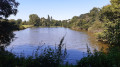
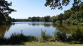
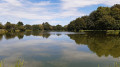
(11) Join the footpath and continue for 300 metres. At the junction, turn left, pass a pond on your left, then turn left again.

(12) When you reach Rue de la Barbottinière, carry straight on and cross Rue Bel Air (D67). Then turn right onto Rue des Tilleuls, then immediately left onto Rue des Acacias, and head down to the public park.

(13) Cross the park on the right, then pass Rue de l’Aiguefou and Rue de la Cave before returning to the car park where you started (S/E).

Waypoints

  1. S/E : mi 0 - alt. 226 ft - Saint-Germain Town Hall car park
  2. 1 : mi 0.36 - alt. 276 ft - Cemetery
  3. 2 : mi 0.83 - alt. 279 ft - On the right, before the tunnel
  4. 3 : mi 1.46 - alt. 305 ft - Crossing the D147
  5. 4 : mi 2.26 - alt. 282 ft - Moulin Neuf
  6. 5 : mi 2.83 - alt. 226 ft - Bon-Secours Chapel
  7. 6 : mi 3.4 - alt. 177 ft - Cross by Marie Papin
  8. 7 : mi 3.88 - alt. 174 ft - Road crossing
  9. 8 : mi 4.34 - alt. 249 ft - On leaving the village of La Davière
  10. 9 : mi 5.25 - alt. 210 ft - Allée des Fougères
  11. 10 : mi 5.81 - alt. 217 ft - Crossing Rue des Aulneaux
  12. 11 : mi 6.48 - alt. 256 ft - Crossing the D67
  13. 12 : mi 7.13 - alt. 266 ft - Rue de la Barbottinière
  14. 13 : mi 7.41 - alt. 207 ft - Public park
  15. S/E : mi 7.65 - alt. 226 ft - Saint-Germain Town Hall car park

Worth a visit

- Barometer and statue of Joan of Arc: This aneroid barometer, 1.10 metres in diameter, was installed on the Villa des Figuiers by Donatien Raffegeau, mayor of Saint-Germain from 1908 to 1929. There was also a thermometer. The statue of Joan of Arc was erected on 31 July 1914 on the site of the former cemetery (which had been relocated in 1865) to enhance the appearance of the square. In 1920, it became the war memorial. The Place du Château de Mondement was given this name in 1918 in memory of the Battle of September 1914 (in the Marne), in which many residents of Saint-Germain took part as part of the77th Infantry Regiment.

- Marie Papin’s Cross: At the junction with the Chemin de la Jarrie, this cross was erected in memory of a young
girl killed at this spot in 1794 during the Wars of the Vendée. Whilst she was bringing food to two wounded men from the Vendée army who were hiding nearby, she found herself surrounded by a squad of
Republicans. As she refused to answer their questions, they tied her up and tortured her to death.

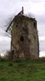
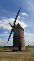
- The Robat Mills: The Robat watermill was already recorded on the 1834 land register. The flour mill
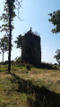
was run by the Durand family for five generations. It was powered by all manner of energy sources; the chimney of the steam engine is still standing. The mill was renovated in 1905 and the wheel, which is still in place, stopped turning in 1989. It was coupled with a windmill (now in a poor state of repair).

Reviews and comments

4.2 / 5
Based on 2 reviews

Reliability of the description
4.5 / 5
Ease of following the route
4 / 5
Route interest
4 / 5
MARTDomi
MARTDomi

Overall rating : 4 / 5

Date of your route : Aug 21, 2024
Reliability of the description : ★★★★☆ Good
Ease of following the route : ★★★★☆ Good
Route interest : ★★★★☆ Good
Very busy route : No

A lovely, varied circular route, alternating between beautiful paths and narrow sunken lanes.
No particular difficulties

Machine-translated

manuuher
manuuher

Overall rating : 4.3 / 5

Date of your route : Jul 28, 2024
Reliability of the description : ★★★★★ Very good
Ease of following the route : ★★★★☆ Good
Route interest : ★★★★☆ Good
Very busy route : No

A lovely walk through the two parishes of Montfaucon and Saint Germain.
Please note that right at the start, before the marker (1), the signposting directs you to turn right to head straight for the point (3) via the road. This cuts out (2). It’s a shame, as the path runs past a charming little pond which you can walk round. You can also have a picnic there; there are tables in the shade. However, you should avoid walking alongside the four-lane road.
I’d recommend using the app, as the route isn’t straightforward and combines two circular loops. You’ll pass through some sections twice.
I didn’t see the famous “barometer” but I did spot the statue of Joan of Arc.
Overall, it’s a lovely walk, alternating between woodland paths and open views, with few roads and a few benches and the occasional table.

Machine-translated

Other walks in the area

For more walks, use our search engine .

The GPS track and description are the property of this route's author. Please do not copy them without permission.