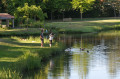
The Oaks and Moorland Route in Villedieu-la-Blouère

Discover several woods in the commune of Villedieu-la-Blouère in the Mauges! Mushroom-pickers take note: this walk is around ten kilometres long.

Details

12792709
Creation:
Last update:
Last review:
  • Walking
    Activity: Walking
  • ↔
    Distance: 6.60 mi
  • ◔
    Average duration: 3h 05 
  • ▲
    Difficulty: Moderate

  • ⚐
    Back to start: Yes
  • ↗
    Ascent: + 82 ft
  • ↘
    Descent: - 82 ft

  • ▲
    Highest point: 351 ft
  • ▼
    Lowest point: 269 ft

Description of the walk

Park in the car park at Villedieu-la-Blouère cemetery.
Follow the yellow markings throughout the walk

(S/E) Walk alongside the cemetery, turning right at the Y-junction, then continue along the road for 1 km. Pass the Maison Neuve farm.

(1) Leave La Veronnière on your left and continue to the Carrefour de la Feuillée.

(2) At the junction, turn right and walk for 200 m; further on, at the three-way junction, veer right onto the grassy track heading towards the Bois de la Feuillée. Go round it on the left and walk alongside it for 1.2 km.

(3) Once at the edge of the woodland, turn left onto a path at a 75° angle that runs between two fields. Walk for 200 m; when you reach the junction with thethird field, take the path on the left for 100 m, then continue to the right along the grassy track.

(4) Turn left onto the road, then carry on straight ahead after passing the Beau Soleil farm on your left. Walk between the fields, along the hedgerow, until you enter the Bois de la Cure des Landes (you’ll take this path on the way back). Carry on straight ahead for 200 m until you reach the edge of the woodland

(5) Once you reach the end of the Bois de la Cure des Landes, you can either:
- turn right to enter the forest for 600 metres, then turn back.
- take the path on the left straight away, which runs alongside the fields and leads you out of the forest.

(6) After 200 m, take the first path on the right and follow it to the Beau Chêne farm.

(7) Turn left at the end of the track towards the hamlet of Chêne Courbet, then turn left between the first house and the farm building. Walk through the fields until you return to the Bois de la Cure des Landes, taking the opposite route to the one you came on.

(5) Enter the woods and take the path on the right (the opposite direction to the outward journey), crossing the woods to pass the Beausoleil farm again.

(4) Take the paths running alongside the fields to reach the Bois de la Feuillée.

(3) Continue straight on, skirting the woods on the left. 600 m further on, when you reach the grassy track, turn left and then continue straight on until you reach the road

(1) At the T-junction, turn left and retrace your steps back to the cemetery car park (S/E).

Waypoints

  1. S/E : mi 0 - alt. 269 ft - Cemetery car park - Église Saint-Christophe (Villedieu-la-Blouère)
  2. 1 : mi 0.51 - alt. 318 ft - Junction of the southern circular loop
  3. 2 : mi 0.72 - alt. 341 ft - La Feuillée crossroads
  4. 3 : mi 1.74 - alt. 318 ft - Junction at the end of the woodland
  5. 4 : mi 2.03 - alt. 338 ft - Tarmac path
  6. 5 : mi 2.56 - alt. 328 ft - Exit from the Bois de la Cure des Landes
  7. 6 : mi 2.74 - alt. 325 ft - Junction of the northern circular loop
  8. 7 : mi 3.49 - alt. 351 ft - Beautiful Oak
  9. S/E : mi 6.6 - alt. 269 ft - Cemetery car park - Église Saint-Christophe (Villedieu-la-Blouère)

Reviews and comments

4.2 / 5
Based on 3 reviews

Reliability of the description
4.7 / 5
Ease of following the route
4.3 / 5
Route interest
3.7 / 5
Gourdon Michel
Gourdon Michel

Hello,
I’m unable to go hiking at the moment due to a torn Achilles tendon. I’ll have to see how things go a bit later, once I’ve had my physiotherapy sessions and been fitted with orthopaedic insoles – I’ll just have to give it time (I’m cycling at the moment, which puts less strain on the sore muscle). In the meantime, I hope you all enjoy some lovely autumn hikes. Michel

Machine-translated

manuuher
manuuher

Overall rating : 4.3 / 5

Date of your route : Nov 03, 2024
Reliability of the description : ★★★★★ Very good
Ease of following the route : ★★★★★ Very good
Route interest : ★★★☆☆ Average
Very busy route : No

An unusual route, as it actually consists of two circular loops linked by a shared path.
The scenery alternates between fields and the edge of the forest, with a bit of woodland here and there; it’s rather monotonous.

Machine-translated

Gourdon Michel
Gourdon Michel

Overall rating : 4.7 / 5

Date of your route : Oct 27, 2023
Reliability of the description : ★★★★★ Very good
Ease of following the route : ★★★★★ Very good
Route interest : ★★★★☆ Good
Very busy route : No

A fairly easy route, with a very narrow path that’s only wide enough for one person. I’m going to go back and do it again, taking my sickle with me – with all the rain we’ve had, the brambles are growing fast and can be a nuisance for inexperienced walkers. Apart from that, there’s a short stretch along a minor road, and the chestnuts along the path are very good…

Machine-translated

chataignier jean-paul

Overall rating : 3.7 / 5

Date of your route : Aug 01, 2022
Reliability of the description : ★★★★☆ Good
Ease of following the route : ★★★☆☆ Average
Route interest : ★★★★☆ Good
Very busy route : No

poorly maintained in places, borderline

Machine-translated

Other walks in the area

For more walks, use our search engine .

The GPS track and description are the property of this route's author. Please do not copy them without permission.