The Bonnettes Farm in Marnans

Discover the small-scale architectural heritage of the Chambaran region.

Details

151023
Creation:
Last update:
Last review:
  • Walking
    Activity: Walking
  • ↔
    Distance: 4.54 mi
  • ◔
    Average duration: 2h 50 
  • ▲
    Difficulty: Easy

  • ⚐
    Back to start: Yes
  • ↗
    Ascent: + 892 ft
  • ↘
    Descent: - 873 ft

  • ▲
    Highest point: 1,955 ft
  • ▼
    Lowest point: 1,335 ft

Photos

Description of the walk

Park in the village square in Marnans: car park beneath the town hall.

(1) Cross the Lolagne on a small road bridge, turn left and follow the RD156c for about 200 metres. Then head up to the right onto a fairly steep farm track.*

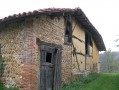
At the 533-metre mark, take the unpaved track on your left to the Ferme des Bonnettes (17th century, listed building).

(2) Head down to the hamlet of Les Gargonnes and return to the RD156c. Follow it to the left for 200 metres, then turn right and head down towards the river, crossing it via a stone-paved crossing.

(3) Turn left and follow a wide path alongside the river for 1 km through a typical Dauphiné landscape amongst walnut trees, until you come to an ascending track on the right in the woods.

(4) Here, there are two options:
- either head up to the right towards the small hamlet via a series of hairpin bends to the 530-metre mark, where you’ll find a tarmac local road (route marked on the map); follow this road to the left, passing through the hamlet of Les Bouillaux, until you reach a cross.
- or carry on straight ahead for 1 km to the village of Marnans.

(5) Leave the road and take the path on the left heading south-east to the 595-metre mark, a place known as ‘La Batterie’, a former firing range for the Chambaran camp. Turn left and head down northwards along the wide farm track.

(6) Pass Les Essarts (a rammed-earth house) then follow a long bend heading south-east which crosses La Rapillière.

(7) The path turns sharply northwards to join the D156c south of Marnans: follow it with care and head for the Prieuré and the car park (S/E).


Waypoints

  1. S/E : mi 0 - alt. 1,522 ft - Car park
  2. 1 : mi 0.76 - alt. 1,693 ft - Bonnettes Farm
  3. 2 : mi 1.51 - alt. 1,335 ft - Foundation on the Pérouse
  4. 3 : mi 2.1 - alt. 1,447 ft - Ascent to Les Bouillaux
  5. 4 : mi 3.08 - alt. 1,886 ft - Cross
  6. 5 : mi 3.69 - alt. 1,831 ft - Les Essarts Farm
  7. 6 : mi 4.16 - alt. 1,578 ft - The Rapillière
  8. S/E : mi 4.54 - alt. 1,522 ft - Car park

Worth a visit

Discover construction methods: rammed earth, half-timbering, cob infill on a trellis and rot-proof chestnut wattle.
Walnut grove.
Bonnetes Farm

Reviews and comments

4.3 / 5
Based on 3 reviews

Reliability of the description
4.3 / 5
Ease of following the route
4.7 / 5
Route interest
4 / 5
CLERC Jocelyne
CLERC Jocelyne

Overall rating : 4 / 5

Date of your route : Nov 10, 2025
Reliability of the description : ★★★★☆ Good
Ease of following the route : ★★★★☆ Good
Route interest : ★★★★☆ Good
Very busy route : No

A few hesitations in certain places that are not entirely identifiable,
In fact, we listened to the route due to lack of time because at this time of year, nightfall and cool temperatures arrive quickly.

Machine-translated

gege roro
gege roro

Overall rating : 4.7 / 5

Date of your route : Apr 05, 2016
Reliability of the description : ★★★★★ Very good
Ease of following the route : ★★★★★ Very good
Route interest : ★★★★☆ Good

Hello, we’ve already done this walk and we’ve posted an article about it here. Thank you.

Machine-translated

gege roro
gege roro

We’re always friendly, and it’s lovely to share what we do
Have a lovely evening

Machine-translated

bibi
bibi ★

Well, that’s great – promoting Visorando . Thanks a lot

Machine-translated

gege roro
gege roro

Overall rating : 4.3 / 5

Date of your route : Mar 13, 2016
Reliability of the description : ★★★★☆ Good
Ease of following the route : ★★★★★ Very good
Route interest : ★★★★☆ Good

We went on this walk to familiarise ourselves with the route on the map; we’d taken some I-G-N map-reading lessons
from the IGN, and we did this route to put what we’d learnt into practice by following the route on the map and reading the description.
Everything went perfectly. We even came across some other walkers and promoted Visorando: .

Machine-translated

Other walks in the area

For more walks, use our search engine .

The GPS track and description are the property of this route's author. Please do not copy them without permission.