Country:

 City:



The start is at the junction of the D71 (Route du Parc) and the Route de Revel in Saint-Pierre-de-Bressieux, at a place called Les Croisettes. It’s fairly easy to park in a small car park signposted ‘Parking de la Tourbière de la Combe des Planchette’, where you can even stop for a bite to eat (wooden table). There’s space for several cars.
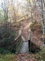
(S/E) At the far end of the car park, head north along the forest track towards Saint-Siméon-de-Bressieux, ignoring the tarmac road leading to the Étang des Essarts, which you’ll take on the way back. Walk downhill for quite a while (about 2 km) under the canopy of trees. Be careful: if it has rained in the days leading up to your walk, it can get quite slippery. Follow the yellow markings, which means heading mainly straight ahead, avoiding all side paths. Further on, you’ll emerge back into civilisation and continue along a small tarmac road. Cross the bridge over the Ruisseau de l’Abbaye, which you can hear flowing below, and walk on for about a hundred metres along Chemin de Moulin Ruel until you reach a junction with a path on the right and various hiking signs pointing in several directions.
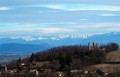
(1) Turn right towards Le Sorbier on the path which climbs slightly. The view from up there is, however, very beautiful and, as you climb, you can catch a glimpse of Bressieux Castle on your left. Continue to follow the yellow markings to reach a junction at Rossière with a new signpost.
(2) Turn right, following the signs for Étang des Essarts. Follow the yellow markings, ignoring any side paths: you’ll be walking on tarmac for a while, but it’s very quiet. Take the opportunity to admire the surroundings.
(3) Pass a spring with a strong flow. You’ll hear it more than you’ll see it, as it’s hidden by the vegetation. Carry on to the crossroads at the hamlet known as l’Abbaye.
(4) Carry on straight ahead, still heading towards Étang des Essarts. The path passes through woodland again and begins to climb once more. Follow the yellow markings, avoiding all paths leading to the right or left.
(5) Carry on straight ahead at the three-way junction, then turn left immediately. You’ll reach a four-way junction.
(6) Turn right, walk alongside the Chambaran Nature Park – marked by a wire fence – until you reach the park entrance.
(7) Turn right, following the signs for the Étang des Essarts. This final section of the walk is entirely on tarmac but very shaded. There are no difficulties on this last stretch; simply ignore the paths to the right and left and carry on until you come out at the Étang des Essarts on your left.
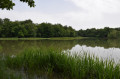
(8) Carry on along the tarmac road, where you’ll find, on your left, access to some picnic tables facing the pond (a very pleasant spot).
(9) Carry on straight ahead along the road, following signs for Saint-Siméon-de-Bressieux, until you reach the junction with the road leading to the Étang de Bressieux.
(10) Turn right and follow this road to the car park at the start of the trail (S/E).

 Visorando Member
 Easy