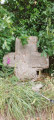
The Stone Cross: a circular walk starting from the Parc de la Higourdais

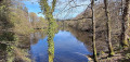
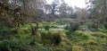
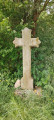
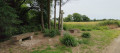
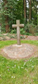
A peaceful and pleasant walk starting from the car park at the La Higourdais departmental nature reserve in Epiniac. The route winds through the countryside, passing through the Landes communal forest to the Croix de Pierre, with numerous ancient granite wayside crosses along the way. Epiniac boasts around twenty wayside crosses! At the start of the route is a restored bakehouse with its thatched roof.

Details

n°109514159
Creation:
Last update:
Last review:
–
  • Walking
    Activity: Walking
  • ↔
    Distance: 6.14 mi
  • ◔
    Average duration: 2h 55 
  • ▲
    Difficulty: Easy

  • ⚐
    Back to start: Yes
  • ↗
    Ascent: + 148 ft
  • ↘
    Descent: - 131 ft

  • ▲
    Highest point: 344 ft
  • ▼
    Lowest point: 226 ft
  • ⚐ Country: France
  • ⚐ City: Epiniac (35120)
  • ⚑
    Start/End: N 48.480078° / W 1.692136°
  • ❏
    IGN map(s): Ref. 1216O
  • Hour-by-hour weather

Photos

Description of the walk

Start from the car park at Parc de la Higourdais.

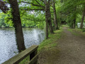
(S/E) From the far end of the car park, head south-east. Walk past the bakery and take the path on the left to follow the edge of the pond. Continue between the two ponds, then turn left to walk past the old mill below.

(1) Head down to the right and cross the small bridge over the Ruisseau du Landal. Follow the stream to the next bridge, cross it and climb the slope, following the path which turns left. At the junction of the paths, follow the PR® – the second path on the right. This joins the D85.

(2) Cross it and take the road opposite, slightly to the right (white markings). After about 300 m, take the dirt track on the left. Then turn right and then left onto the second track, heading west, until you reach the crossroads with a cross.

(3) Take the signposted track to the left. Turn left after about 700 m and join a road. Follow it to the left for about 40 metres, then cross the road and take the path on the right.

(4) At the road, follow it to the left for 1 km. Pass the Bouillére gate and the wayside cross on the right.

(5) Turn left onto the grassy path to reach the place known as La Croix de Pierre. Take the road on the left to cross the hamlet.

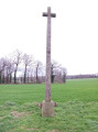
(6) At the end of the hamlet, turn right at the wayside cross, known as ‘la Croix de Pierre’. Continue along the path, crossing a small stone bridge. The path heads due north. Turn left at the crossroads, then right onto the stony track. Pass the shed and join the road leading off to the right towards the place known as ‘la Madrelle’.

(7) Turn left and walk alongside the low wall. Shortly afterwards, leave the road to the right onto the track. After about 250 metres, pass a wayside cross on the left, at the hamlet known as Le Bahut. Continue straight on until the next wayside cross on the right, the Croix de Saint-Menas.

(8) Turn right and head down towards the car park where you started, crossing the D85 (S/E).

Waypoints

  1. S/E : mi 0 - alt. 295 ft - Higourdais car park
  2. 1 : mi 0.52 - alt. 253 ft - Mill
  3. 2 : mi 1.29 - alt. 312 ft - Crossing the D85
  4. 3 : mi 2.17 - alt. 282 ft - The ‘Landes’ wayside cross
  5. 4 : mi 3.33 - alt. 308 ft - Junction with the road
  6. 5 : mi 3.98 - alt. 344 ft - La Bouillère
  7. 6 : mi 4.45 - alt. 331 ft - Waycross known as the ‘Croix de Pierre’
  8. 7 : mi 5.52 - alt. 315 ft - La Madrelle
  9. 8 : mi 5.93 - alt. 331 ft - The wayside cross known as the Saint-Menas cross
  10. S/E : mi 6.14 - alt. 295 ft - Higourdais car park

Notes

Take care when crossing the roads.

Worth a visit

Epiniac Church: bas-relief listed as a historic monument
The ‘le Diable’ family, who lived at the Château de la Higourdais, are said to have donated a bas-relief depicting the Death of the Virgin to the parish. It can be seen beneath the altar of the Blessed Virgin.

The so-called ‘Cuckoo’ Cross
A mission cross erected in 1884 during an evangelisation campaign, as was often the case. Missions took place every five years and usually concluded with the erection of a cross. There are 18 wayside crosses in the parish.

The washhouse
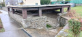
Located in Epiniac, on Rue des Douets des Roches, opposite number 7. ‘Douet’ means ‘washhouse’ in Gallo. This restored washhouse features a beautiful timber frame and a roof designed to collect rainwater. There is a fine wooden pump at the nearby well.

Always be cautious and plan ahead when you're outdoors. Visorando and the author of this route cannot be held responsible for any accidents occurring on this route.

The GR® and PR® markings are the intellectual property of the Fédération Française de Randonnée Pédestre.

Other walks in the area

For more walks, use our search engine .

The GPS track and description are the property of this route's author. Please do not copy them without permission.