The Croix de Peyre

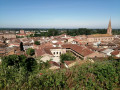
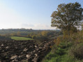
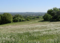
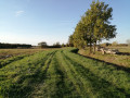
Towering over the Villemurien landscape with its slender silhouette, the Croix de Peyre welcomes you with open arms and offers stunning views of the town and its river.

Details

3385017
Creation:
Last update:
Last review:
  • Walking
    Activity: Walking
  • ↔
    Distance: 3.27 mi
  • ◔
    Average duration: 1h 50 
  • ▲
    Difficulty: Easy

  • ⚐
    Back to start: Yes
  • ↗
    Ascent: + 417 ft
  • ↘
    Descent: - 417 ft

  • ▲
    Highest point: 666 ft
  • ▼
    Lowest point: 318 ft

Photos

Description of the walk

Parking at Place Mandela.

(S/E) Walk up the square to the statue of the Virgin Mary. Turn left onto Rue des Stradélis, then turn right onto Place Jean Jaurès towards the mission cross. Climb the steps and follow the path.

(1) Visit the viewpoint overlooking the town and return towards the hillside to walk down the small path opposite, then turn right onto the Route de Bifranc (D87) (take a short detour by turning left onto the Route de Bifranc to see the 14th-century Tour Papou, then turn back).

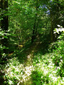
(2) Turn left onto the track by a house to take the small path that opens up immediately on the right. At the Fork in the road, leave the path straight ahead and turn left, continuing uphill to the D87d, passing under a power line.

(3) Turn right when you reach the road and carry on for 800 m.

(4) At the little Croix de Peyre, head down the road to the right to reach Villemur-sur-Tarn. There’s a lovely view of the town and its river. Take Rue de la Cote to reach Place Mandela (S/E).

Waypoints

  1. S/E : mi 0 - alt. 318 ft - Place Mandela - Tarn (rivère)
  2. 1 : mi 0.26 - alt. 417 ft - Square Pierre de la Voie
  3. 2 : mi 0.63 - alt. 390 ft - Chemin de Bifranc
  4. 3 : mi 1.31 - alt. 653 ft - The D87 road, known as the ‘Croix de Peyre’
  5. 4 : mi 2.03 - alt. 650 ft - Croix de Peyre
  6. S/E : mi 3.27 - alt. 318 ft - Place Mandela

Worth a visit

Don’t miss the chance to explore this medieval town, featuring:
- The 12th-century defence tower
- The 17th-century Greniers du Roy
- The 19th-century Brusson industrial wasteland
- The viewpoint at Square Pierre de la Voie

Reviews and comments

4.7 / 5
Based on 2 reviews

Reliability of the description
5 / 5
Ease of following the route
5 / 5
Route interest
4 / 5
Shrando31410
Shrando31410

Overall rating : 4.7 / 5

Date of your route : Aug 30, 2022
Reliability of the description : ★★★★★ Very good
Ease of following the route : ★★★★★ Very good
Route interest : ★★★★☆ Good
Very busy route : No

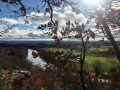
A pleasant, easy walk. Take care at point 2 – the narrow path isn’t immediately visible if the vegetation is dense. Look carefully for the yellow markers at this junction. The return route offers lovely views of the Tarn valley and Villemur. Don’t forget your binoculars!
Route completed as part of the Filhols circular route.

Machine-translated

randonannie
randonannie

Overall rating : 4.7 / 5

Date of your route : Aug 03, 2021
Reliability of the description : ★★★★★ Very good
Ease of following the route : ★★★★★ Very good
Route interest : ★★★★☆ Good
Very busy route : No

An interesting little walk around Villemur to start exploring some of the narrow streets and take the steps leading up to the Square de Pierre de La Voie, which offers a lovely panoramic view of the town.
The Peyre Cross seems rather small to us to be welcoming us with open arms… but the views of the town as you make your way down are indeed lovely!

Machine-translated

Other walks in the area

For more walks, use our search engine .

The GPS track and description are the property of this route's author. Please do not copy them without permission.