Lus-la-Jarjatte – La Jarjatine

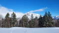
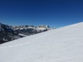
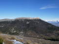
This walk follows lovely trails at the bottom of the Jarjatte valley. At the foot of the Grand Ferrand and the Rocher Rond (2,453 m, the highest peak in the Drôme), within a designated conservation area, this short walk offers a pleasant and gentle introduction to snowshoeing.
Please take care: the circular path runs alongside cross-country ski trails; please do not obstruct them and respect the tracks.

Details

n°1214115
Creation:
Last update:
Last review:
  • Snowshoeing
    Activity: Snowshoeing
  • ↔
    Distance: 1.62 mi
  • ◔
    Duration according to the author: 1.5 hrs 
  • ▲
    Difficulty: Easy

  • ⚐
    Back to start: Yes
  • ↗
    Ascent: + 151 ft
  • ↘
    Descent: - 151 ft

  • ▲
    Highest point: 3,996 ft
  • ▼
    Lowest point: 3,845 ft

Description of the walk

Snowshoe trail marker no. 1

Car park: Cross-country ski centre. Parking is also available at the downhill ski resort. From there, walk on snowshoes to the cross-country ski centre by following the ‘Piste piétons’ route. This adds 1 km to the route.

(S/E) Walk past the cross-country ski centre and cross the large meadow to the left. The path winds through the woods and emerges onto the cross-country ski trail opposite a riding school. Turn left onto a path that descends the slope towards the stream.

(1) The path zigzags beneath the pine trees and crosses a small ford. After climbing a small embankment, follow the footpath to the left for 100 metres.

(2) Cross the cross-country ski trail and turn immediately left before the bridge, heading towards the banks of the Buëch. Follow the embankment to the right, then continue towards the right-hand side of the valley.

(3) Cross a cross-country ski trail, then follow the path that winds through the forest, heading south-west, at the foot of the north-facing slope, running parallel to this trail. The path rejoins the track; cross it and head down a small path through the boxwood bushes which takes you back to the riding school. Then follow the footpath which takes you back to the cross-country skiing centre (S/E).

Waypoints

  1. S/E : mi 0 - alt. 3,845 ft - Cross-country skiing centre
  2. 1 : mi 0.4 - alt. 3,907 ft - Path through the pine trees
  3. 2 : mi 0.58 - alt. 3,930 ft - Crossing via the cross-country ski trail - Buëch (rivière)
  4. 3 : mi 0.92 - alt. 3,996 ft - Crossing via the cross-country ski trail
  5. S/E : mi 1.62 - alt. 3,845 ft - Cross-country skiing centre

Notes

In the event of an accident, call the resort on 04 92 58 51 86 and the emergency services on 112.
Hikers must be self-sufficient and responsible for themselves and any animals they bring with them. Respect for the natural environment and other users of the ski area is also part of responsible behaviour for hikers.
Snowshoes are not permitted on the ski runs.
Winter weather conditions can be changeable and challenging: check the forecast before setting off, adapt your kit accordingly, take some provisions (water and sugary foods), carry your mobile phone, let someone know your route before setting off, and avoid ridgelines.

- Lus Ski Resort
04 92 58 51 86 / station-lus@ladrome.fr

- Diois Tourist Office
04.75.22.03.03 / www.diois-tourisme.com

Reviews and comments

3.8 / 5
Based on 2 reviews

Reliability of the description
3.5 / 5
Ease of following the route
4 / 5
Route interest
4 / 5
GONG54
GONG54

Overall rating : 3 / 5

Date of your route : Jul 09, 2026
Reliability of the description : ★★★☆☆ Average
Ease of following the route : ★★★☆☆ Average
Route interest : ★★★☆☆ Average
Very busy route : No

A short walk with nothing particularly charming about it
Good for a warm-up

Machine-translated

passiflore1955
passiflore1955

Overall rating : 4.7 / 5

Date of your route : Mar 26, 2022
Reliability of the description : ★★★★☆ Good
Ease of following the route : ★★★★★ Very good
Route interest : ★★★★★ Very good
Very busy route : No

A lovely, if somewhat short, walk, but suitable for people who aren’t used to walking. You can extend it by continuing along one of the paths that run alongside the river, or by heading further up the hill. The valley and the surrounding mountains are truly magnificent.

Machine-translated

Other walks in the area

For more walks, use our search engine .

The GPS track and description are the property of this route's author. Please do not copy them without permission.