The Southern Paris Green Corridor

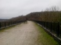
The Southern Paris Green Corridor is a series of green spaces that have been developed alongside or above the TGV Atlantique railway lines. The first two stages of this route follow this corridor from Montparnasse station to Massy. The subsequent stages extend the corridor into the Yvette Valley and across the Saclay Plateau.

Details

4135098
Creation:
Last update:
Last review:
  • Walking
    Activity: Walking
  • ↔
    Distance: 74.51 mi
  • ◔
    Average duration: 14 days 
  • ▲
    Difficulty: Moderate

  • ⚐
    Back to start: No
  • ↗
    Ascent: + 4,485 ft
  • ↘
    Descent: - 4,508 ft

  • ▲
    Highest point: 574 ft
  • ▼
    Lowest point: 157 ft
  • ⚐ Country: France
  • ⚐ City: Paris (75000)
  • ⚑
    Start: N 48.841546° / E 2.320976°
  • ⚑
    End: N 48.702903° / E 2.070924°
  • Hour-by-hour weather

Photos

Stages of the route

This route needs several days, find the details below:

  1. S
  2. 2
  3. 3
  4. 4
  5. 5
  6. 6
  7. 7
  8. 8
  9. 9
  10. 10
  11. 11
  12. 12
  13. 13
  14. E

Notes

The vast majority of the stages are accessible by public transport, RER or metro.

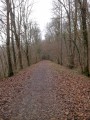
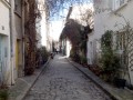
Good trainers or low-cut walking shoes are sufficient for this route, which follows paths that are mostly tarmac, concrete or compacted, or runs through streets and alleyways.

The first two stages of this route were completed by the author in November 2016. The remaining stages were completed subsequently, up to July 2026.

Worth a visit

See the details for each stage.

Always be cautious and plan ahead when you're outdoors. Visorando and the author of this route cannot be held responsible for any accidents occurring on this route.

Reviews and comments

Nazanine
Nazanine

We were two friends who had walked the Coulée Verte du Sud Parisien in four hours, stopping for lunch in Sceaux.
At the start of the route, which begins at Place Catalogne in Paris, it was a bit tricky to find the starting point. I checked Google Maps, which showed the start of the path next to the church. The rest was fairly straightforward thanks to the illustrated signposts (bicycles, pedestrians) which clearly indicated the town we were in and the direction to follow. The path was very well maintained and pleasant, with some ups and downs as it wound through the Bièvre Valley. We debated whether to take a detour to the Parc des Sceaux or the Vallée aux Loups in Chatenay-Malabry. As the former was closer, after a short stroll through the park we rejoined the greenway all the way to Massy, where we caught the RER B at Massy-Palaiseau as it was starting to get dark around 5.00 pm.

Machine-translated

Other walks in the area

For more walks, use our search engine .

The GPS track and description are the property of this route's author. Please do not copy them without permission.