Country:
 City:


From Avignon or Bagnols-sur-Cèze, head to Saint-Victor-la-Coste and park in front of the town hall. There is also a car park further up, accessible via Rue Gérard Philippe.
(S/E) With your back to the town hall, turn left onto Avenue du 11 Novembre 1918. Cross the junction.
(1) Head down Rue du Chemin Neuf to the right, turn left onto Rue de la Combe, then turn right at the next junction. Cross the Ruisseau de Remoneyret and continue along the road.
(2) Leave the road and turn left onto a track: marked in yellow. Walk alongside the vineyards, cross a short wooded area, leaving a path on your left, and reach a fork in the track.
(3) Carry straight on through the vineyards, pass under two power lines and continue along the edge of the woodland on your left.
(4) Keep left at the junction and carry on straight ahead; further on, cross a small road and join a second one.
(5) Take the road on the right for a few dozen metres, then turn left onto a grassy track. Carry on straight ahead at the junction in the middle of the vineyards.
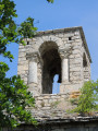
(6) Turn left onto a track, then right about 300 metres further on to reach the Chapelle Saint-Jean.
(7) Turn back and follow the route you took on the way there in the opposite direction to return to the car park (S/E).
 Visorando Member

 Moderate


 Difficult