La Chapelle des Buis

Circular walk around Besançon. A mix of roads, tracks and steep paths. Take care in wet weather, as the paths can be slippery. Significant elevation gain at the start of the walk and very flat towards the end.

Details

3391968
Creation:
Last update:
Last review:
  • Walking
    Activity: Walking
  • ↔
    Distance: 8.37 mi
  • ◔
    Average duration: 5h 00 
  • ▲
    Difficulty: Moderate

  • ⚐
    Back to start: Yes
  • ↗
    Ascent: + 1,293 ft
  • ↘
    Descent: - 1,293 ft

  • ▲
    Highest point: 1,614 ft
  • ▼
    Lowest point: 774 ft
  • ⚐ Country: France
  • ⚐ City: Besançon (25000)
  • ⚑
    Start/End: N 47.234054° / E 6.033529°
  • ❏
    IGN map(s): Ref. 3323ET
  • Hour-by-hour weather

Description of the walk

Park at the Porte de Rivotte in Besançon.
Note regarding this car park:
- paid parking on the citadel side
- free on the opposite bank at the car park for the La Rodia concert hall.

(S/E) Head towards Porte Taillée via the Route de Pontarlier. Continue to the junction by the river tunnel.

(1) Carry on straight ahead to reach the Porte Taillée.

(2) After passing through this gate, turn immediately right onto a flight of wide steps leading to a winding road. Continue left along the Chemin de Trois-Châtels until you reach the highest point at the junction with the Chemin de la Chapelle.

(3) Turn left onto this path. Follow it until you reach the junction with the Chemin de la Bro. Turn right here and continue uphill. You will reach the junction with the Chemin de la Chapelle des Buis.

(4) Turn left onto this path to reach the Notre-Dame des Buis Chapel.

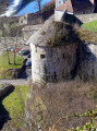
(5) Turn 180° to the right onto the Chemin du Fort de l’Ouest. Stay on this path, passing right next to the overgrown Fort de l’Ouest des Buis. Please note that the path is rocky and steep in places.
Continue along this path until you reach a fork and turn right, crossing the Bois de Peu. Pass under the N57. You’ll come to the junction with the Chemin de la Chapelle des Buis.

(6) Turn right onto this path. You’ll come to a hunter’s hut on your left; carry on straight ahead across a field.

(7) Continue left along a very steep path leading down to Beure; take care on the right-hand side of this path as there is a risk of falling. You’ll reach the edge of the field; turn right onto Chemin du Sert. Join the tarmac road at Chemin de Maillot.

(8) Turn left onto this road, which takes a 180° bend for about 200 metres. You’ll come to a crossroads of paths.

(9) Take the steep path on the right, which descends to the hamlet of Le Bout du Monde.
You’ll reach the bottom of the valley in the village of Beure. Walk up Rue de la Waterfall, cross the village’s main street, continue along Rue de la République, then turn right onto Rue du Four. Carry on to the right down a narrow lane, join Chemin du Pauliet, and turn right. Cross Route de Lyon to the right of the roundabout.

(10) Turn left onto a gravel track that descends and runs alongside the roundabout. Continue along this narrow gravel track and pass through a tunnel. You’ll emerge onto the towpath running alongside the River Doubs.

(11) Turn right onto this path and carry on until you reach the Pont de Velotte.

(12) Carry on straight ahead along the towpath, which is known here as the Chemin de Casamène. Stay close to the banks of the Doubs, taking the Chemin de halage de Tarragnoz, which leads to a lock. A small bridge spans a branch of the river; pass under the road. You’ll reach the entrance to the river tunnel.

(13) Begin crossing the river tunnel, which passes under the Citadel. At the tunnel exit, head back towards the Rivotte district to the original junction.

(1) Turn left onto the Route de Pontarlier to return to the car park you chose at the start (S/E).

Waypoints

  1. S/E : mi 0 - alt. 807 ft - Porte Rivotte. Car park - Citadelle de Besançon
  2. 1 : mi 0.21 - alt. 801 ft - Crossroads at the end of the circular loop
  3. 2 : mi 0.44 - alt. 902 ft - Porte Taillée
  4. 3 : mi 1.02 - alt. 1,138 ft - The Chapelle des Buis Trail
  5. 4 : mi 1.74 - alt. 1,358 ft - Way of the Cross
  6. 5 : mi 1.97 - alt. 1,490 ft - Chapelle des Buis
  7. 6 : mi 3.23 - alt. 1,476 ft - Bois de Peu crossroads
  8. 7 : mi 4 - alt. 1,388 ft - Viewpoint overlooking Beure
  9. 8 : mi 4.37 - alt. 902 ft - Maillot Trail
  10. 9 : mi 4.5 - alt. 958 ft - Trail junction
  11. 10 : mi 5.38 - alt. 791 ft - Roundabout junction
  12. 11 : mi 5.56 - alt. 778 ft - Towpath
  13. 12 : mi 6.61 - alt. 778 ft - Velotte Bridge - Doubs (rivière)
  14. 13 : mi 7.87 - alt. 784 ft - River tunnel - Canal du Rhône au Rhin
  15. S/E : mi 8.37 - alt. 817 ft - Porte Rivotte - Fort de Brégille

Notes

Good walking shoes.
Walking poles.
Meals or snacks and water are strongly recommended.

Worth a visit

Beure Waterfall at a place known as ‘Le Bout du Monde’, which tends to have water towards the end of winter.
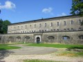
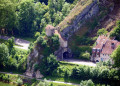
Fort de l’Ouest des Buis.

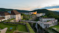
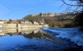
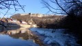
(4) At La Chapelle des Buis, on your left, you can enjoy a superb view of Vauban’s citadel as well as the town of Besançon and its surroundings – a splendid sight on a sunny day.
(4) The Saint-Léonard Caves near La Chapelle des Buis.

(7) At the end of the field, a lovely viewpoint reveals the village of Beure and its surrounding hills. Before reaching a tarmac road as you approach Beure, you can see the remains of a Roman road, with the wheel ruts of Roman chariots visible in the rock.

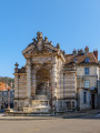
(Between 9 and 10) In the old part of Beure, don’t miss the wash house, which is well worth seeing.

Reviews and comments

4.5 / 5
Based on 2 reviews

Reliability of the description
4.5 / 5
Ease of following the route
5 / 5
Route interest
4 / 5
phmlgcn
phmlgcn

Overall rating : 4.7 / 5

Date of your route : Dec 05, 2025
Reliability of the description : ★★★★★ Very good
Ease of following the route : ★★★★★ Very good
Route interest : ★★★★☆ Good
Very busy route : No

A very beautiful route. After several days of rain, the descent to Beure was really tricky.

Machine-translated

Papijoyeux
Papijoyeux

Overall rating : 4.3 / 5

Date of your route : Jul 25, 2020
Reliability of the description : ★★★★☆ Good
Ease of following the route : ★★★★★ Very good
Route interest : ★★★★☆ Good
Very busy route : No

Watch out for the heat on the way back: there isn’t much shade (none at all!) along the towpath.

Machine-translated

Other walks in the area

For more walks, use our search engine .

The GPS track and description are the property of this route's author. Please do not copy them without permission.