Country:
 City:
City:


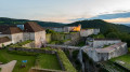
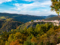
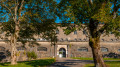
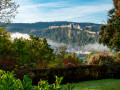
Access by car: free car parks at La Rodia.
(S/E) From the car park, walk under the Rodia theatre. Follow the footpath to the junction with the Pont Chardonnet. Cross the Pont Chardonnet.
At the end of the bridge, turn left along Square Rivotte until you reach the entrance to the tunnel that takes you under Avenue Arthur Gaulard. Go through the tunnel until you reach the junction with Faubourg Rivotte. There, turn right towards Porte Rivotte.
Pass under the Porte Rivotte; about ten metres further on, take the staircase on the left leading up to the Citadel. You’re now set to climb 270 steps up to the Citadel.
Once at the top of the steps, turn right towards the Citadel’s entrance gate.
(1) Continue along Rue des Fusillés de la Résistance until you reach the bend where the descent begins. At the bend, take the path on the left which leads back down to Rue Charles Nodier. You’ll be descending 211 steps.
Once you reach Rue Charles Nodier, turn left towards the Kirless Huddersfield roundabout. Cross the road to get closer to the River Doubs. You are now on Faubourg Tarragnoz. Facing the River Doubs, turn left towards the Tarragnoz Lock. Just after the bridge, take the footpath leading down to the lock.
(2) With your back to the river tunnel, walk along the lock and continue to the Mazagran Footbridge. Cross the Mazagran Footbridge and, at the other end, turn left onto Chemin de Mazagran.
Walk for about 500 metres until you come to a small path and a wooden signpost on the right, just before a house, pointing towards Fort de Chaudanne.
(3) Take this path. At the end, you’ll find yourself on a plateau with a few houses. Continue straight on along a narrow path with a few steps leading down to the Chemin des Echenoz de Velotte (road).
Immediately turn right onto a new path which, at the start, runs alongside a property on the left. At the top of the path, you’ll reach the Chemin du Fort de Chaudanne. Turn left until you reach the next junction.
You’ll come out onto a road which is still the Chemin du Fort de Chaudanne and which forms a three-way junction. Turn right. Continue along this road until the first junction on the left. Take this and walk uphill to the viewpoint, about 200 m away.
(4) Once at the viewpoint, turn right to walk alongside a fence, behind which lies the Fort de Chaudanne estate. You’ll come to a wooden staircase. Go down it and turn right, walking alongside the fort’s perimeter wall.
When you reach the end of the wall, walk up the gentle slope opposite for about ten metres and turn left onto the path leading to the entrance to Fort de Chaudanne.
Continue on to the park and the viewpoint overlooking the city of Besançon.
(5) Facing the fort (with the viewpoint behind you), turn right into the park and walk along the fort’s ramparts to their end. You’ll come to a junction of paths.
The path on the left continues to follow the ramparts, whilst the path on the right, which goes downhill, takes you down from Chaudanne to the Chemin de Mazagran. Take this downhill path.
You’ll come to a junction with a signpost; head towards the town centre.
You’ll reach another junction with the Montée Jean de Gribaldy. Continue along the path on the right, still heading towards the town centre.
At the end of the descent, you’ll come to some wooden steps before going down a flight of metal steps and reaching Chemin de Mazagran.
(6) Turn left, continue along Chemin de Mazagran and then along Quai Henri Bugnet towards the Pont de Canot.
About 50 metres before the bridge, take the pedestrian crossing on the right which takes you under the bridge. Continue along the banks of the Doubs, which lead back up to Quai Veil Picard.
Continue along Quai Veil Picard until you reach the junction with Rue Marulaz on the left. Walk up Rue Marulaz to Place Marulaz and its fountain.
(7) Cross the square diagonally and turn into Rue Gratteris, signposted as a dead end, directly opposite. Follow the street to the stairs on the right, which lead down to Rue Léon Deubel.
Immediately on your right, take the steps leading down between the houses, which will take you onto Rue Sechal (a cul-de-sac). Continue to the junction with Rue du Petit Charmont. Turn right, walk for about 10 metres, then turn left into the courtyard of the Hôtel particulier de Jouffroy.
Exit at the other end onto Rue du Grand Charmont. Turn right to go down this street, then left onto Rue de la Madeleine. Walk down Rue de la Madeleine to the junction with Rue des Frères Mercier. Walk up this street to Fort Griffon. Viewpoint overlooking the town.
(8) At Fort Griffon, turn right onto Rue de Ronde du Fort Griffon and continue to the Chardonney pedestrian underpass. Enjoy the view before heading down the underpass to the Hôtel particulier de Chardonney.
Go through the access tunnel to emerge onto Rue Battant. Turn left and walk up Rue Battant to the next junction on the right with Rue Champrond. Take Rue Champrond to the junction with Quai de Strasbourg. Turn left.
Continue along Quai de Strasbourg until you reach the Tour de la Pelote on your left. Walk a few dozen metres further and take the pedestrian crossing on the right, which takes you under the Robert Schwint Bridge.
Continue along the towpath to the entrance to Parc Micaud, passing under the Pont de la République.
(9) Continue through Parc Micaud along the River Doubs until you are almost at the other end. Less than a hundred metres before the exit, on your left, there is a tunnel passing under Avenue Édouard Droz; it leads to some steps and a gentle slope to the right. Take this slope, which leads you onto Allée de l’Île aux Moineaux.
Take the path opposite (with a bakery on your right) which leads to the steps up to Rue des Fontenottes. Climb the steps to reach Rue des Fontenottes, then turn left onto this street until you reach the junction with a path that’s somewhat hidden between two properties, marked by a signpost indicating Fort de Beauregard.
(10) Climb the 193 steps leading to Fort de Beauregard. You’ll come to a three-way junction and a signpost. Turn right towards Fort de Beauregard. After about 30 metres, go through the gate and climb the stairs to enter the fort’s enclosure. Climb up to the viewpoint.
(11) With your back to the town of Besançon, walk up through the Fort de Beauregard park to the Chemin du Fort de Bregille. Once you reach the path that makes a 180° bend, take the upper section.
At the first junction, turn right, staying on the Chemin du Fort de Bregille. At the second junction, turn right and follow the sign for Fort de Bregille.
After a little over a hundred metres, take the path on the left. At the end of the path, go up the steps and turn left again onto the Chemin du Fort de Bregille until you reach the next junction. Continue along Rue Marnotte, following the sign on the hiking post for Grand Désert.
After about a hundred metres, take the forest track (tarmacked) on the right. At the end of the first section of the track, you’ll come to a junction with the Chemin des Verjoulots (road). Stay on the forest track, which turns right.
Once you’ve left this track (marked by a wooden barrier blocking access), turn right and continue to the Bregille car park.
(12) At the car park entrance, take the path into the Grand Désert and cross it diagonally. On the other side of the Grand Désert, turn left and follow the signs on the hiking signposts for Fort de Bregille/Town Centre.
Please note that part of the path is a little uneven. You’ll arrive at Fort de Bregille
(13) Take the path on the left, opposite the fort’s entrance gate, which leads down towards the town centre. Follow the ‘Trail’ signs on the hiking signposts to descend towards Old Bregille. Complete the descent via some steps onto a concrete path until you reach the junction with Chemin du Fort de Bregille (road).
Cross the road and take Rue de la Fontaine opposite to enter Vieux Bregille. Walk down Rue de la Fontaine to the junction with Rue Fabre, where you turn left. Walk down Rue Fabre to the next junction on the left with Rue Crotot. Walk down Rue Crotot to the roundabout.
(14) Take the Chemin du Fort de Bregille for about 40 metres (the first exit from Rue Crotot) before turning right onto the Chemin des Ragots.
At the next junction on the right, take Chemin Fourchu. Follow the path down to the roundabout further down, towards Rhodiacéta.
(15) Take the Passage Charles Guyon between the Rhodiacéta buildings towards the River Doubs. Once you reach the banks of the River Doubs, take the path on the right back to the starting point at La Rodia (S/E).

 Visorando Member
 Easy
Easy