


 Country:

 City:


Park at Place du Carrouge.
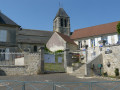
(S/E) Head north, towards the church and the town hall.
(1) Take the first street on the right, Rue des Granges, passing the town hall and then the church on your left. Continue straight on along the road and then along the path until you reach the D921.
(2) Cross this road carefully and continue along the path opposite, which runs alongside the blackcurrant bushes.
(3) At the barrier, turn right and head due south until you reach the D151.
(4) Cross it carefully and follow the path opposite to the four-way crossroads.
(5) Turn right towards the hamlet of Héréville, crossing the D927 with care.
(6) In the hamlet, turn left onto Rue du Sausseron and cross the river. At the end of the street, continue along the signposted path opposite until you reach a crossroads.
(7) Take the path on the right and continue until you reach a road; follow this to the right towards Arronville (D188).
(8) Follow it to the right and, before the bend, take the path on the left to reach “la Cavée de Margicourt”.
(9) Turn right and follow this path downhill, which joins Rue des Acacias and then Rue de Margicourt.
(10) Turn right onto this street and stop to look at the Porte Saint-Martin.
(11) Continue along this street until you reach a path on the left, Sente de Margicourt.
(12) Follow it, cross the Sausseron again, and walk past the stadium and then the primary school.
(13) Go round the school and turn right onto the Sente des Claquets, which leads onto Rue Emmanuel d’Astier; follow this to the left to reach Place de Carrouge (S/E).
 Association / Club / Walk leader
 Easy

 Visorando Member
 Difficult

