Country:

 City:
City:


Car park at the Robert Leroy Nursery School.
(S/E) Walk up the Grande Rue to the right and turn right onto the path opposite Rue du Mesnil.
(1) At the top of the path, turn right and follow the track which joins Rue de la Bauve. Turn right, then immediately left onto Rue Neuve.
(2) Turn left onto Rue de l’Ancienne Gare. Pass the cemetery on your right and carry on straight ahead. Cross the Sausseron stream, then turn left onto Rue de Labbeville. Pass under the high-voltage power line, then turn left.
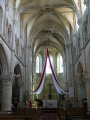
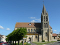
(3) Turn right before passing under the high-voltage power line again and continue along this path (former railway line). Pass the emergency services centre on your right and the old Nesles-la-Vallée railway station on your left. Turn left onto Rue de la Falaise, then right onto Rue Pierre Pilon, which leads to the church of Nesles (12th century). Continue towards the town hall.
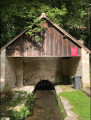
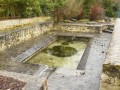
(4) Turn right onto Rue Jules Chardon. At the junction with Rue Emile Henriot, turn right. Cross the Sausseron and turn left onto the path that runs alongside the stream, after taking a look at the wash house.
(5) After about 150 m, cross the stream via a footbridge and follow the path which leads to the Sentier du Pré à l’Ane. Turn right at the junction with Rue de Parmain. At the next junction, turn left towards the campsite.
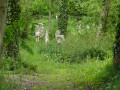
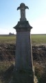
(6) At the fork in the road shortly afterwards, continue to the right. Note a stone cross on your right-hand side at the first left-hand bend. The path goes through a wood.
(7) Take thefirst turn-off on the right (GR®1).
(8) Turn right to continue on theGR®, towards Parmain. Stay on theGR® until you reach this village. Walk past the Quai des Brumes care home. Take thefirst street on the right.
(9) Leave the street and head up a path on the right through the woodland. At the top of the path, continue climbing along the road (Sente au Beurre). Walk alongside a wood on your left. At the first junction, turn left to join the D64. Cross it carefully. Continue straight ahead on the PR®.
(10) At the first junction, turn left into the woods. The path leads to Parmain cemetery. Walk down the street on the left, then keep right at the next junction.
(11) Turn right onto Rue du Lieutenant Guilbert. Lovely views over Parmain. The street ends in a path. Turn left at the first junction (PR®). At the next junction, turn left then right to continue along the PR®.
(12) Turn left to continue the descent. At the next junction, turn right onto Boulevard de la Gare, after noting the arch on the left. Turn right towards Moulin le Roy. Walk past the mill on your left (information board), then turn left to cross the Sausseron.
(13) Turn right onto a path running parallel to the Sausseron (old railway line). Continue along this greenway until you reach the junction with the D151.
(14) Turn left and head up the road, following thePR® signposts. At the top of the hill, turn right onto thePR®. Ignoring all turn-offs to the right and left, continue to Nesles-la-Vallée.
(15) Turn left and head up Rue de Pontoise. Pass the pumping station and turn right. You’ll come to a crossroads.
(16) Turn left onto thePR® towards the high-voltage power line.
(17) At the Croix à Baptiste, turn right. Pass under the high-voltage power line and turn left. Then take thefirst street on the left, which leads to the car park (S/E).

 Association / Club / Walk leader
 Moderate
 Visorando Member