Peyrouse Circular Trail

A lovely walk through meadows and woods, from the hamlet of Les Merles to the site of the Cistercian Abbey of Peyrouse, at the bottom of the valley. This helps to better understand the context in which the monks settled here in the 12th century.

Details

n°24502419
Creation:
Last update:
Last review:
  • Walking
    Activity: Walking
  • ↔
    Distance: 2.31 mi
  • ◔
    Average duration: 1h 10 
  • ▲
    Difficulty: Easy

  • ⚐
    Back to start: Yes
  • ↗
    Ascent: + 164 ft
  • ↘
    Descent: - 164 ft

  • ▲
    Highest point: 909 ft
  • ▼
    Lowest point: 745 ft

Photos

Description of the walk

In the village of Les Merles, 5 km from Saint-Martin-de-Fressengeas (via the RD 98, towards Saint-Jory-de-Chalais; turn left at the junction by the monument to the hostages).
At the entrance to the village, near the Château des Merles, there is a car park for walkers on the left-hand side of the road.

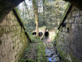
(S/E) A few metres further on, to the right of the road, opposite a barn, a grassy path branches off between two standing stones, leading across the meadows. Follow it. At the fork in the road, carry on straight ahead between the meadows and, at the edge of the woods, follow the signposted path downhill which runs alongside a moss-covered wall, the sole remaining part of the abbey’s enclosure. It then runs alongside the meadows, crosses a stream and arrives behind the Peyrouse mill.

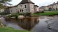
(1) At the crossroads, level with the mill, turn right, cross the stream again over a small wooden footbridge and continue downhill alongside a meadow, then follow the course of the stream to a ford which you cross over stones. Carry on straight ahead to the road to take in the view of the abbey at the bottom of the valley. Follow the road to the right until you reach the sign for the Fontaine aux Engelures. A farmhouse in the middle of the meadow is the only (recent) remnant of the abbey.

(2) Retrace your steps back to behind the mill and cross the footbridge again.

(1) Turn right, walking alongside the mill’s fence.

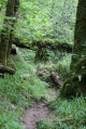
(3) At the fork in the road, in dry weather, take the path furthest to the right, which overlooks the Peyrouse pond. Through the woods, it climbs up towards the plateau (see the alternative route described in the ‘Practical information’ section for wet seasons).

(4) At the junction with a wider track (shown on the OSM map but not on the IGN map), turn left, then immediately right, across the meadows. A sign indicates a “shortcut to the village of Les Merles”. Head towards the village and turn left onto the road to return to the car park (S/E).

Waypoints

  1. S/E : mi 0 - alt. 909 ft - Château des Merles
  2. 1 : mi 0.8 - alt. 771 ft - Peyrouse Mill
  3. 2 : mi 0.94 - alt. 745 ft - Fontaine aux Engelures
  4. 3 : mi 1.17 - alt. 801 ft - Crossroads
  5. 4 : mi 1.54 - alt. 860 ft - Shortcut to the village
  6. S/E : mi 2.31 - alt. 909 ft - Château des Merles

Notes

There are no significant difficulties in following this path, which has been developed, signposted and maintained by a local voluntary organisation (Amis Chemins).
In wet weather, the path along the pond can be very muddy; it is best to follow the route which climbs immediately to the left at the Fork in the road ::3:: and joins the junction with the shortcut to the village ::4::

Worth a visit

The route is dotted with information boards detailing the history of the places you pass through:
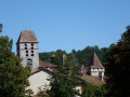
- the Manoir des Merles, whose present buildings date fromthe 17th century, probably served as a guesthouse for important visitors to the abbey. The path leading straight to the abbey site was likely used by them.
- The Cistercian Abbey of Peyrouse, founded in 1168, owned numerous farms and outbuildings in the surrounding villages.

In the hamlet, a place of grim remembrance: the barn where ten hostages were executed in April 1944.

Reviews and comments

4.7 / 5
Based on 1 review

Reliability of the description
5 / 5
Ease of following the route
4 / 5
Route interest
5 / 5
lili fauriac
lili fauriac

Overall rating : 4.7 / 5

Date of your route : Jan 29, 2024
Reliability of the description : ★★★★★ Very good
Ease of following the route : ★★★★☆ Good
Route interest : ★★★★★ Very good
Very busy route : No

A short but very rewarding walk, well signposted with information boards.

Machine-translated

Other walks in the area

For more walks, use our search engine .

The GPS track and description are the property of this route's author. Please do not copy them without permission.