La Borne au Lion, starting from Bellecombe

A leisurely walk through the valleys. The difficulty of the route depends on snow conditions; if you have to break trail, it can of course quickly become tiring. There are no technical difficulties and no tricky sections. This route is certainly less busy than the one starting from La Pesse.
To reach the starting point, bear in mind that in winter the road is often snow-covered; it’s a cold spot, so snow tyres are essential.

Details

5484026
Creation:
Last update:
Last review:
  • Snowshoeing
    Activity: Snowshoeing
  • ↔
    Distance: 7.12 mi
  • ◔
    Duration according to the author: 5 hrs 
  • ▲
    Difficulty: Moderate

  • ⚐
    Back to start: Yes
  • ↗
    Ascent: + 1,096 ft
  • ↘
    Descent: - 1,099 ft

  • ▲
    Highest point: 4,449 ft
  • ▼
    Lowest point: 4,058 ft

Photos

Description of the walk

Park in the car park at the Auberge de la Guienette.

(S/E) Follow the cross-country ski trail uphill. Continue until you reach the junction with the signpost for Le Berbois and La Borne au Lion.

(1) Leave the trail and turn right, heading uphill, to reach the Col des Salettes with ease.

(2) Head back down to the bottom of the valley, keeping slightly to the right. You’ll reach the junction with the GTJ trail (Grande Traversée du Jura) at a place called La Morseline.

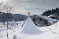
(3) Turn left onto this path and head straight into the valley. After a gentle climb through the forest, descend a gentle slope to a cross-country ski trail. Continue along this trail or over the surrounding hills, through rolling countryside bordered by woodland. Pass a few farm buildings near Malatrait. You will then reach the Berbois lodge and its teepee-style tents.

(4) Turn left towards La Borne au Lion, then take the track immediately on the right. About a hundred metres further on, head up to the left into the woods to reach the car park at La Borne au Lion. This avoids having to walk along the cross-country ski trail. The ascent is through the woods and is marked out.

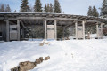
(5) Take the track on the left, running alongside the cross-country ski trail, towards the Col au Merle. Pass the monument dedicated to the Maquisards. Then continue due east to reach the Col du Merle.

(6) Here, a short alternative route to the left allows you to extend the walk by taking a detour via the Crêt au Merle to enjoy the views. The climb up to the Crêt au Merle is steep and is not marked on the GPX file.
Return to the pass and begin the descent along the cross-country ski trail. You’ll soon reach the junction leading into the valley.

(7) Leave the cross-country ski trail and head into the valley; the route is the same but more pleasant. Descend gently, then climb back up – this covers a fair distance; on the ascent, you’ll pass under a high-voltage power line. Continue on to reach the Bretta crossroads.

(8) Carry on along the cross-country ski trail, which descends gently, until you reach the original junction marked by the ‘Le Berbois’ sign.

(1) Carry on straight ahead along the same route as on the way out to reach the car park at the Auberge de la Guienette (S/E).

.

Waypoints

  1. S/E : mi 0 - alt. 4,075 ft - Car park at the - La Guienette
  2. 1 : mi 0.75 - alt. 4,190 ft - Le Berbois signpost
  3. 2 : mi 1.04 - alt. 4,380 ft - Col des Salettes
  4. 3 : mi 1.49 - alt. 4,124 ft - La Morseline
  5. 4 : mi 3.55 - alt. 4,206 ft - Le Berbois
  6. 5 : mi 3.96 - alt. 4,236 ft - La Borne Au Lion
  7. 6 : mi 4.46 - alt. 4,446 ft - Col du Merle (1351m)
  8. 7 : mi 4.88 - alt. 4,236 ft - Valley crossroads
  9. 8 : mi 5.98 - alt. 4,341 ft - Trail
  10. S/E : mi 7.12 - alt. 4,075 ft - Car park at the - La Guienette

Notes

Important note on this route: it is easy, with no significant elevation gain. Take care not to damage the cross-country ski trail when you have to walk along its edge. In principle, there are no navigation difficulties as the route is well signposted and the natural contours of the terrain are very easy to follow. With the IGN map, there’s little risk of getting lost.
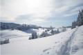
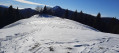
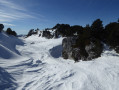
Between (3) and (4) The route is practically a straight line with gentle ascents and descents all the way to Le Berbois. You can head up the sides of the valley to enjoy the views. It’s a long, straight stretch to Le Berbois, but the undulating route is quite pleasant thanks to the snow cover, with gentle ascents and descents.

This route passes through a protected area, which may be subject to special regulations:

Worth a visit

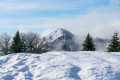
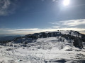
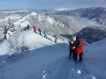
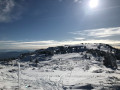
(5) The Borne au Lion stone with its information panel. View from the Borne au Lion towards the Reculet and, to the right, the Crêt de Chalam. In the distance, the Alpine range.
(5) You can descend 30 metres to visit the Borne au Lion. A stone marker demarcating the borders between France and Spain.
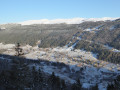
(6) A detour via the Crêt au Merle if you wish to extend the walk a little. The ridge marks the boundary between the departments of Ain and Jura; an inscription painted on the rock at the summit confirms this. Take in the view here of the Crêt de Chalam, the Reculet and the Crêt de la Neige.

Reviews and comments

4.7 / 5
Based on 3 reviews

Reliability of the description
4.5 / 5
Ease of following the route
4.7 / 5
Route interest
5 / 5
MUMMY
MUMMY

Thank you for your comment

Machine-translated

Sylvie3913
Sylvie3913

Overall rating : 4.7 / 5

Date of your route : Jul 20, 2026
Reliability of the description : ★★★★☆ Good
Ease of following the route : ★★★★★ Very good
Route interest : ★★★★★ Very good
Very busy route : No

The GPS track is very useful, thank you.

Machine-translated

MUMMY
MUMMY

Thank you for your comment. I hope you continue to enjoy your walks.

Machine-translated

Remysapin@club-internet.fr
• Edited:

Overall rating : 5 / 5

Date of your route : Jul 16, 2023
Reliability of the description : Not used / Not applicable
Ease of following the route : ★★★★★ Very good
Route interest : ★★★★★ Very good
Very busy route : No

This route, described for snowshoeing, can easily be followed on foot without walking through pastureland. About 200 metres after passing through the Col du Merle (6), leave the stony path and follow the footpath markings to the left, which take you along a magnificent old path through the woodland. The markings will then lead you back to the starting point without any difficulty.

Machine-translated

MUMMY
MUMMY

Thank you for your comment, and all the best for the future

Machine-translated

giroddo@orange.fr
giroddo@orange.fr

Overall rating : 4.7 / 5

Date of your route : Jan 31, 2023
Reliability of the description : ★★★★★ Very good
Ease of following the route : ★★★★☆ Good
Route interest : ★★★★★ Very good
Very busy route : Yes

This section of the route is only used by skiers and snowshoe walkers.
On this point, although we were on the right-hand side of the route on this unavoidable section following the GR (Crêt du Merle–Borne au Lion), we were shouted at by someone claiming the trail was for skiers only!!!
A magnificent and peaceful route, particularly on the higher ground leading to the Crêt du Merle (with views of the high mountain range: Reculet, Crêt de la Neige, etc.).
At Borne au Lion, there are tables and benches where you can enjoy a picnic in the sun and have a rest.
Return to the right of the ski run through the Vallon des Closettes (unmarked) but easily identifiable, much appreciated for its wonderfully peaceful atmosphere.
Many thanks to the creator of this unforgettable route.

Machine-translated

Other walks in the area

For more walks, use our search engine .

The GPS track and description are the property of this route's author. Please do not copy them without permission.