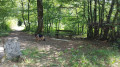
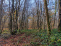
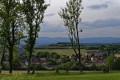
The structure at La Côte in Bavilliers

A walk for the curious, exploring unusual landscapes linked to the history and geography of our region.
The route is signposted.

Details

988251
Creation:
Last update:
Last review:
  • Walking
    Activity: Walking
  • ↔
    Distance: 4.40 mi
  • ◔
    Average duration: 2h 20 
  • ▲
    Difficulty: Easy

  • ⚐
    Back to start: Yes
  • ↗
    Ascent: + 374 ft
  • ↘
    Descent: - 371 ft

  • ▲
    Highest point: 1,506 ft
  • ▼
    Lowest point: 1,135 ft
  • ⚐ Country: France
  • ⚐ City: Bavilliers (90850|90800)
  • ⚑
    Start/End: N 47.621124° / E 6.83363°
  • ❏
    IGN map(s): Ref. 3621OT
  • Hour-by-hour weather

Description of the walk

Park in the car park at Bavilliers Town Hall. N.B. There is another car park near the shopping centre.

The walk is signposted: a route marked with a Red Ring.

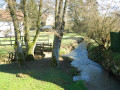
(S/E) Walk between the library and the river. Cross the bridge and go round the shopping centre on the right, then past the school complex; the path leads to the resurgence of the Douce.

(1) Join Rue des Champs de la Belle and follow it to the right. At the end of the tennis courts is the ‘Trou-la-Dame’. Continue up the same street, which leads to the Haute-Saône canal.

(2) Cross the canal and continue left along the footpath on the east side of the canal.

(3) At the bridge, turn left onto Rue du Port and then turn right along the towpath on the west side of the canal. You’ll come to another bridge.

(4) Turn left, walk down Rue Maréchal-de-Lattre-de-Tassigny, then turn right onto Rue du Sergent Leyris. At the bottom, there is an interesting fountain: this is where the River Douce rises. Walk back up the path. At the entrance to the woodland, you’ll find the little Chapel of Notre-Dame-du-Vœu.

(5) Turn right, then right again onto the first path. Follow this path – which remains very wide – until it leads to the esplanade of the Fort de la Côte, which can be visited on request.

(6) Opposite the entrance, take the main path leading back down to Bavilliers. You’ll reach the first houses.

(7) Turn right into Rue des Champs Granier, then into Rue des Chênes, and carry on straight ahead. Go down the steps opposite the shopping centre. Return to the first junction.

(1) Turn right and follow the route back the way you came to reach the town hall car park (S/E).

Waypoints

  1. S/E : mi 0 - alt. 1,138 ft - Town hall car park. Towards the - Douce (cours d'eau)
  2. 1 : mi 0.08 - alt. 1,138 ft - Crossroads of the circular loop
  3. 2 : mi 0.73 - alt. 1,214 ft - Crossing the Haute-Saône Canal
  4. 3 : mi 1.08 - alt. 1,211 ft - Bridge over the - Canal de Montbéliard à la Haute-Saône
  5. 4 : mi 1.68 - alt. 1,234 ft - On the left, Rue De Lattre de Tassiigny
  6. 5 : mi 2.11 - alt. 1,240 ft - Notre-Dame-du-Vœu Chapel
  7. 6 : mi 2.86 - alt. 1,496 ft - Ouvrage de la Côte
  8. 7 : mi 3.92 - alt. 1,211 ft - On the right, Rue des Champs Granier
  9. S/E : mi 4.4 - alt. 1,138 ft - Town hall car park

Notes

Visorando was provided with this information by Mr Chevalley, a volunteer member of balisage90, based on leaflets published by the Belfort Department of Territorial Planning.

Worth a visit

An unfinished canal
Following the loss of Alsace and part of Lorraine in 1870, it became necessary to establish a link between the industrial region of Montbéliard and that of French Lorraine. A project for a canal from Montbéliard to the Haute-Saône was therefore launched. The return of Alsace-Lorraine to France in 1918 rendered the plan for a direct link between the Doubs and the Saône less relevant, and it was soon abandoned. Only the Belfort section (12.5 km), linking the Rhône–Rhine Canal to the port of Botans, was completed and filled with water in 1926. Today, the Canal’s ‘Coulée Verte’ (Green Corridor) allows walkers and cyclists to travel from the lock at Essert to Montbéliard.

The Côte Project
Situated between the Vosges and the Jura, the Belfort Gap is the only plain linking the Rhine and Danube valleys with that of the Rhône: it therefore had to be protected. Various fortified systems were thus built in succession, culminating in the famous Séré de Rivières fortified belt (1874). The Côte d’Essert fort, built in 1890, forms part of a new generation of modern forts entirely carved out of the rock, in which concrete was first used. The facilities, which are entirely underground, were designed to accommodate more than 250 men.

Trou-la-Dame
In the valley, amidst a copse, you will come across a funnel-shaped depression where the Douce disappears, before re-emerging 150 metres further down. This phenomenon, known as a resurgence, is directly linked to the limestone nature of the soil: the karst landscape, which can be glimpsed on the surface, is even more impressive underground, giving rise to underground rivers and caves.

Reviews and comments

4.8 / 5
Based on 2 reviews

Reliability of the description
5 / 5
Ease of following the route
5 / 5
Route interest
4.5 / 5
vero4400
vero4400

Overall rating : 5 / 5

Date of your route : Sep 18, 2023
Reliability of the description : ★★★★★ Very good
Ease of following the route : ★★★★★ Very good
Route interest : ★★★★★ Very good
Very busy route : Yes

A lovely walk that’s half through the town and half through the woods. Most of the route follows the pretty Parc de la Douce alongside the canal before heading into the woods. A good climb takes you up to the Côte embankment, followed by a gentle descent back to the charming little village of Bavilliers. The Red Ring sign is clearly visible throughout. Well done and thank you!

Machine-translated

Egon
Egon

Overall rating : 4.7 / 5

Date of your route : Oct 11, 2020
Reliability of the description : ★★★★★ Very good
Ease of following the route : ★★★★★ Very good
Route interest : ★★★★☆ Good
Very busy route : No

Hello,
Just a quick note: it would be better if the map in the PDF file were centred so that it fills the page completely when printed.
Kind regards,
Egon

Machine-translated

jcduch
jcduch

Hello
These two routes will be launched in the coming months.
Kind regards
JCDuch

Machine-translated

Other walks in the area

For more walks, use our search engine .

The GPS track and description are the property of this route's author. Please do not copy them without permission.