Country:
 City:
City:


The route is marked with Red Rings.
Start: Rue des Charmilles, next to the shopping centre car park.
(S/E) At the start, take Rue des Charmilles. At the bend, turn right onto a path that runs alongside the road and enters the forest. Walk alongside the fence of a private property and pass above the fire station.
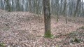
(1) Just past the fire station, the route splits into two. Turn right, following the Red Rings. The forest has few logging tracks, and the route follows the occasional clearings between the forest plots.
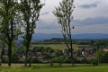
(2) Halfway along the route, the trail crosses the underground water main that supplies the town of Belfort and the surrounding villages with drinking water from Mathay, near Montbéliard. You’ll arrive at the sports ground and schools in the village of Froideval.
(3) Leave the forest, go round the Froideval sports ground, then turn left onto the northern section of Rue du Hameau du Berger.
(4) At the end of the street, head back into the forest, following the Red Ring markers. Shortly afterwards, cross the water pipeline you encountered earlier once more. As you leave the forest, walk past the fire station heading north to rejoin the path you took at the start of the walk.
(1) Follow the route in reverse to return to the start of the walk (S/E).


 Visorando Member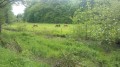
 Moderate
 Local authority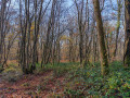
 Difficult