From Bavilliers to Sevenans via the forts

This walk follows the fortified belt around Belfort.
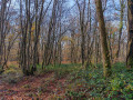
You’ll discover lovely countryside and woodland scenery, as well as several charming villages: Bavilliers, Froideval, Botans, Dorans, Bermont and Sevenans. You’ll pass by the Fort du Bois d’Oye. You’ll be able to admire the Coulée Verte and the Haute-Saône Canal. Near Bermont, you’ll find a superb 360° viewpoint over the Vosges and the Jura.
The start and finish points are served by a bus service.

This walk is part of a multi-day hike: Tour des forts en 6 étapes autour de Belfort : les forts

Details

n°3147207
Creation:
Last update:
Last review:
  • Walking
    Activity: Walking
  • ↔
    Distance: 8.90 mi
  • ◔
    Average duration: 4h 35 
  • ▲
    Difficulty: Moderate

  • ⚐
    Back to start: No
  • ↗
    Ascent: + 558 ft
  • ↘
    Descent: - 558 ft

  • ▲
    Highest point: 1,404 ft
  • ▼
    Lowest point: 1,106 ft
  • ⚐ Country: France
  • ⚐ City: Bavilliers (90850|90800)
  • ⚑
    Start: N 47.62074° / E 6.833677°
  • ⚑
    End: N 47.588982° / E 6.859546°
  • ❏
    IGN map(s): Ref. 3621OT
  • Hour-by-hour weather

Photos

Description of the walk

The route is marked with a yellow and red rectangle.

(S) From Bavilliers Town Hall, walk along the River Douce towards the shopping centre (northwards), cross the river and turn right, following the path alongside the river. This is where the Yellow Rectangle and Red Rectangle markings begin.
Turn right onto Rue des Champs la Belle.

(1) Turn left just before the River Douce to take a short detour and see an astonishing natural phenomenon: the ‘Trou la Dame’. Cross the River Douce via the footbridge, turn left and follow the signs to the ‘Trou la Dame’. Return by following the left bank, turn left onto the street and, at the junction, continue straight on along Rue des Champs la Belle.

(2) When you reach the canal, turn left and then immediately right onto a hairpin bend to walk alongside the Haute-Saône Canal via the greenway. This is also a cycle path. Please note that on a ‘shared path for pedestrians and cyclists’, pedestrians should walk on the left. This makes it easier to see oncoming cyclists. Continue along the greenway for 4 km. Look out for locks No. 11 and No. 10.

When you reach Grande Rue François Mitterrand, cross at the pedestrian crossing. Continue straight ahead along the green corridor. Look out for the wildlife park on your left, next to the playground. Carry on straight ahead at Lock No. 9, cross Rue des Écoles at the pedestrian crossing and continue straight ahead. Look out for Locks No. 8 and No. 7. Pass under the Belfort–Héricourt railway line and continue along the canal.

(3) Look out for the signposting and turn right to reach the bridge over the canal, then turn right, following the path that leads into the forest. 300 metres further on, follow the signposting carefully to take a sharp left turn onto a small path. Leave the forest, pass under the high-voltage power line and arrive at Rue de Froideval in Botans. Turn left and continue along Rue des Sources.

(4) At the junction, turn right onto Rue de Dorans. Walk past the eco-museum and leave Botans.

(5) Cross the bridge over the E54/N1019 expressway.
Due to roadworks at the Sevenans junction, the route will be altered. The signposting will be updated in 2020. To follow the new route, turn left 50 metres after the bridge. The path runs alongside the expressway and the junction slip road.

(6) When you reach the D18, cross it and continue along the path opposite. Head up into the forest.

(7) When you reach the tarmac road, Rue de Dorans, cross it and continue along the path opposite. Look out for the defence bunkers on the left-hand side of the path. As you leave the forest, the path becomes Rue des Noisetiers.

(8) Turn left at the junction of Rue des Noisetiers and Rue de la Chapelle. 50 metres further on, take the left-hand turn. Continue along the road until you reach the Notre Dame du Chêne chapel, which you’re sure to admire. Carry on straight ahead.

(9) At Fort du Bois d’Oye, turn right onto the road, walk past the shooting range and take the path on the left immediately afterwards. 100 metres further on, turn left again. 300 metres further on, take the path on the left which climbs up the hill.

(10) Reach the summit. Take in the 360° view: an exceptional panorama of the Vosges mountain range, Belfort, the Trévenans Hospital, the TGV viaduct and the Jura mountain range. Head back down to the left, following the signposts. Enter the forest and, 100 metres further on, turn right, following the signposts. At the next junction, continue straight ahead. Walk past the stadium, cross Rue de Chatenois and continue along the path opposite, which becomes Impasse d’Avolle and leads to the village of Bermont.

(11) Turn right at the junction of Impasse d’Avolle and Rue de Chatenois. 50 metres further on, turn right into the Grande Rue. Take the path running along the right-hand side of the church. The path leads downhill. At the bottom, turn left onto Rue de la Suze. Look out for the old bridge over the Douce. Continue straight ahead (do not cross the old bridge).

(12) At the junction, take the sharp right-hand bend onto Rue des Roches (D45). Please note that this is a major road with heavy traffic. Cross the River Douce and go over the bridge above the A36 motorway. Cross over the canal.

(13) 50 m after the bridge, 10 m before the main road, turn left off the tarmac to follow the canal along the footpath.

(14) Continue along the canal and pass under the D18 bridge.
Shortly afterwards, join the cycle path. This is a ‘shared path for pedestrians and cyclists’. Reach the D19. Cross it carefully (heavy traffic) and head to the bus stop opposite, which is the finish point (E).

Waypoints

  1. S : mi 0 - alt. 1,138 ft - Bavilliers Town Hall - Douce (cours d'eau)
  2. 1 : mi 0.38 - alt. 1,148 ft - Trou la Dame junction
  3. 2 : mi 0.85 - alt. 1,214 ft - Pin near the footbridge over the canal
  4. 3 : mi 3.06 - alt. 1,138 ft - Bridge over the - Canal de Montbéliard à la Haute-Saône
  5. 4 : mi 4.09 - alt. 1,165 ft - Junction of Rue des Sources and Rue de Dorans (D9)
  6. 5 : mi 4.43 - alt. 1,184 ft - Bridge over the E54/N1019
  7. 6 : mi 5.07 - alt. 1,125 ft - D18 road
  8. 7 : mi 5.24 - alt. 1,214 ft - Rue de Dorans
  9. 8 : mi 5.98 - alt. 1,250 ft - Rue des Noisetiers – Rue de la Chapelle
  10. 9 : mi 6.66 - alt. 1,362 ft - Fort du Bois d’Oye
  11. 10 : mi 7.18 - alt. 1,404 ft - Point de vue remarquable au coeur de la trouée de Belfort
  12. 11 : mi 7.95 - alt. 1,188 ft - Impasse d’Avolle – Rue de Chatenois. Towards the - Savoureuse (rivière)
  13. 12 : mi 8.23 - alt. 1,158 ft - D45 junction. Cross the - Douce (cours d'eau)
  14. 13 : mi 8.47 - alt. 1,122 ft - Canal bank
  15. 14 : mi 8.69 - alt. 1,122 ft - Coulée Verte – Bridge under the D18
  16. E : mi 8.9 - alt. 1,119 ft - ‘Carrefour des Oeufs Frais’

Notes

The departure point is at Bavilliers Town Hall, next to the bus stop for line 2 of the Optymo network.
You can download the Optymo app onto your phone to check timetables. You can pay for your journey using your phone.
There is a car park near the town hall at 38 Grande Rue François Mitterrand, and another car park near the shopping centre on the corner of Rue de la Libération and Rue Jacques Pignot in Bavilliers.

The bus arrives in Sevenans at the ‘Carrefour des Œufs Frais’ junction. Bus route 3
If travelling by car, you can park at the end of Rue des Sablettes near La Savoureuse (2 or 3 parking spaces).

Worth a visit

A fortified ring wall was built after the War of 1870. General Séré de Rivières oversaw the operations. For further details, see the following link.
Trou-la-Dame
In the valley, amidst a copse, you’ll find a funnel-shaped opening where the Douce disappears, before re-emerging 150 metres further down. This phenomenon, known as a resurgence, is directly linked to the limestone nature of the soil: the karst landscape, which is faintly visible on the surface, is even more impressive underground, giving rise to underground rivers and caves.

The Botans Agricultural Museum.
Housed in a farmhouse dating from 1830, this museum traces the development of agricultural machinery over the past 200 years, as well as displaying all the tools of life in days gone by: 100 machines and 1,700 objects (veterinary instruments, horse-drawn carriages, bread-making equipment, and apparatus for producing brandy and apple juice). A vegetable garden features local plants: wormwood, horseradish and angelica.

Haute-Saône Canal and the ‘Coulée Verte’
The route offers an insight into the extensive engineering work involved in the canal’s construction, carried out between the late 19th and early 20th centuries. Starting from Bavilliers, you’ll discover ‘la Coulée Verte’, the western bank of the canal stretching from Montbéliard to the Haute-Saône. The canal was intended to link the Rhône–Rhine Canal to the Haute-Saône. The declaration of public utility for the canal, signed by the Minister for Public Works, C. de Freycinet, dates from 1879. Construction work began in 1883. Aninth attempt to fill the canal from the Champagney Reservoir took place in 1933. As water losses were enormous, it was decided to abandon the project.

The Chapel of Notre-Dame du Chêne:
Its name is said to derive from a statuette of the Virgin and Child discovered in the hollow of an oak tree in the Bois d’Oye forest. Carved from lime wood, its creator remains unknown, which has given rise to a number of legends.

Saint-Laurent Church:
Perched on its rocky outcrop, the church dates from the 12th century but was extended in the 19th century before being renovated in 1999. All that remains from the 12th century is the pointed-arch apse with a squat bell tower. The Rhenish influence is evident in this massive five-sided structure, adorned with blind pointed arches and a cornice featuring thick arcades. The church and one of its bells are listed in the supplementary register of Historic Monuments. The stained-glass windows are by Maison Janin of Nancy.

The Fort du Bois d’Oye:
General Éblé lent his name to this large pentagonal fort, built in 1883. The main barracks stretches its long façade across a vast esplanade at the centre of the fort. Designed to accommodate over 600 men and some thirty artillery pieces, this fort was tasked with blocking the roads and railway lines leading from Montbéliard and Delle. Having become an infantry strongpoint, it underwent major modernisation work between 1908 and 1913, including the pouring of concrete, the construction of turrets and the creation of counterscarps. The fort is not open to the public for safety reasons.

Reviews and comments

5 / 5
Based on 1 review

Reliability of the description
Not used
Ease of following the route
5 / 5
Route interest
5 / 5
Orando974
Orando974 ★

Overall rating : 5 / 5

Date of your route : Dec 26, 2025
Reliability of the description : Not used / Not applicable
Ease of following the route : ★★★★★ Very good
Route interest : ★★★★★ Very good
Very busy route : No

I did this stage at the same time as the one between Bas-Evette (Lac du Malsaucy) and Bavilliers. I preferred this stage, which is more varied in terms of landscape. To my surprise, I really enjoyed walking along the canal on the outskirts of Bavilliers. The viewpoint after the fort is nice, providing a pleasant end to the walk and offering a view of the Savoureuse valley. The last village is also worth lingering in for a while. I can't wait to do the last two stages. So far, I really like this GRP .

Machine-translated

Other walks in the area

For more walks, use our search engine .

The GPS track and description are the property of this route's author. Please do not copy them without permission.