A short walk in the hills above Essert

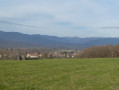
This unpretentious little walk will allow you to enjoy some lovely rural and woodland scenery just a stone’s throw from the centre of Belfort. As an added bonus, a few old boundary stones with engraved coats of arms mark the route.

Details

2197302
Creation:
Last update:
Last review:
  • Walking
    Activity: Walking
  • ↔
    Distance: 2.11 mi
  • ◔
    Average duration: 1h 10 
  • ▲
    Difficulty: Easy

  • ⚐
    Back to start: Yes
  • ↗
    Ascent: + 213 ft
  • ↘
    Descent: - 213 ft

  • ▲
    Highest point: 1,545 ft
  • ▼
    Lowest point: 1,332 ft
  • ⚐ Country: France
  • ⚐ City: Essert (90850)
  • ⚑
    Start/End: N 47.638065° / E 6.82336°
  • ❏
    IGN map(s): Ref. 3520ET, 3621OT
  • Hour-by-hour weather

Photos

Description of the walk

Start at the end of Rue du Lieutenant Cadinot in Essert.

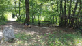
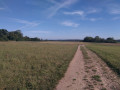
(S/E) At the end of the street and continuing in the same direction, take the tarmac path that climbs up under the trees. About a hundred metres further up, leave this path and take the one branching off to the left, straight across the meadows, with a woodland edge running parallel on either side. At the end of the woodland edges, turn right and follow the field path running along the edge of the small woods.

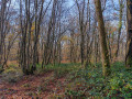
(1) Enter the undergrowth, turn left onto a dirt track and continue along this main path, which leads into the forest a little further on.

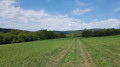
(2) At the path marked with Red Saltires, turn right. Follow the path to the high-voltage power line, with an old boundary marker nearby. Leave the path and turn right onto a faint track that follows the edge of the woodland, with a large field on the left.

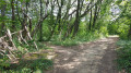
(3) Take care at this fork in the undergrowth; leave the most clearly marked path, then turn left to emerge into the meadows, pass under the high-voltage power line and then walk alongside various copses and thickets. You’ll soon rejoin a field track (with two ruts!) and follow it to a wide, well-marked dirt track under the trees.

(4) On this track, turn left as it descends and join Rue du Lieutenant Cadinot (S/E).

Waypoints

  1. S/E : mi 0 - alt. 1,332 ft - Rue du Lieutenant Cadinot
  2. 1 : mi 0.39 - alt. 1,434 ft - Path through the woodland
  3. 2 : mi 0.89 - alt. 1,440 ft - Signposted path
  4. 3 : mi 1.59 - alt. 1,480 ft - Junction in the woodland
  5. 4 : mi 1.86 - alt. 1,427 ft - Return route
  6. S/E : mi 2.11 - alt. 1,332 ft - Rue du Lieutenant Cadinot

Reviews and comments

4.4 / 5
Based on 3 reviews

Reliability of the description
4.3 / 5
Ease of following the route
4.3 / 5
Route interest
4.7 / 5
Jean Luc C
Jean Luc C

Overall rating : 5 / 5

Date of your route : Sep 25, 2023
Reliability of the description : ★★★★★ Very good
Ease of following the route : ★★★★★ Very good
Route interest : ★★★★★ Very good
Very busy route : No

A nice walk where you can let the dog off the lead

Machine-translated

pat_cbl-rando
pat_cbl-rando

Overall rating : 4 / 5

Date of your route : Nov 17, 2020
Reliability of the description : ★★★★☆ Good
Ease of following the route : ★★★★☆ Good
Route interest : ★★★★☆ Good
Very busy route : Yes

A lovely route, one of the many options available in this small mountain range.
A word of warning to those coming by car: parking is very limited.

Machine-translated

Other walks in the area

For more walks, use our search engine .

The GPS track and description are the property of this route's author. Please do not copy them without permission.