Between the Brune and the Serre

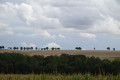
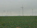
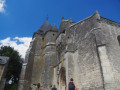
An easy walk along country lanes through vast fields of wheat and flax. The hills of the Thiérache offer sweeping views in every direction. Admire the churches at Morgny and Sainte-Geneviève, as well as the many fortified churches in the surrounding area.

Details

105420998
Creation:
Last update:
Last review:
  • Walking
    Activity: Walking
  • ↔
    Distance: 7.49 mi
  • ◔
    Average duration: 3h 50 
  • ▲
    Difficulty: Moderate

  • ⚐
    Back to start: Yes
  • ↗
    Ascent: + 410 ft
  • ↘
    Descent: - 390 ft

  • ▲
    Highest point: 696 ft
  • ▼
    Lowest point: 433 ft

Photos

Description of the walk

You can park in front of the town hall in Morgny-en-Thiérache.

(S/E) From the town hall, head down towards the church and take Rue du Château on the left. Carry on straight towards Genneval and pass a wash house. At the fork, leave the D74 road and head up to the left towards Chemin des Laveuses without actually taking it.

(1) Continue straight on along the stony track. After about 300 m, keep to the right and follow the track southwards until you reach the D110 road linking Dolignon to Renneval.

(2) Follow it to the right and, after 100 m, turn left off it. About a hundred metres further on, carry straight on. This track does not appear on the 1:25,000-scale IGN map, but it is definitely there. Follow it to the D611.

(3) Turn left onto the road and, 300 metres further on, take the dirt track on the left. Head down towards Magny.

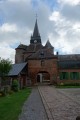
(4) Follow the D58 to the left and you’ll reach Sainte-Geneviève. Take a moment to admire the little church with its Gothic features.

(5) At the town hall, turn left into Rue de la Fontaine. Near a wash house, turn right, then at the fork, take the path on the right and head up through the fields to Dolignon and the D110 road.

(6) In Dolignon, turn left onto this road, leave the Route d’Archon on your right and take the next path on the right heading due north. Pass the farm and continue straight on in the same direction.

(7) Pass through the Bois Maudit. When you reach Morgny, turn right onto Rue du Petit Noyer, then turn left onto Rue des Lavoirs and you’ll arrive at the town hall (S/E).

Waypoints

  1. S/E : mi 0 - alt. 525 ft - Morgny-en-Thiérache Town Hall. Near the - Brune (rivière) - Affluent du Vilpion
  2. 1 : mi 0.27 - alt. 568 ft - Chemin des Laveuses
  3. 2 : mi 1.86 - alt. 643 ft - D110
  4. 3 : mi 2.7 - alt. 653 ft - D611
  5. 4 : mi 3.61 - alt. 479 ft - Reuil-Magny. D58 - Gare de Magny (Aisne)
  6. 5 : mi 4.32 - alt. 456 ft - Sainte-Geneviève - Serre (rivière) - Affluent de l'Oise
  7. 6 : mi 5.33 - alt. 509 ft - Dolignon. D110
  8. 7 : mi 6.75 - alt. 656 ft - The Bois Maudit
  9. S/E : mi 7.49 - alt. 525 ft - Morgny-en-Thiérache Town Hall

Notes

No refreshment points on the route. Shops in Rozoy, Brunehamel, Montcornet or Vervins.
Water points at the cemeteries in Morgny-en-Thiérache and Sainte-Geneviève.
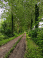
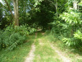
The paths are generally easy to walk on. There are a few grassy sections.

Worth a visit

Churches in Morgny-en-Thiérache and Sainte-Geneviève.
There are many fortified churches in the surrounding area: Montcornet, Rozoy, Chaourse, Renneval, Dohis, Jeantes, Plomion, etc.
Parfondeval is one of the most beautiful villages in France.
Greenway along the River Serre.

Other walks in the area

For more walks, use our search engine .

The GPS track and description are the property of this route's author. Please do not copy them without permission.