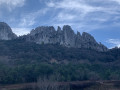
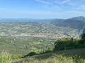
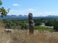
Prébayon Abbey and the Bishops’ Cypresses as seen from Vaison-La-Romaine

A lovely walk alternating between footpaths, tracks and forest roads, with a few technical sections. Often sheltered by pine trees or following ridgelines, offering views of the Dentelles de Montmirail and the Crête Saint-Amand. Prébayon Abbey is also well worth a brief stop.

Details

n°18293899
Creation:
Last update:
Last review:
  • Mountain biking
    Activity: Mountain biking
  • ↔
    Distance: 13.88 mi
  • ◔
    Duration according to the author: 3 hrs 
  • ▲
    Difficulty: Moderate

  • ⚐
    Back to start: Yes
  • ↗
    Ascent: + 1,791 ft
  • ↘
    Descent: - 1,768 ft

  • ▲
    Highest point: 1,762 ft
  • ▼
    Lowest point: 630 ft
  • ⚐ Country: France
  • ⚐
  • ⚐ City: Vaison-la-Romaine (84110)
  • ⚑
    Start/End: N 44.238071° / E 5.076708°
  • ❏
    IGN map(s): Ref. 3040ET

  • ◶
    Type of surface:
  •  
     
     
    ■ 30% Road ■ 60% Byway ■ 10% Path
  • ⇧
    Bike carrying: No
  • ▲
    Difficulty: Moderate
  • Hour-by-hour weather

Photos

Description of the route

Park in the large car park downstream of the Roman bridge.

(S/E) Cross this thousand-year-old bridge, turn left after the bridge and, a few dozen metres further on to the right, you’ll find a footpath.

(1) Take this path, the Chemin de la Frigaulière, which begins with a steep climb, and follow it until you join the Chemin des Bois Communaux.

(2) Turn left and continue for a good while along this tarmac road. Start the gentle climb.

(3) At the sharp left-hand bend at the top of the valley, turn right onto the forest track. Pass a hairpin bend and you’ll soon reach a T-junction.

(4) Take the path on the left that leads uphill; it becomes stony. Carry on without leaving this forest track.

(5) At the junction with the stony track, turn right and carry on to the Croix de la Verrière.

(6) Carry on to the right for 300 m until you reach La Verrière.

(7) Keep left at the three-way junction and head towards the Cyprès des Évêques.

(8) Turn right, ignore the track on the left and carry on, keeping the vineyards on your right,

(9) At the top of the path, veer right, heading down between the vineyards and then through the woodland until you reach the crossroads.

(10) Head down the steep, technical little path on the right for about a hundred metres, cross the bridge at Prébayon Monastery and take the small path directly opposite. The ride is then fairly easy and pleasant. Follow the Ravin de Prébayon on your left until you reach a stony track.

(11) Head up the road on the right towards Côte Chaude as far as La Combe and the junction with the forest track,

(12) Turn right and continue along this stony track (GR® 4). Follow it, ignoring the side paths on either side, until you reach La Verrière.

(7) Turn left, heading in the opposite direction to the way you came, for 300 m until you reach the Croix de la Verrière.

(6) Carry on straight ahead until you reach Les Faysses.

(13) Turn sharply left and head down the Chemin des Fontaines. Continue down the slope; there is a lovely viewpoint at the bottom. Return to the starting path.

(2) Turn right and head back down the Chemin de Frigoulière.

(1) Cross the road, then the Roman bridge, and head right, down below, to the car park (S/E).

Waypoints

  1. S/E : mi 0 - alt. 646 ft - Car park along the - Ouvèze (rivière)
  2. 1 : mi 0.18 - alt. 669 ft - Start of the Frigoulière hiking trail
  3. 2 : mi 0.36 - alt. 817 ft - Communal woodland path
  4. 3 : mi 2.43 - alt. 1,086 ft - Barbanot
  5. 4 : mi 2.82 - alt. 1,152 ft - Junction with the Petit stream
  6. 5 : mi 3.68 - alt. 1,519 ft - Le Laquet
  7. 6 : mi 4.25 - alt. 1,634 ft - Croix de la Verrière
  8. 7 : mi 4.44 - alt. 1,670 ft - La Verrière
  9. 8 : mi 4.76 - alt. 1,686 ft - The Bishops’ Cypresses
  10. 9 : mi 5.4 - alt. 1,627 ft - Descent through the vineyards
  11. 10 : mi 5.77 - alt. 1,375 ft - Ruines du monastère de Prébayon
  12. 11 : mi 6.73 - alt. 1,073 ft - Côte Chaude
  13. 12 : mi 7.59 - alt. 1,480 ft - La Combe
  14. 13 : mi 10.51 - alt. 1,240 ft - Les Faysses
  15. S/E : mi 13.88 - alt. 646 ft - Ouveze car park

Notes

A few short technical sections and plenty of forest tracks.

Worth a visit

Ruins of Prebayon Monastery. Château du Crestet orientation board

Always be cautious and plan ahead when you're outdoors. Visorando and the author of this route cannot be held responsible for any accidents occurring on this route.

The GR® and PR® markings are the intellectual property of the Fédération Française de Randonnée Pédestre.

Reviews and comments

4 / 5
Based on 2 reviews

Reliability of the description
4.5 / 5
Ease of following the route
4 / 5
Route interest
3.5 / 5
Jacky Anx
Jacky Anx

Thank you for your feedback
Enjoy your walk

Machine-translated

bp620
bp620

Overall rating : 3.7 / 5

Date of your route : Jan 13, 2025
Reliability of the description : ★★★★☆ Good
Ease of following the route : ★★★★☆ Good
Route interest : ★★★☆☆ Average
Very busy route : No

Mountain bike route – please note that the start is very steep, so make sure you warm up properly in the car park; otherwise, you might want to take the detour via the old town.

Machine-translated

Domdom Lucien
Domdom Lucien

Overall rating : 4.3 / 5

Date of your route : Jun 05, 2024
Reliability of the description : ★★★★★ Very good
Ease of following the route : ★★★★☆ Good
Route interest : ★★★★☆ Good
Very busy route : No

Not to be missed

Machine-translated

Other walks in the area

For more walks, use our search engine .

The GPS track and description are the property of this route's author. Please do not copy them without permission.