Pays de Grignan – The Invasions Trail

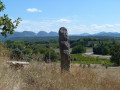
This route will take you along the Taulignan Silk Road, with its old mill and two restored factories. You’ll continue your journey amongst lavender fields, vineyards and stone huts, passing very close to the La Clarté Notre-Dame des Dominicaines Monastery. The final section will take you along the Chemin des Invasions, where, via a short detour, you’ll catch a glimpse of the beautiful Saint-Marcel Chapel. You’ll finish your walk in the narrow streets of the medieval village of Taulignan.

Details

1214178
Creation:
Last update:
Last review:
  • Mountain biking
    Activity: Mountain biking
  • ↔
    Distance: 6.33 mi
  • ◔
    Duration according to the author: 1.5 hrs 
  • ▲
    Difficulty: Easy

  • ⚐
    Back to start: Yes
  • ↗
    Ascent: + 243 ft
  • ↘
    Descent: - 240 ft

  • ▲
    Highest point: 1,050 ft
  • ▼
    Lowest point: 771 ft
  • ⚐ Country: France
  • ⚐
  • ⚐ City: Taulignan (26770)
  • ⚑
    Start/End: N 44.441296° / E 4.977836°
  • ❏
    IGN map(s): Ref. 3038SB, 3039ET

  • ◶
    Type of surface: Not specified
  • ⇧
    Bike carrying: Not specified
  • ▲
    Difficulty: Not specified
  • Hour-by-hour weather

Description of the route

Starting point: Taulignan village hall.

Mountain bike route no. 10.

(S/E) From the village hall, turn right and carry on straight ahead along the small road.

(1) At the three-way junction, turn left onto the Chemin de la Soie. Continue along the road. View of the old mill and the two restored former factories.

(2) Turn right onto the road until you reach the D167.

(3) Cross the road – watch out for cars! Carry on straight ahead.
You can follow route 10bis by heading up to the left to reach the plateau.

(4) Leave the road leading to the monastery and follow the path straight on, running alongside the vineyards. Further down, turn off and head up the lovely path on the left.

(5) At the top, turn right. Lovely view of the mountains and Mont Ventoux! Further on, turn left onto a path lined with vineyards to reach the Blaches plateau.

(6) Keep to the right and carry on straight along the track, then take the small road on the left to reach the D24.

(7) Continue along the road for 100 metres –watch out for cars! – then turn left onto a track. A little further on, take the path up to the left through the woodland to reach a plateau near the Chapelle Saint-Marcel.

(8) Carry on straight ahead along the Chemin des Invasions, with its beautiful low stone walls. Reach the road, then the Northern Calvary (alt. 280m), to come within sight of the medieval village.

(9) Pass under the stone archway to enter the narrow streets of Taulignan.
Follow the signposts, passing the church and the washhouse, to return to the starting point (S/E).

Waypoints

  1. S/E : mi 0 - alt. 850 ft - Village hall
  2. 1 : mi 0.48 - alt. 817 ft - Three-way junction
  3. 2 : mi 1.03 - alt. 801 ft - Turn right onto the road
  4. 3 : mi 1.61 - alt. 817 ft - Crossing the D167
  5. 4 : mi 2.08 - alt. 896 ft - Path opposite
  6. 5 : mi 2.75 - alt. 955 ft - Highest point on the coast
  7. 6 : mi 3.76 - alt. 968 ft - Crossroads of 4 paths
  8. 7 : mi 4.55 - alt. 981 ft - Crossing the D24
  9. 8 : mi 4.88 - alt. 1,043 ft - Junction near a chapel
  10. 9 : mi 5.87 - alt. 906 ft - Entrance archway to Taulignan
  11. S/E : mi 6.33 - alt. 850 ft - Village hall

Notes

We strongly recommend that you take the IGN map referred to on these pages with you. Mountain bikers must be self-sufficient; professional guides are available if required. Emergency numbers: 18 or 112
Enquiries at the Pays de Grignan – Enclave des Papes Tourist Office: 04 75 46 56 75 (Grignan) and 04 90 35 04 71 (Valréas) / info@tourisme-paysdegrignan.com
Pays de Grignan Tourist Office
Valréas Tourist Office

Reviews and comments

4.7 / 5
Based on 2 reviews

Reliability of the description
5 / 5
Ease of following the route
4.5 / 5
Route interest
4.5 / 5
4807
4807

Overall rating : 4.7 / 5

Date of your route : Sep 03, 2023
Reliability of the description : ★★★★★ Very good
Ease of following the route : ★★★★★ Very good
Route interest : ★★★★☆ Good
Very busy route : Yes

A walk – a lovely discovery

Machine-translated

PIERALB
PIERALB

Overall rating : 4.7 / 5

Date of your route : Apr 04, 2022
Reliability of the description : ★★★★★ Very good
Ease of following the route : ★★★★☆ Good
Route interest : ★★★★★ Very good
Very busy route : No

A route to complement the Silk Road trail in Taulignan. Of considerable cultural and heritage interest.

Machine-translated

Other walks in the area

For more walks, use our search engine .

The GPS track and description are the property of this route's author. Please do not copy them without permission.