The hills above Saint-Cyr-en-Retz

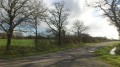
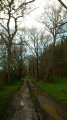
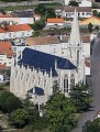
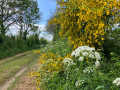
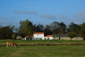
Explore the hedgerow countryside of the Pays de Retz with views over the Breton marshes. Starting from the orientation table, take a walk through the hedgerow countryside and return via the village, where you can discover one of the most beautiful churches in the Loire-Atlantique.

Details

207954
Creation:
Last update:
Last review:
  • Walking
    Activity: Walking
  • ↔
    Distance: 3.84 mi
  • ◔
    Average duration: 1h 50 
  • ▲
    Difficulty: Easy

  • ⚐
    Back to start: Yes
  • ↗
    Ascent: + 79 ft
  • ↘
    Descent: - 79 ft

  • ▲
    Highest point: 125 ft
  • ▼
    Lowest point: 36 ft

Photos

Description of the walk

Start from the orientation table, on the road leading to the viewpoint. Yellow signposts on trees and street furniture.

(S/E) With your back to the orientation table, go straight ahead (north-north-east). At the T-junction, turn left. At the next junction (marker 37), turn right then immediately left. Cross a path and come out onto the D80 road.

(1) Cross the D80 and continue along the small road opposite. Pass the hamlet of Le Cloître and ignore the side paths.

(2) When the road bends to the right, leave it and take the track on the left (waycross). Ignore a track coming from the left.

(3) At the junction, turn left (east) then turn right onto the track.

(4) After passing La Renauderie, turn left at the junction. Cross a stream, pass a path, then turn right (south-west). You’ll come out onto a small road; follow it straight ahead (south) and walk alongside a livestock farm.

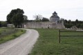
(5) At the Fork in the road, take the left-hand path. Cross the D80 again and follow the Route du Point de Vue. Continue straight on to the church and carry on towards the cemetery.

(6) Leave the road and continue (east-southeast) along a track. Cross a track and, after a few metres, turn left (north-east). Ignore a track coming from the left and head for the orientation table (S/E).

Waypoints

  1. S/E : mi 0 - alt. 115 ft - Orientation table
  2. 1 : mi 1.02 - alt. 108 ft - D80 road
  3. 2 : mi 1.77 - alt. 102 ft - Calvary
  4. 3 : mi 2.11 - alt. 102 ft - Crossroads
  5. 4 : mi 2.37 - alt. 72 ft - Junction
  6. 5 : mi 2.98 - alt. 95 ft - Fork in the road
  7. 6 : mi 3.33 - alt. 49 ft - Cemetery
  8. S/E : mi 3.84 - alt. 115 ft - Orientation table

Notes

Public toilets near the church.
Bar and tobacconist’s on the street below the church.

Worth a visit

Nearby: Arzelier Mill; 19th-century church; “Les Priés” wine cellar; “Hérissé” wine cellar.

Reviews and comments

3.9 / 5
Based on 4 reviews

Reliability of the description
4.3 / 5
Ease of following the route
4 / 5
Route interest
3.5 / 5
MacRando1955
MacRando1955

Overall rating : 3.7 / 5

Date of your route : May 15, 2021
Reliability of the description : ★★★☆☆ Average
Ease of following the route : ★★★★☆ Good
Route interest : ★★★★☆ Good
Very busy route : Yes

I did indeed do this short but pleasant walk, apart from two things worth mentioning: I couldn’t find the orientation board, and there was a pheasant farm along the route… and I must admit I didn’t like seeing these animals so sadly caged up, visible from the path!
Otherwise, the church is very beautiful!

Machine-translated

Rivages
Rivages

Overall rating : 3 / 5

Date of your route : Mar 14, 2021
Reliability of the description : Not used / Not applicable
Ease of following the route : ★★★★☆ Good
Route interest : ★★☆☆☆ Disappointing
Very busy route : No

Not much to see. Endless, straight farm tracks and tarmac roads running alongside fields. Three-quarters of the way along, we finally reach a pleasant, shaded path, but we soon come across a battery farm full of turkeys and have to put up with the sight of thousands of animals squawking and crammed into aluminium crates for 300 metres. The only thing we enjoyed was the break at the foot of the very pretty church, from where there’s a magnificent view.

Machine-translated

zazathep1960
zazathep1960

Overall rating : 4.3 / 5

Date of your route : Jan 07, 2019
Reliability of the description : ★★★★★ Very good
Ease of following the route : ★★★★☆ Good
Route interest : ★★★★☆ Good

Great view from the orientation table. A lovely walk for a beginner like me.

Machine-translated

randonnée pascal
randonnée pascal

Overall rating : 4.3 / 5

Date of your route : Sep 19, 2017
Reliability of the description : ★★★★★ Very good
Ease of following the route : ★★★★☆ Good
Route interest : ★★★★☆ Good

A lovely view over the Breton marshes, but the vegetation around the orientation table will need to be cut back as the view will soon be obstructed; not too much tarmac. The church is very beautiful, especially in the evening when the low light of the setting sun reveals its full architectural splendour and the finesse of the stonework
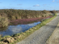
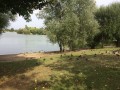
. My favourite spot is the little pond just before you reach the village – is it private property?? In any case, it’s absolutely charming.

Machine-translated

Other walks in the area

For more walks, use our search engine .

The GPS track and description are the property of this route's author. Please do not copy them without permission.