Tenu Route

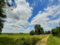
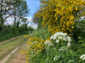
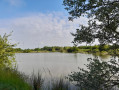
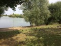
This walk will take you through countryside landscapes shaped by nature and the changing seasons. As you follow the River Tenu, you’ll be able to spot the lake’s birds and admire the local flora. If you stop for a break by the water’s edge, you may notice a distinctive feature of this river. It can actually flow in both directions: from south to north towards the Acheneau, or from north to south to join the Breton marshes near Machecoul-Saint-Même.

Details

22528590
Creation:
Last update:
Last review:
  • Walking
    Activity: Walking
  • ↔
    Distance: 6.77 mi
  • ◔
    Average duration: 3h 10 
  • ▲
    Difficulty: Moderate

  • ⚐
    Back to start: Yes
  • ↗
    Ascent: + 66 ft
  • ↘
    Descent: - 66 ft

  • ▲
    Highest point: 92 ft
  • ▼
    Lowest point: 3 ft

Photos

Description of the walk

Starting point sign and car park: Les Grandes Vignes.

(S/E) Continue straight on towards the north-west. Follow the edge of the wheat field until you reach a junction

(1) Turn right and carry on through the vineyards to the end of the track.

(2) Turn left onto this path. Cross the road carefully and continue straight ahead until you reach another junction.

(3) Turn left as you round the bend.

(4) When you reach the road, head left for about 150 metres and turn right onto Chemin du Marais Gabarre at the entrance to La Renourie.

(5) In the bend, turn left and then, a little further on, at La Baffrie, turn right heading due west. Keep the hamlets on your left.

(6) When you reach another road, turn right onto it. Pass under a power line.

(7) Then take the tree-lined path on your right.

(8) After the first houses in La Bourrière, turn right, then right again a few metres further on. A little further on, you’ll come to another road.

(9) Turn right onto it for about 300 m, then continue along the track to the left. At the road, turn left towards La Trancherie, then continue along a track that extends this road round a right-hand bend.

(10) When you reach the road, turn right onto it, then take the rural track on the left, through the vineyards. At the end, first turn right then left and join another track. Turn left onto this track to reach Les Grandes Vignes (S/E).

Waypoints

  1. S/E : mi 0 - alt. 52 ft - Grandes Vignes
  2. 1 : mi 0.53 - alt. 66 ft - Junction
  3. 2 : mi 1.12 - alt. 36 ft - Junction
  4. 3 : mi 1.73 - alt. 52 ft - Junction
  5. 4 : mi 2.06 - alt. 56 ft - Junction – Road
  6. 5 : mi 2.56 - alt. 10 ft - Port de la Bafferie - Tenu (rivière) - Affluent de l'Acheneau
  7. 6 : mi 3.58 - alt. 13 ft - Road
  8. 7 : mi 3.91 - alt. 13 ft - Road / Track
  9. 8 : mi 4.14 - alt. 16 ft - Junction
  10. 9 : mi 5.07 - alt. 43 ft - Road
  11. 10 : mi 5.95 - alt. 79 ft - Junction – Road
  12. S/E : mi 6.77 - alt. 49 ft - Grandes Vignes

Notes

Depending on the water level of the Tenu, one section is impassable in winter near Port de la Bafferie.
A detour is therefore possible by road from (4). Please take care and obey the traffic regulations!

Worth a visit

Nearby, discover Lake Grand-Lieu!
It is the largest lowland lake in France in winter, covering an area of 6,300 hectares (reduced to 3,500 hectares in summer), and the second-largest bird sanctuary after the Camargue, thanks to its rich biodiversity.

Reviews and comments

4.5 / 5
Based on 2 reviews

Reliability of the description
4.5 / 5
Ease of following the route
4.5 / 5
Route interest
4.5 / 5
la fée des fleurs
la fée des fleurs

Overall rating : 4.3 / 5

Date of your route : Oct 21, 2025
Reliability of the description : ★★★★☆ Good
Ease of following the route : ★★★★☆ Good
Route interest : ★★★★★ Very good
Very busy route : Yes

This is a route we had never done before, even though it's not far from where we live. I took a Nordic walking group there and they enjoyed the trail as much as I did. It's a wonderful discovery. We enter the vineyards on the heights of Saint Mars de Coutais and then descend along the wild and magnificent Tenu river. There were more people when I recognised this path; many people come here to enjoy pleasant moments of rest and fishing with their families.
Thank you, VISORANDO, for this route, which I highly recommend
The flower fairy

Machine-translated

Yogui44
Yogui44

Overall rating : 4.7 / 5

Date of your route : Aug 17, 2025
Reliability of the description : ★★★★★ Very good
Ease of following the route : ★★★★★ Very good
Route interest : ★★★★☆ Good
Very busy route : No

Very beautiful route
https://www.visugpx.com/rzyVPqUMr4

Machine-translated

Other walks in the area

For more walks, use our search engine .

The GPS track and description are the property of this route's author. Please do not copy them without permission.