Country:
 City:


To reach the start of the walk, drive through Épinal towards Dogneville. At the Dogneville chemist’s, turn left and continue to the end of the tarmac road. Park at the north-western end of the airfield.
(S) Walk along the airfield towards Dogneville, cross the road opposite the chemist’s and turn left. Pass under the four-lane bridge and turn right onto Rue de Brunove. Continue to the end of this street, then turn left onto the Grande Rue; walk 50 metres and turn right onto Rue de l’Abbé Poirot.
After the stream, carry on straight ahead and head uphill. At the cemetery, turn right and, at the wayside shrine, cross Route de Dignonville and take Chemin du Fort.
(1) At Fort de Dogneville (private property), take the path on the right and carry on straight ahead until you reach Route de Dignonville. Turn left and take the first path on your right. Walk past the farm on your left and take the first path on the left.
(2) At the high-voltage power line, take a fairly flat track which is the old 60-mm or Décauville railway line that served the forts. Continue to Fort de Longchamp (not accessible).
(3) With the fort behind you, head down to the left, south-south-east, through the woods, then along the edge of a field until you reach a track.
(4) Follow this path to the right, cross the small road and continue straight on, following the edge of the woodland on your left.
(5) At the corner of the woodland, head up to the left along the edge until you reach the corner of the field.
(6) Take the small path on the left and join a forest track. Follow it straight ahead until you reach the Route de Rambervillers (D46).
(7) Take care – there is a lot of traffic. Turn left and follow the road for about 400 metres. At the first junction, turn right, go 100 metres and then turn left.
(8) Follow the old Route 60 and head towards Deyvillers Fort.
(9) Walk round the fort along the path and head down the hill. At the junction, turn left towards the village of Deyvillers, go straight on through the village, cross the stream and head up the hill on your left until you reach the road (N420). Turn left, walk 500m to a bridge (elevation 337), cross the road and head towards “Les Thuilleries”.
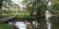
(10) At the hamlet known as “Les Thuilleries”, head towards a shelter, turn right and cross the stream via the small footbridge. Head back up towards Rue René Caire and turn right. Walk 100 metres and turn left onto Chemin des Fontaines. Continue along the path beyond the tarmac road, heading south-south-west, until you reach a road. Cross it and carry on until you reach the edge of the forest. When you reach the track, turn left and follow it for a few metres.
(11) Take the path on the left and follow the track closely. The Voiriménil farm is private and entry is prohibited.
Follow the well-marked path through the forest, which goes well wide of the farm on the left. Join a tarmac road and follow it to the left to reach Fort des Adelphes (private property).
(12) Continue along the road, cross the D11 with care and carry on almost directly opposite along the path through the forest.
(13) You’ll reach the Route 60 linking Les Adelphes to Razimont. Follow this road to Fort de Razimont (no access).
(14) Carry on until you reach a busy road; take care and walk alongside it until you reach the bridge over the dual carriageway. Cross the dual carriageway and, at the next junction, turn left.
(15) Cross the busy road with care, then take the pedestrian crossing heading towards the wood-fired heating plant. Walk past it and, at the next junction, take the descending stony path almost directly opposite. Continue towards the “Pré Serpent” farm, then turn left and walk down the hill.
At the bottom, turn left and head back up the valley, following the path.
(16) After the bend to the right, at the crossroads, turn left onto the old Route 60 coming from the centre of Épinal via Fontaine Gueury. Continue to the tarmac road, cross it and turn right towards Fort de la Mouche.
(17) At Fort de la Mouche, continue a few metres to the right and rejoin the Route Séré de Rivières (E).


 Tourist office
 Easy
 Visorando Member
 Difficult