Country:

 City:
City:


Start from the Arlanc swimming pool car park: on the D300 at the village exit, just before the bridge over the Dolore.
(S/E) From the car park, continue along the small road that crosses the leisure centre and follows the Dolore upstream along the right bank. You’ll come to a right-hand bend where the road veers slightly away from the river.
(1) Take a small path (not very visible) which follows the riverbank for about a hundred metres.
(2) Cross the Dolore via a small wooden bridge on the right and carry on straight ahead along a small road until you reach a track branching off to the left.
(3) Take this track and soon turn right, then join the main road (D300). Follow the road to the left until you reach the next junction.
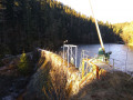
(4) Turn left onto a track. A sign points to the Chalas dam; carry on until you reach a three-way junction.
(5) After passing a small power station, turn right and you’ll soon reach the Chalas Dam.
(6) At the dam, the track becomes a path that climbs to the right. After a hairpin bend, rejoin the D300.
(7) Cross the road and continue along a track that starts almost directly opposite. Follow it to the end, then turn left onto a wider track that climbs towards the hamlet of Croches.
(8) When you reach a farm, turn left again and walk through the hamlet of Croches. Continue straight on at the first junction, then at the second (where several roads meet), turn left towards Chassaignes Hautes. Continue straight on until you reach a three-way junction at the entrance to the hamlet.
(9) Turn left at the three-way junction and carry on straight ahead to cross the entire hamlet. The road becomes a track which continues straight on westwards towards the hamlet of Issandolangettes.
(10) Just before the hamlet, which can be seen at the end of the track, turn left onto a grassy farm track that leads downhill. Cross the D300 again and continue straight ahead onto a track (a sign reads ‘site d’Issandolanges’).
(11) A cross marks the entrance to the abandoned village of Issandolanges. An information board and a map are located nearby. Several paths criss-cross the village, dotted with information boards. Take any path (or explore them all!) to head down to the right to the bottom of the village and the River Dolore.
(12) Cross the bridge over the Dolore and take a path that climbs to the right (ignore another path, not marked on the IGN map, which runs along the riverbank). At the first junction, continue climbing to the left. At the next junction, turn left again and follow the track to the hamlet of Perpillanges.
(13) Turn left onto a small road and follow it to the end. You’ll come to a T-junction at the entrance to the hamlet of La Sagne.
(14) Turn left at the T-junction, then take the first road on the right. When you come out onto the main road (D105), follow it for a few dozen metres, then take a path on the left which cuts across a bend, passing behind a few houses. When you rejoin the road, you’ll come to a level crossing.
(15) Cross the level crossing and take the road (D105) on the right towards Saint-Sauveur-la-Sagne.
(16) In the village, carry on straight ahead along an uphill road (to cut across a hairpin bend on the D105). When you rejoin the D105, follow it to the right for a few dozen metres, then turn onto a wide track to the left.
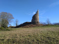
(17) At the first bend in the track, turn off onto a narrower track which continues straight on to the village of Clavelier. At the first junction at the entrance to the village, a sign points towards the tower (straight ahead).
(18) At the next junction, the tower is signposted to the left via a path that runs behind a few houses and joins a forest track. Follow this track to the right, then right again at the next junction to reach the tower.
(19) Once at the tower, retrace your steps.
(18) Turn left onto a street that forms a semicircle.
(20) Before reaching the main road, turn left onto a path that runs alongside a house and then enters the forest. At the end of the path, turn right onto a wide track. The track crosses a stream and narrows slightly as it climbs up the other side. Continue straight on until you reach a large junction.
(21) Turn left onto a wide track and follow it to the hamlet of Le Merle, where you’ll join a road that crosses the River Dolore.
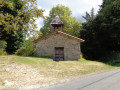
(22) Just after the bridge, take a path that climbs to the left. Pass under the railway line, then turn left onto a flight of steps leading up to the Chapel of Notre-Dame de Roche. Continue straight on after the chapel, then take a track to the left when you reach a house.
(23) After about fifty metres, turn right onto another track at the edge of the forest. Carry on until you come to a road (D38) at the entrance to the hamlet of Rouayres.
(24) Cross the road and carry on straight ahead through the hamlet until you reach a three-way junction at the edge of the hamlet.
(25) Turn right and carry on straight along this track until it becomes a small road and joins another after passing a few houses.
(26) Carry on straight ahead at this junction, then turn left at the next one to reach the banks of the Dolore as far as the pretty Capartel bridge.
(27) Do not cross the bridge but take a small path that follows the right bank, passing between the River Dolore and the first house. You will reach a junction you passed on the way there.
(2) Ignore the bridge on your left (the one you crossed on the way out) and, following the route in the opposite direction to the outward journey, head towards (S/E).

 Visorando Member
 Easy
Easy 
 Moderate
  Tourism professional