Îlet à Bourse – Casabois

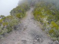
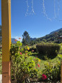
As you pass through the Grande Ravine again, the path takes you back to La Plaque, where the start of the Sentier Scout is located – this is the most pleasant way out of Mafate. A beautiful climb through lush vegetation takes you back to the small road leading to the Col des Boeufs. However, it is in the other direction that a narrow path, hidden amongst flowers and tall grass, leads to the village of Bélier and then the hamlet of Casabois, both of which are part of the small town of Salazie.

Details

n°3083256
Creation:
Last update:
Last review:
  • Walking
    Activity: Walking
  • ↔
    Distance: 6.57 mi
  • ◔
    Average duration: 6h 20 
  • ▲
    Difficulty: Difficult

  • ⚐
    Back to start: No
  • ↗
    Ascent: + 3,822 ft
  • ↘
    Descent: - 2,500 ft

  • ▲
    Highest point: 5,459 ft
  • ▼
    Lowest point: 2,552 ft

Photos

Description of the walk

(S) Set off from the “Îlet à Bourse” lodge and retrace the previous day’s route, heading back down towards the Grande Ravine. Cross the Grande Ravine and climb up the other side to La Plaque.

(1) At La Plaque, turn right onto the Sentier Scout orGR® R2-R3. Continue along this path as it winds through lush vegetation. Pass the Plateau Sahala and continue through the impressive mountain landscape known as ‘les Deux Fesses’ until you reach the small road leading to the Col des Boeufs, which marks the exit from Mafate.

(2) Follow the road to the left for a short while, then leave it at the next bend at the junction with the path that runs alongside the road.

(3) Take this path, which is hidden amongst tall vegetation and flowers. It joins the road towards Bélier.

(4) Take the small road that winds down to Bélier in sweeping bends until you reach the entrance to Bélier.

(5) Carry on straight ahead, bypassing Bélier towards Grand Îlet, until you reach Casabois. The “Ti kaz lontan” lodge is located along the road on the right (E).

Waypoints

  1. S : mi 0 - alt. 2,913 ft - Lodge at Îlet à Bourse
  2. 1 : mi 0.94 - alt. 2,923 ft - The Plaque
  3. 2 : mi 3.93 - alt. 5,407 ft - Leaving Mafate via the Col des Boeufs road
  4. 3 : mi 4.08 - alt. 5,351 ft - Junction with the path to Bélier
  5. 4 : mi 4.55 - alt. 4,918 ft - Junction with the Bélier road
  6. 5 : mi 6.06 - alt. 4,124 ft - Junction with the road to Bélier
  7. E : mi 6.57 - alt. 4,229 ft - Ti kaz lontan lodge

Notes

Good, non-slip shoes.
Sun cream.

Worth a visit

The church at Îlet à Bourse.

Always be cautious and plan ahead when you're outdoors. Visorando and the author of this route cannot be held responsible for any accidents occurring on this route.

The GR® and PR® markings are the intellectual property of the Fédération Française de Randonnée Pédestre.

Reviews and comments

4.7 / 5
Based on 1 review

Reliability of the description
5 / 5
Ease of following the route
4 / 5
Route interest
5 / 5
Papimina
Papimina
• Edited:

Overall rating : 4.7 / 5

Date of your route : Nov 30, 2025
Reliability of the description : ★★★★★ Very good
Ease of following the route : ★★★★☆ Good
Route interest : ★★★★★ Very good
Very busy route : Yes

A very beautiful hike. Quite physically demanding!
The views are magnificent! Thierry's refuge is superb: a warm welcome, comfortable sleeping (in tents) and excellent meals – highly recommended.
To be enjoyed without moderation.

Machine-translated

Other walks in the area

For more walks, use our search engine .

The GPS track and description are the property of this route's author. Please do not copy them without permission.