Country:
 City:
City:


Red and white markings ofthe GR®®100, shared with theGRP®® des Maîtres Sonneurs
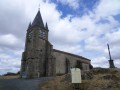
(S) From Huriel church, follow Rue de la Croix, then head down the road to the left. At the three-way junction, turn right towards the campsite.
(1) Just before the entrance to the campsite, turn left onto a grassy path and join the D916.
(2) Pass under the railway bridge (take care) and join the dirt track opposite. It changes direction and leads to a track on the right
(4) At Prebre, on the right in the hamlet of Mandrant, turn left and head for Maussat by taking the road on the right. Continue until you reach the start of a track.
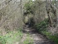
(4) Leave the road and take the footpath on the left. After fording a stream, head uphill along a sunken track. Cut across the D150.
(5) Head straight on towards Peige. Further on, turn off to the right. At a junction, turn right twice: the path heads towards Archignat and soon descends towards the railway line. Turn left, then pass under the line through a narrow tunnel. Cross a stream and climb up to Archignat.
(6) Turn left towards Boussac. Pass a junction and continue to a bend. Turn left onto the Chemin de Longevergne (panoramic view). You’ll reach a crossroads before the hamlet of Longevergne.
(7) At the junction with the small road, turn left. Cross the Magieure and pass under the railway bridge.
(8) Take the path on the right and follow it straight on until you reach a road. Head straight ahead and, before reaching La Baudre*, cross the level crossing and continue straight up to the D916.
(9) Take this road to the left, keeping to the hard shoulder (take care). Cross over and continue along the grassy path to the right. Turn left twice to climb up to Les Maisons.
(10) Walk through the village and continue along the second path on the right. Follow this path, which passes close to Les Boueix: carry on straight ahead at a three-way junction, then take the path on the right. You’ll reach a crossroads with four paths.
Red and yellow markings forthe GRP®® ‘Tour sur les Pas des Maîtres Sonneurs’
(11) Carry on straight ahead, rejoining the GRP®® trail. At the entrance to the Bois de Sugère, carry on straight ahead along a forest track. At the junction of the tracks, turn right and continue along this track to leave the woods. You’ll come to a small road; follow it to the crossroads. Go straight ahead, then turn right onto the D549 towards Chambérat. Then head right until you reach a fork in the road.
(12) Then turn left towards La Cueille. After the houses, carry on straight ahead along a path lined with boxwood until you reach the Meuzelle ford.
(13) Carry on and head up a sunken track to the Vieille Vigne pond.
(14) Go round to the right, cross the D249 and carry on straight ahead along a grassy track. You’ll reach a junction after passing under the high-voltage power line.
(15) Carry on to the right along theGRP®®, then at the following path junctions, turn left and then left again. Cross the D113 road.
(16) Carry on straight ahead. Pass a path on the left, then another on the right. Go straight on at the next junction, turn left and arrive at another nearby hamlet called Les Brandes.
(17) Leave theGRP®® here and turn left towards Saint-Rémy. Walk to the chapel.
(18) Return to the previous junction.
(17) Join theGRP®® again and take the stony track on the left. Cross a road and continue straight ahead. At a bend after a house, turn left onto a grassy path. At the next two junctions, turn right then left. The path descends towards the Arnon.
(19) Wade across the spillway of the ponds. After an old mill, take the path on the right through the woodland. Walk through the hamlet of Le Patouiller to the footbridge over the Arnon (on the right at the junction).
(20) Take the footbridge over the Arnon on the right. A steep slope, followed by a small road to the left, leads to Vienny. Follow the access road to Vienny, taking a left-hand bend until you reach a three-way junction.
(21) Turn left. Cross the D245 and head straight on along a wide grassy track. You’ll reach a crossroads with four paths.
(22) Carry on straight ahead, then turn left. You’ll come to a road: follow it to the right, passing a reservoir, and you’ll reach the D112. Turn right onto the departmental road. The route leaves the Allier department and the Bourbonnais region to enter Berry in the Cher department, in the commune of Préveranges.
(23) Take the first path on the left. Cross a farmyard (local path), then follow a small road to the left for a few metres. Turn right onto a path (east); follow it easily until you reach the D997 departmental road (note, opposite, a rest area with a pond, whilst on the right a beautiful farmhouse forms the corner). Follow the road to the right as far as Préveranges Church (E).
 Association / Club / Walk leader
 Moderate
  Easy
Easy