


 Country:
 City:


For information on campsites, accommodation and places to eat, see here.
In the Footsteps of the Master Bell-Ringers: The Bourbonnais Circular Bocage Loop


This circular route takes you along the Allier section of the ‘Sentier d’Itinérance: Sur les Pas des Maîtres Sonneurs’ between Berry and Bourbonnais
covering a distance of 73 km; it can be completed in three or four days.
As this is a circular route, you can start from any town, depending on the availability of your chosen accommodation and your mode of transport to get to Huriel from Montluçon (via public transport:the Montluçon–Limoges train, with connections from Lyon, Clermont-Ferrand or Paris).
Details
Creation:
Last update:
Last review:
–
–
-
 Activity: Walking
-
 Distance: 45.39 mi
-
 Average duration: 3 days
-
 Difficulty: Very difficult
-
-
 Back to start: Yes
-
 Ascent: + 2,887 ft
-
 Descent: - 2,904 ft
-
-
 Highest point: 1,483 ft
-
 Lowest point: 889 ft
Stages of the route
This route needs several days, find the details below:
Notes
Worth a visit
Click here for details of the villages along the route.
Other walks in the area
Huriel - Préveranges
 Association / Club / Walk leader19.28 mi
+1,060 ft
-712 ft
9h 45
Very difficult
 Departure from Huriel (Allier)
In the footsteps of the Master Bell Ringers, stage7.
Huriel - Préveranges
19.24 mi
+1,073 ft
-725 ft
9h 45
Very difficult
Departure from Huriel (Allier)
Hiking route: ‘In the footsteps of the master bell-ringers between Berry and Bourbonnais’. A circular variation of the Bocage Bourbonnais route.Route linking Huriel to Préveranges
The Ricros tour
6.88 mi
+285 ft
-276 ft
3h 25
 Moderate
Departure from Domérat (Allier)
This route is particularly well suited to Nordic walking. The asphalt sections are kept to a minimum and the quality of the surface on the tracks allows for movements that make the exercise very interesting. In addition, this hike is suitable in all seasons. The route is of course also suitable for classic hiking.
The wine-growing villages of the Huriel region
5.59 mi
+509 ft
-509 ft
3h 00
 Easy
Departure from Huriel (Allier)
A nostalgic walk: you’ll explore a whole chapter of local history, with old vineyards and wine-growing villages dotted along the route.
Suitable for mountain biking, with a very technical section between (2) and (3).
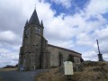
From La Bartillatte to the church at Quinsaines
 7.58 mi
+440 ft
-427 ft
3h 50
Moderate
Departure from Huriel (Allier)
A hike over hill and dale that takes you from the Bartillatte valley and its famous Roman bridge to the distinctive church of Quinssaines, perched on its rock.
This route is suitable for mountain bikes.
It can easily be shortened (see map and practical information).
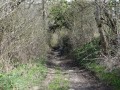
The Saint-Martinien region
 6.23 mi
+351 ft
-335 ft
3h 10
Easy
Departure from Huriel (Allier)
A bucolic walk: little streams, sunken paths, meadows and copses, typical of the Bourbonnais countryside
This route is suitable for mountain biking, but features a very technical descent from the (11).
From the Roman bridge at Courtioux to the wind turbines at Savernat
6.31 mi
+449 ft
-453 ft
3h 15
Moderate
Departure from Huriel (Allier)
A hike along the paths, but also through the history of human achievements. From the Roman bridge at Courtioux to the wind turbines at Savernat, you will travel through nine centuries. You can also admire two sunken lanes characteristic of the Bourbonnais bocage. If you are observant, you will see the tracks of our ancestors' iron-wheeled carts and wagons engraved in the granite of the lane leading down from La Chaux. Another return to our heritage.
For more walks, use our search engine .
The GPS track and description are the property of this route's author. Please do not copy them without permission.

