Croupatier Cave from Ollioules

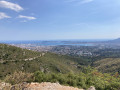
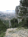
This walk is particularly beautiful thanks to the many views it offers across a near 360°, especially of Toulon and its harbour.

Details

n°32173154
Creation:
Last update:
Last review:
  • Walking
    Activity: Walking
  • ↔
    Distance: 6.66 mi
  • ◔
    Average duration: 4h 15 
  • ▲
    Difficulty: Average

  • ⚐
    Back to start: Yes
  • ↗
    Ascent: + 1,375 ft
  • ↘
    Descent: - 1,358 ft

  • ▲
    Highest point: 1,627 ft
  • ▼
    Lowest point: 381 ft
  • ⚐ Country: France
  • ⚐ City: Ollioules (83190)
  • ⚑
    Start/End: N 43.147114° / E 5.873298°
  • ❏
    IGN map(s): Ref. 3346OT
  • Hour-by-hour weather

Description of the walk

Park in the large tarmac car park at the top of the Châteauvallon road in Ollioules.

(S/E) Turn left onto the small tarmac road which climbs steeply up to the water reservoirs.

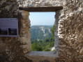
(1) Take the lovely track on the right, heading north, which leads to the Détras ruins and its cistern.

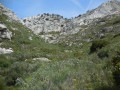
(2) Climb towards the ridge along the wide track as it winds its way up, until you reach a crossroads of tracks where there is also a cistern.

(3) Turn left onto the track on the left and continue the climb to reach the pass. Here you’ll cross theGR®51.

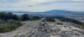
(4) Turn left onto the GR®51 and follow it, passing a ruin and continuing for a few metres until you reach a cairn.

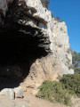
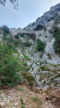
(5) Turn left to reach the edge of the cliff. Take the steep path downwards. At the bottom of this short, steep section, keep to the right, as close to the cliff as possible, until you reach the Croupatier cave.

(6) Retrace your steps along the route you took on the way there to return to the Détras crossroads.

(2) Turn left onto the wide track at the bottom of the valley to return easily to the Chemin de Château Vallon car park (S/E).


Waypoints

  1. S/E : mi 0 - alt. 381 ft - Car park on Chemin de Château Vallon
  2. 1 : mi 0.36 - alt. 636 ft - Equipped rest area
  3. 2 : mi 0.75 - alt. 558 ft - Village Le Détras (Ruines)
  4. 3 : mi 2.58 - alt. 1,411 ft - Carrefour Citerne
  5. 4 : mi 3.02 - alt. 1,621 ft - GR51 Pass
  6. 5 : mi 3.32 - alt. 1,568 ft - Cairn junction
  7. 6 : mi 3.39 - alt. 1,572 ft - Grotte du Croupatier
  8. S/E : mi 6.66 - alt. 381 ft

Notes

Sturdy footwear and walking poles are recommended.
There is no water along the way.

Worth a visit

(1) A rest area by the ponds: enjoy a beautiful view of the sea.

Between (2) and (4), the route offers some stunning views of Toulon and its surroundings, Saint-Mandrier and the harbour.

Interesting note: Walking down this path on a full moon night, without a head torch, is a safe experience and a real treat for the eyes.

Always be cautious and plan ahead when you're outdoors. Visorando and the author of this route cannot be held responsible for any accidents occurring on this route.

The GR® and PR® markings are the intellectual property of the Fédération Française de Randonnée Pédestre.

Reviews and comments

4.3 / 5
Based on 2 reviews

Reliability of the description
4 / 5
Ease of following the route
4.5 / 5
Route interest
4.5 / 5
Hervé goujon
Hervé goujon

Overall rating : 4.7 / 5

Date of your route : Dec 23, 2024
Reliability of the description : ★★★★☆ Good
Ease of following the route : ★★★★★ Very good
Route interest : ★★★★★ Very good
Very busy route : No

Things to do: explore the Croupatier cave, which is difficult to find, then return via the Chape Telegraph Line – a tricky descent along a very treacherous path – and back to Château Vallon via Tallian and the little lake of Le Détras, making a total of about a dozen kilometres.

Machine-translated

Pépé le Moka
Pépé le Moka

Overall rating : 4 / 5

Date of your route : Apr 09, 2023
Reliability of the description : ★★★★☆ Good
Ease of following the route : ★★★★☆ Good
Route interest : ★★★★☆ Good
Very busy route : No

Monday 10 2023
A very pleasant walk with views of Les Embiez, Ollioules and the Bay of Toulon.
Correction to be made: at the end of the walk, after the ruin, there is no longer a cairn; you should state… about 30 metres after the ruin, take the small path on the left…

Thanks, Visorando

Pépé le Moka

Machine-translated

Other walks in the area

For more walks, use our search engine .

The GPS track and description are the property of this route's author. Please do not copy them without permission.