


 Country:
 City:


Head to Ollioules and park along the wall bordering Avenue Barthélémy Dagnan, alongside the River Reppe.
(S/E) Head towards the town (southwards) and pass the first bridge on your left.
(1) Turn left onto Chemin de la Bonnefont, crossing a beautiful bridge over the Reppe. Continue along the lane and cross the Route des Gorges to join theGR® 51 (Chemin de l’Oratoire) on the opposite side. This path first passes the Bonnefont site (one of the springs feeding the River Reppe) and, after a bend to the left, continues uphill on a steep slope.
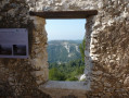
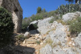
(2) Pass the ruins of a large chapel (Notre-Dame de l’Espérance) and continue climbing north-eastwards. At the last houses, the paved section of the Chemin de l’Oratoire ends and gives way to a mostly rocky path, still marked in red and white (GR® 51), which leads into the forest.
(3) At the highest point, the path crosses a track which follows the route of a pipeline from the Canal de Provence. Cross this track and continue straight ahead until you reach a crossroads of paths where there is a picnic table.
(4) Leave the return path, marked in yellow, on your left, and theGR®, which climbs towards the telegraph station, on your right. Take the path marked in blue straight ahead (actually the old route ofthe GR®), which climbs gently northwards.
(5) Turn right onto a path that climbs steeply and joins the Croupatier ridge.
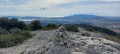
(6) You’ll reach an old boundary stone at the junction with theGR®51; take this path to the right. Take care to follow the red and white markings ofthe GR® carefully, as the route is not always clearly defined; it passes a number of rectangular stone cairns which are the old boundary markers. The path is marked with both red and white markings and blue markings (which appear to correspond to the boundary markers’ route).
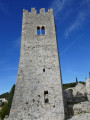
The path runs along the ridge, then descends steeply to the square Télégraphe tower. After this, turn left and continue down until you reach the crossroads of paths and the picnic table.
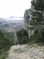
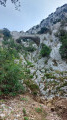
(4) Take the yellow-marked path opposite. About 40 metres further on, slightly off the path to the right, you can visit the Grotte du Patrimoine. The path then descends alongside the Barre de Taillan (which looms over it on the right) down to the Reppe valley.
(7) Take a detour to the right to visit the Puits du Trou de la Bombe, in an open area on the banks of the Reppe, then set off along a track beside the Reppe towards Ollioules.
Shortly afterwards, on the left, you can see a lime kiln and its information panel. The track then crosses the river via a ford, taking you to the right bank, just below the Route des Gorges. The valley floor widens and you pass close to the Noria at the Piot plot – which was undergoing restoration when we visited – as well as all the low stone walls of the surrounding plots.
Further on, on the left, after crossing another ford, you can see the spring known as ‘la Mère des Fontaines’. The track then climbs back up towards the road.
(8) Turn left onto the road towards Ollioules and follow it for about 600 metres, taking care as there is little room on the hard shoulder.
(9) After walking alongside an irrigation canal on the left-hand side of the road, turn left onto a track which crosses the Reppe via a ford fitted with culverts, and you’ll reach the Chemin des Arbres. On the right, alongside the irrigation canal bordering the path, you’ll see the large Les Arbres washhouse.
(10) Cross the Route des Gorges and take the lane opposite which runs alongside the Rattes washhouse; then, opposite the Ollioules Water Services building, cross the bridge over the Reppe.
Turn right and look for the car park (S/E) along the wall bordering the avenue.

 Visorando Member
 Moderate

 Very difficult
 Association / Club / Walk leader
 Easy

