Roche Chèvre cave from Détain-et-Bruant

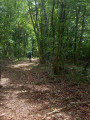
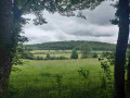
This hike, mainly in the forest and on the heights of the Côte-d'Or, will take you to the vast Grotte de Roche Chèvre cave, which is well worth a visit. Please note, however, that there are two passages with tall grass.

Details

87460242
Creation:
Last update:
Last review:
  • Walking
    Activity: Walking
  • ↔
    Distance: 6.26 mi
  • ◔
    Average duration: 3h 20 
  • ▲
    Difficulty: Moderate

  • ⚐
    Back to start: Yes
  • ↗
    Ascent: + 518 ft
  • ↘
    Descent: - 525 ft

  • ▲
    Highest point: 2,044 ft
  • ▼
    Lowest point: 1,857 ft

Photos

Description of the walk

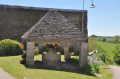
Coming from Collonges-lès-Bévy, park at the entrance to Détain-et-Bruant on the D109 next to the wash house.

(S/E) Set off along the road towards the village and turn into the first street on the right to reach the town hall.

(1) Turn right and, taking care, cut across the D8’s hairpin bend via a footpath, then follow the D8 to the left until you reach a path on the left.

(2) Take this track, which, depending on the season, may be overgrown with tall grass at the start. Continue straight on, passing a track on the left, and enter the forest. Pass the first path on the right and then continue for 250 m.

(3) Turn right onto the straight path heading due north which, at the 601-metre mark, curves north-east and comes into view of a hut.

(4) Turn left onto the track, heading west, and pass the first track on the right.

(5) Turn right onto the straight track, which passes through a slightly karstic area before joining the D8; follow this to the right for about 100 metres.

(6) Turn left onto the Route Forestière de Roche Chèvre, follow it for 2 km, then turn right onto a steep, narrow path leading to the Grotte de Roche Chèvre.

(7) After visiting the cave, head back down the path and rejoin the forest road heading north-east until you reach a junction.

(8) Take the hairpin bend to the right onto the track heading south-west, then due south, and continue until you reach a Fork in the road.

(9) Turn left towards the east, then south, until you reach the D104; follow this for 50 metres until you reach a junction.

(10) Carefully turn right onto the D104 towards Détain-et-Bruant, pass a poultry farm and arrive at the entrance to Le Poiset.

(11) Turn left to head along a field, bordering a strip of woodland. This section may also be overgrown with tall grass. Enter the Bois de Pierre Saux for a few metres.

(12) Turn right onto the signposted path at the edge of the woodland (Route de Pierre Saux), which leads back to Détain-et-Bruant and continues along a street.

(13) At the cross, head down to the left, carefully crossing the bend in the D8, and arrive at the town hall.

(1) Return to the car park via the streets you took at the start (S/E).

Waypoints

  1. S/E : mi 0 - alt. 1,929 ft - Parking near the wash house
  2. 1 : mi 0.14 - alt. 1,926 ft - Town Hall
  3. 2 : mi 0.37 - alt. 1,972 ft - Path on the left
  4. 3 : mi 0.96 - alt. 2,001 ft - Path on the right
  5. 4 : mi 1.52 - alt. 1,916 ft - Junction next to a hut
  6. 5 : mi 1.81 - alt. 2,008 ft - Path on the right
  7. 6 : mi 2.21 - alt. 2,018 ft - Roche Chèvre forest track
  8. 7 : mi 3.28 - alt. 1,926 ft - Grotte de Roche Chèvre
  9. 8 : mi 3.57 - alt. 1,909 ft - Junction
  10. 9 : mi 3.96 - alt. 1,936 ft - Junction
  11. 10 : mi 4.33 - alt. 1,857 ft - Road junction
  12. 11 : mi 4.58 - alt. 1,860 ft - Junction along the field
  13. 12 : mi 4.74 - alt. 1,926 ft - Marked trail (Pierre Saux route)
  14. 13 : mi 6.03 - alt. 1,978 ft - Shortcut down to the left
  15. S/E : mi 6.26 - alt. 1,929 ft - Parking near the wash house

Notes

Cover your legs and arms for grassy passages; walking sticks may be useful for pushing aside the grass.

Bring an extra layer of clothing and a headlamp for visiting the cave.

During hunting season, consult the ChasseInfo app.

Worth a visit

Reviews and comments

4.2 / 5
Based on 3 reviews

Reliability of the description
4 / 5
Ease of following the route
4.3 / 5
Route interest
4.3 / 5
Denis26
Denis26 ★

Thank you, Rudbeckia, for pointing that out; I’ve just corrected it.

Machine-translated

Rudbeckia
Rudbeckia

I have spotted an error in point 12. It reads:
“(12) Turn left onto the signposted path at the edge of the woods (Route de Pierre Saux), which leads back to Détain-et-Bruant and continues along a street.”
In fact, it should read “Turn right …”
A lovely walk!

Machine-translated

Michel des Courtils
Michel des Courtils

Overall rating : 4 / 5

Date of your route : Jul 23, 2026
Reliability of the description : ★★★★☆ Good
Ease of following the route : ★★★★☆ Good
Route interest : ★★★★☆ Good
Very busy route : No

A lovely walk, mostly in the shade.
Our beautiful forests are suffering from climate change. There are lots of fallen trees, but the paths are still very walkable.
Thank you for sharing this route!

Machine-translated

Claudiousse
Claudiousse

Overall rating : 4.3 / 5

Date of your route : Jul 26, 2026
Reliability of the description : ★★★★☆ Good
Ease of following the route : ★★★★★ Very good
Route interest : ★★★★☆ Good
Very busy route : No

A lovely walk on a summer’s morning. The forest path is a bit long, but at the end of it is the cave. It’s often in the shade.
Thanks for this walk.

Machine-translated

juliuskronos
juliuskronos

Overall rating : 4.3 / 5

Date of your route : Dec 01, 2025
Reliability of the description : ★★★★☆ Good
Ease of following the route : ★★★★☆ Good
Route interest : ★★★★★ Very good
Very busy route : No

An interesting and very uncrowded hike

Machine-translated

Other walks in the area

For more walks, use our search engine .

The GPS track and description are the property of this route's author. Please do not copy them without permission.