Camp Dackel and Roche Chèvre

Follow a very pleasant route through the woodland to reach the remains of Camp Dackel and explore the Roche Chèvre Cave.

Details

40360569
Creation:
Last update:
Last review:
  • Walking
    Activity: Walking
  • ↔
    Distance: 6.23 mi
  • ◔
    Average duration: 3h 30 
  • ▲
    Difficulty: Moderate

  • ⚐
    Back to start: Yes
  • ↗
    Ascent: + 738 ft
  • ↘
    Descent: - 728 ft

  • ▲
    Highest point: 2,018 ft
  • ▼
    Lowest point: 1,709 ft

Photos

Description of the walk

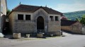
Park in the car park in the fields along the path leading to the Belle Émilia farm, towards a large stone trough in Saint-Jean-de-Bœuf.

(S/E) Turn left onto the track known as the Champs du Tilleul until you reach the crossroads before the Belle Émilia farm.

(1) Turn left onto the Chemin du Creux des Chaumes, which passes in front of the farm and heads straight into the woods. When you reach a Fork in the road, turn right and enter the former site of the German camp, where you will already see some remains: a radar base, etc. At the next crossroads, turn right and continue straight on until you reach further remains (concrete garage slabs).

(2) Continue along the main path which crosses the site. Before the block of toilet facilities – a raised, concrete esplanade – turn right onto a narrow track, guided on the left by a low stone wall. The wall breaks off and then resumes: look out for green arrows on trees pointing in the direction of travel. You’ll emerge into a large clearing.

(3) Take the grassy path to the right, leaving the footpath that continues straight ahead into the woods. Cross the clearing diagonally along this path until you reach a track suitable for vehicles.

(4) Turn left onto it, taking the hairpin bend, and head down into the woods. At the bottom of the descent, you’ll reach a three-way junction.

(5) Stay on the main track, which curves to the left, until you reach a wide crossroads of tracks. A hunting lodge is visible on the left-hand side of the crossroads.

(6) Continue along the path opposite at the bottom of the descent until you reach a junction with a wide track.

(7) Turn right and carry on until you reach the junction for the Grotte de Roche Chèvre. Turn left to reach the cave.

(8) Return to the white path, turn left and continue through the woods. Then veer right downhill (orange arrows on a tree), cross a path and climb slightly to reach a track marked by boundary stones.

(9) Take this path to the left and follow it until you reach a 90° right-hand bend, leading onto a forest track.

(10) Carry on almost straight ahead, slightly to the right, and after joining a wider track at a place called Le Bas de Chaux, you’ll reach another junction about a hundred metres further on.

(11) Turn right and head towards the hunting lodge, where you’ll find a Y-junction. Turn left to make your way back at a leisurely pace to the car park at the watering hole (S/E).

Waypoints

  1. S/E : mi 0 - alt. 1,837 ft - Car park and drinking trough
  2. 1 : mi 0.44 - alt. 1,867 ft - La Belle Emilia farm
  3. 2 : mi 0.87 - alt. 1,798 ft - Station radars de Saint-Jean-de-Bœuf
  4. 3 : mi 1.28 - alt. 1,785 ft - Vast clearing
  5. 4 : mi 1.52 - alt. 1,818 ft - Road suitable for vehicles
  6. 5 : mi 1.77 - alt. 1,719 ft - Three-way junction
  7. 6 : mi 2.3 - alt. 1,936 ft - Hunting lodge
  8. 7 : mi 2.99 - alt. 1,893 ft - Wide track
  9. 8 : mi 3.19 - alt. 1,926 ft - Roche Chèvre Cave
  10. 9 : mi 3.56 - alt. 1,850 ft - State boundary path
  11. 10 : mi 4.61 - alt. 1,896 ft - Crossroads with several directions
  12. 11 : mi 5.54 - alt. 1,883 ft - Le Bas de Chaux
  13. S/E : mi 6.23 - alt. 1,834 ft - Car park and drinking trough

Notes

(6) and after (11) Hunting lodges.

Worth a visit

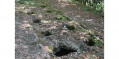
(2) Dackel radar station – known as ‘Basset’ in French – which served as accommodation for the German army between 1942 and 1944. Visit the discernible remains, following the paths: radar bases, offices, accommodation, canteen, kitchen, function room, toilets, swimming pool, bunkers, storage rooms, parade ground, garage, kennels, well, etc. See § Practical Information. Use the visible remains (concrete garage floors) as landmarks.

Reviews and comments

3.7 / 5
Based on 4 reviews

Reliability of the description
3.5 / 5
Ease of following the route
3.5 / 5
Route interest
4 / 5
User 23188370

Overall rating : 2 / 5

Date of your route : Jun 24, 2025
Reliability of the description : ★★☆☆☆ Disappointing
Ease of following the route : ★☆☆☆☆ Very disappointing
Route interest : ★★★☆☆ Average
Very busy route : No

The description in the first part of the itinerary is incomprehensible and very confusing.
The route is probably very rarely used, with little or no trail.
The section in Camp Dackel is of little interest. A few ruins covered by vegetation.

Machine-translated

chafouine21
chafouine21

The Dackel campsite really isn’t looked after at all. You need to check the information before setting off on a hike
online
https://www.histavia21.net/DACKEL/DACK-0...
Otherwise, the cave isn’t hard to find using the GPS coordinates

This walk isn’t on a signposted trail

Machine-translated

coumalin
coumalin

Overall rating : 3.3 / 5

Date of your route : Jun 23, 2024
Reliability of the description : ★★★☆☆ Average
Ease of following the route : ★★★☆☆ Average
Route interest : ★★★★☆ Good
Very busy route : No

Unmarked route; Camp Dackel has not been cleared of undergrowth and has no information boards; paths overgrown with tall grass; cave not signposted

Machine-translated

chafouine21
chafouine21

Hello

Thank you for your comments
I have amended the description accordingly

Machine-translated

Christian21
Christian21

Overall rating : 4.3 / 5

Date of your route : Jun 13, 2024
Reliability of the description : ★★★★☆ Good
Ease of following the route : ★★★★★ Very good
Route interest : ★★★★☆ Good
Very busy route : No

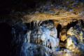
Thank you for this walk through the woodland, the main highlight of which was the Roche Chèvre cave, which I was discovering for the first time: a superb cave, with several chambers and beautiful stalactites and stalagmites, which is definitely worth a visit.
I had no trouble following this route with my GPS as the track is spot on. For those relying mainly on the description, I’d like to add a few details:
- at the end of (2): there is no longer a ‘vast clearing’; it only appears further on.
- at the end of (4): I didn’t see the third turn-off (at this point)
- (5): Rather than “Carry on straight ahead”, stay on the main path which curves to the left…
- (6): After “Continue along the path straight ahead”, add: “at the bottom of the descent, head back up” until…
- (8): Instead of “head down into the woods”, “carry on through the woods” (as the white path climbs slightly). After “Then turn right”, specify “downhill (orange arrows on a tree); cross a path and climb slightly” to reach…
- (10): After “carry on almost straight ahead”, specify “slightly to the right, and after joining a wider path,” reach...

Machine-translated

chafouine21
chafouine21

I’m glad you liked it

Machine-translated

Chantal S.
Chantal S.

Overall rating : 5 / 5

Date of your route : Feb 27, 2024
Reliability of the description : ★★★★★ Very good
Ease of following the route : ★★★★★ Very good
Route interest : ★★★★★ Very good
Very busy route : No

A lovely walk. The route is clearly marked and well documented. The cave is stunning and easy to get to.

Machine-translated

Other walks in the area

For more walks, use our search engine .

The GPS track and description are the property of this route's author. Please do not copy them without permission.