


Refine your search for walks in Grez-sur-Loing
Grez-sur-Loing walks


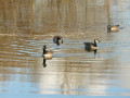
 The ponds of Grez-sur-Loing and the banks of the Loing
 Visorando Member
 4.54 mi
 +26 ft
 -26 ft
 2h 05
 Easy
 Departure from Grez-sur-Loing (Seine-et-Marne)
Take a loop around the Étang de la Clarette, with a short historical walk along the Loing and through the wonderful village of Gretz-sur-Loing. Very pleasant, with unforgettable views along the Loing.
Around the Étang de la Clarette
 2.66 mi
+10 ft
-10 ft
1h 15
Easy
Departure from Grez-sur-Loing (Seine-et-Marne)
A short stroll around this charming lake, home to swans, green-necked ducks and many other migratory birds when the time comes. Photographers, get your cameras ready...
From Bourron-Marlotte to Bois-le-Roi through the Forest of Fontainebleau
 18.17 mi
+725 ft
-679 ft
8 hrs
 Very difficult
Departure from Bourron-Marlotte (Seine-et-Marne)
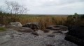
A south-to-north traverse of the Forest of Fontainebleau, from station to station! The long route showcases all aspects of this vast forest: high forests of various species, heathland plateaus, ponds, sweeping views and, of course, rocky outcrops.
N.B. Due to the winding paths through the rocky sections, the distance and elevation gain are likely underestimated: expect around 30km and between 300 and 400m of elevation gain.
From Bourron-Marlotte to Montigny-sur-Loing via the Rocher des Étroitures
 8.71 mi
+699 ft
-686 ft
4h 35
 Moderate
Departure from Bourron-Marlotte (Seine-et-Marne)
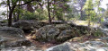
A hike from station to station in the south-east of the Forest of Fontainebleau. In addition to passing through two pretty villages, the start and end of this route follow good forest paths. In between, you follow trails that wind through rocky terrain, with several beautiful viewpoints, the lovely Mare aux Fées and the Grotte Béatrix.
From Bourron-Marlotte to Nemours via Dame Jouanne
 14.00 mi
+558 ft
-577 ft
6h 55
 Difficult
Departure from Bourron-Marlotte (Seine-et-Marne)
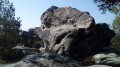
A hike from station to station, mainly through forest, crossing the rocky chaos of Maunoury, Dame Jouanne and Éléphant, which are every bit as impressive as those in the neighbouring Fontainebleau Forest. The village of Larchant, with its church and a few old houses, adds a superb touch of heritage.
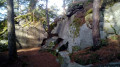
From Montigny to Thomery via Long Rocher and Malmontagne
 9.97 mi
+574 ft
-561 ft
5h 05
Difficult
Departure from Montigny-sur-Loing (Seine-et-Marne)
A hike from station to station through the eastern part of the Forest of Fontainebleau, which is not the most popular area of this forest. The forest trail alternates between wide paths and trails that wind through rocky terrain. Several viewpoints offer extensive panoramic views.
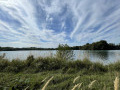
From Montigny-sur-Loing to Moret-Veneux-les-Sablons
 8.52 mi
+115 ft
-184 ft
4h 00
Moderate
Departure from Montigny-sur-Loing (Seine-et-Marne)
A hike from station to station starting from Montigny-sur-Loing. A varied route through the forest with a few rocks and the banks of the Loing. The Loing valley is an authentic green paradise that can be explored over a medium distance via footpaths, rural tracks and towpaths. This route takes you along the river and the canal of the same name, which flow side by side until they meet the Seine.
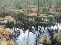
Rocher de la Mare Marcou and the Abri des Francs
 4.01 mi
+312 ft
-318 ft
2h 05
Moderate
Departure from Recloses (Seine-et-Marne)
Circular starting from the charming village of Recloses. Rocks and forest slightly different from the forest of Fontainebleau.
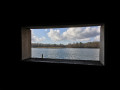
The Plaine de Sorques from Montigny-sur-Loing
 8.77 mi
+223 ft
-217 ft
4h 15
Moderate
Departure from Montigny-sur-Loing (Seine-et-Marne)
An easy hike with two bird observatories at the Plaine de Sorques, a sensitive natural area.
Bring binoculars.
L'Abri des Francs and circular loop via the Carrefour des Ventes to Galène
 5.85 mi
+279 ft
-253 ft
2h 55
Moderate
Departure from Recloses (Seine-et-Marne)
A route in the very south of the Fontainebleau Forest, comprising two distinctly different sections. The route begins, outside the national forest, on the Denecourt-Colinet path no. 20, which winds its way through the Rochers de Recloses, featuring several rock shelters, including one known as the “Abri des Francs”. We continue north of this area to complete a circular route via forest paths. At the end of the route, the church at Recloses adds a lovely touch of heritage.
La Mare aux Fées, La Malmontagne, Le Carrosse and the Grotte Béatrix
 10.05 mi
+804 ft
-787 ft
5h 20
Moderate
Departure from Fontainebleau (Seine-et-Marne)
A loop in the heart of Fontainebleau: a magnificent poetic pond, venerable oak trees, four viewpoints, memories of revolutionary battles, a cave, a chasm, sandstone cliffs... and plenty of peace and quiet.
Plaine Verte car park
 6.95 mi
+610 ft
-597 ft
3h 45
Difficult
Departure from Fontainebleau (Seine-et-Marne)
Flat terrain to warm up, ending with rocks...
The circular loops around the Restant du Long Rocher
6.57 mi
+505 ft
-499 ft
3h 30
Moderate
Departure from Fontainebleau (Seine-et-Marne)
Two circular loops allow the whole family to take part in just one section of the walk, as we circle round the car park and a playground. The first circular loop is 4.5 km long and takes you through the rocky terrain, followed by a circular loop extending as far as Haut Mont (8 km).
From Nemours to Montigny, following the Loing river closely.
 9.35 mi
+131 ft
-66 ft
4h 25
Moderate
Departure from Saint-Pierre-lès-Nemours (Seine-et-Marne)
A hike from station to station that starts along the Canal du Loing and the river that gave it its name. A circular hike around the Étang de la Clarette allows you to observe numerous birds before admiring the rich heritage of the commune of Grez-sur-Loing. The hike ends mainly through fields.
From Nemours to Souppes-sur-Loing along the canal
 8.76 mi
+118 ft
-108 ft
4h 10
Moderate
Departure from Saint-Pierre-lès-Nemours (Seine-et-Marne)
A hike from station to station that mainly follows the towpath of the Canal Loing. Before reaching the canal, you cross a municipal park and a small maze of rocks. Along the way, the canal's surroundings become increasingly bucolic and reveal an interesting industrial heritage.