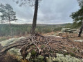
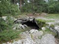
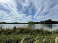
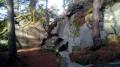
The circular loops around the Restant du Long Rocher

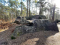
Two circular loops allow the whole family to take part in just one section of the walk, as we circle round the car park and a playground. The first circular loop is 4.5 km long and takes you through the rocky terrain, followed by a circular loop extending as far as Haut Mont (8 km).

Details

n°122404
Creation:
Last update:
Last review:
  • Walking
    Activity: Walking
  • ↔
    Distance: 6.57 mi
  • ◔
    Average duration: 3h 30 
  • ▲
    Difficulty: Moderate

  • ⚐
    Back to start: Yes
  • ↗
    Ascent: + 505 ft
  • ↘
    Descent: - 499 ft

  • ▲
    Highest point: 443 ft
  • ▼
    Lowest point: 276 ft

Description of the walk

Car park at the end of the Route de la Vallée.

(S/E) Once in the car park, there is a large open area blocked off with large cobblestones. Past the cobblestones, take the path on the right, the “Route du Néant”.
At the first junction with a blue-marked path, follow this path to the left for 300 m until the next junction.

(1) Carry on straight ahead; shortly afterwards, ignore a path on the left and, further on, cross the Route du Languedoc.

(2) After crossing the Route du Languedoc, turn left and continue to follow the blue markings. You’ll reach a rocky section. The maritime pines are marked with large blue signs; there are several lovely viewpoints. Grotte Béatrix is on the left.

(3) Continue following the blue markings, alternating between rocky sections and paths.

(4) At the junction with the “Plaine Verte” path, turn left. Leave the marked trail. At the end of this path, you’ll reach the car park (where you can meet up with the second group if necessary) and turn left onto the “Route de la Mort”.

(1) Carry on straight ahead along the “Route de la Grande Vallée”, a sandy bridle path. Do not follow the markings. Continue along this track and, at the second path on the left, turn onto the “Route du Croc Marin”.

(5) At the first track, turn right onto the Route de Varsovie, which you follow. At the junction with the Route de la Gravine, go straight on and follow this track for a few metres.
Turn right onto the “Route du Roi de Pologne”. Cross the Route du Long Rocher and veer slightly to the right, still on the Route du Roi de Pologne.
At the end, turn left onto Route du Râle.

(6) At the crossroads, take the path furthest to the left, marked with blue signs; this is a very steep, sandy path.
At the top, take the steps on the left to reach the summit of Haut Mont. Follow the blue markings to the junction at the bottom of the descent, ignoring all the paths branching off to the right or left.

(7) Turn right onto the “Route du Long Rocher”, at a right angle. There are no further markings. Pass a path on the right and continue to a junction where six paths meet.

(8) Take the “Route de la Mort”, the path furthest to the left. This path takes you back to the car park (S/E).

Waypoints

  1. S/E : mi 0 - alt. 305 ft - Car park at the end of the Route de la Vallée
  2. 1 : mi 0.38 - alt. 354 ft - Junction with a bridle path
  3. 2 : mi 0.94 - alt. 417 ft - Turn left after crossing the Route du Languedoc
  4. 3 : mi 1.46 - alt. 433 ft - Béatrix Cave
  5. 4 : mi 2.28 - alt. 302 ft - Junction with the “Plaine Verte” path
  6. 5 : mi 3.48 - alt. 361 ft - On the right, Route de Varsovie
  7. 6 : mi 4.48 - alt. 305 ft - Sandy path on the left
  8. 7 : mi 5.63 - alt. 292 ft - “Route du Long Rocher” path, on the left
  9. 8 : mi 6.24 - alt. 289 ft - On the left, the return route
  10. S/E : mi 6.57 - alt. 302 ft - Car park at the end of the Route de la Vallée

Reviews and comments

4 / 5
Based on 2 reviews

Reliability of the description
4 / 5
Ease of following the route
4 / 5
Route interest
4 / 5
8Asfour4
8Asfour4
• Edited:

Overall rating : 4.3 / 5

Date of your route : Jul 04, 2022
Reliability of the description : ★★★★☆ Good
Ease of following the route : ★★★★☆ Good
Route interest : ★★★★★ Very good
Very busy route : Yes

A lovely walk, which I did in part (sections 1, 2, 3, 4, 7 and 8) but extended to include the Rocher des Etroitures section; this corresponds to trail number 11 on the website.

Machine-translated

ChristelleR
ChristelleR

Overall rating : 3.7 / 5

Date of your route : Apr 07, 2018
Reliability of the description : ★★★★☆ Good
Ease of following the route : ★★★★☆ Good
Route interest : ★★★☆☆ Average

We only did the 8km circular route. If you’re used to the Fontainebleau Forest, this walk seems a bit dull in terms of scenery. There are some lovely views nonetheless, and it’s a very easy route suitable for beginners.
The car park is difficult to find.

Machine-translated

Other walks in the area

For more walks, use our search engine .

The GPS track and description are the property of this route's author. Please do not copy them without permission.