Country:

 City:
City:


Start from the Carrefour de Recloses car park, on the D301.
(S/E) Set off from the Carrefour de Recloses junction and take the Parc aux Bœufs forest track, heading south-west. Walk 250 m to find, on the left, a European larch (1.65 m in circumference) followed by another larch on the same side. At the Parc aux Bœufs junction, on the right-hand side, between the Parc aux Bœufs forest track and the Roitelet forest track, look out for the bushy false pistachio trees spreading out at the foot of an ash tree with a circumference of 1.75 m.
(1) Continue straight ahead towards the Route Forestière des Petites Mares. Thirty metres after passing the Carrefour des Sept Pins, on the left-hand side of the path and about fifteen metres into the plot, look out for the sessile oak with a circumference of 4.40 m. About 200 metres further on, note two field maples standing very close together, still on the south side. Reach the junction between the Route du Parc aux Bœufs and the Route des Petites Mares (note a hornbeam).
(2) Carry straight on and you’ll come across two service trees, each 1.70 m in circumference, at the edge of the path: the first on the right shortly after the junction and the second on the left 100 m further on. Retrace your steps.
(2) Turn left, heading due north, onto the Route des Petites Mares. At its junction with the Route du Chêne aux Chapons, you’ll see a horse chestnut tree with a circumference of 2.00 m (on the left-hand side) followed by a larch with a circumference of 2.00 m (on the right-hand side). Continue to the junction at the edge of the D152.
(3) Then turn right onto the Route de Joinville. Here, you’ll see a lichen-covered larch on the left-hand side of the path. Cross a junction and go straight on until you reach the Carrefour des Ventes in Galène. You’ll find a Scots pine with a circumference of 2.50 m directly in front of you.
(4) Continue straight on along Route de Joinville until you reach the Carrefour du Parc aux Bœufs.
(1) Take thesecond left, the Route du Chardonneret, and head towards the Route Ronde (D301).
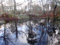
(5) Follow the road to the right along the verge (caution: busy road). After about 150 m, go round the Mare aux Bœufs on the right and you’ll come across a sessile oak leaning out over the pond (note its root system raised above the ground). Continue round the pond to find a service tree on the southern side, then a black alder with a dead trunk. Finish at the south-eastern edge of the pond, where there is a sessile oak. Finally, continue along the D301 to the Carrefour de Recloses (S/E).


 Visorando Member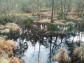
 Moderate
 Difficult