Country:


(S) Walk a short way up the road towards the east, turn left onto the lane leading to the “Cheval Roc Hotel” and walk past the hotel.
(1) Leave the path leading down to Fort la Crête on your left. Further on, the path turns right to begin a lovely climb towards the Platons car park.
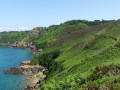
(2) Just below the car park, follow the path which turns left, running parallel to the road heading east. The path descends to the left to go round the speed cameras. Stay on the main upper path, which joins the lower path almost at the summit of La Belle Hougue. The path goes round the headland to the junction with the Chemin de la Belle Hougue.
(3) Leave this road on your right and continue along the path, which bends and descends to the left. Further on, you’ll enter a wooded area (Egypt Wood) and pass a plaque commemoratingOperation Hardtack 28 in 1943, overlooking Wolf’s Lair, a small, very secluded cottage near the water. The path begins to climb up to a junction.
(4) Continue along the path. The climb becomes gentler and more even. A small path leads slightly uphill to the left: after a few dozen metres, it reaches a stone hut (an observation post?) offering a panoramic view of Bouley Bay.
(5) Return to the main path and keep to the left. The route takes you past a tea plantation on the right, then descends to the road leading to Bouley. Walk all the way down the road.
(6) Walk to the jetty overlooked by Fort Leicester to enjoy the well-deserved view.
(7) Retrace your steps.
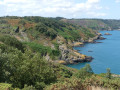
(6) Pass the Mad Mary café again and, once you’ve gone past the old abandoned hotel (a relic of holidays from the 1960s and 1970s), take the small road leading uphill on your left. The path enters a wooded area. Leave the path leading up to the Jardin d’Olivet on your right and stay on the coastal path. Further on, the path leads to a rock amidst the ferns, offering a beautiful viewpoint.
(8) From Motorbyke Rock, ignore the path climbing to the right and stay on the coastal path, ignoring the paths branching off to the right, until you reach the White Rock car park.
(9) Follow the track to Rue du Catel. Follow it to the left as far as Rozel and head down towards the sea.
(10) Walk to the jetty and retrace your steps.
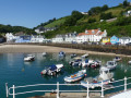
(10) Return to the bus at the village exit via the pebble beach, then take Impasse Breque du Sud, at the end of which you’ll find the bus stop (100 metres further on, you can enjoy a lovely panoramic view of Rozel) (E).
 Association / Club / Walk leader
 Easy
Easy  Visorando Member