Country:

 City:


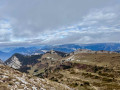
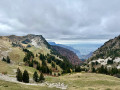
The route starts at the Col de la Placette, accessible via its southern slope from Saint-Égrève, heading up the D105 via Proveysieux and then Pomarey. The northern slope of the Col has been closed for many years.
(S/E) Head towards the Chalet de la Charmette and, after 100 m, turn left onto the signposted forest track which leads to a crossroads near the chalet-hotel. Turn left to climb along a forest track towards Vararey and the Col d’Hurtières. Follow this marked path, where flat sections alternate with steep climbs, until you reach a path junction marked by a cairn.
(1) Turn right onto the less well-trodden and unmarked path, heading towards Golet d’Hurtières. It climbs through the forest, reaching a limestone cliff (Cime de la Charrière or Rocher du Plan), which it follows to the left. It joins an old forest track, which you follow northwards on a gentle slope to a path junction (at 1,580 m).
(2) Turn left and climb straight up to the Goulet d’Hurtières pass.
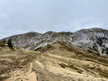
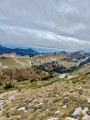
(3) Descend on the other side (the path may be slippery) and take the path winding beneath the Mollard de la Chaleur to the right. It runs level across the terrain to a drinking trough, then climbs up the opposite side through the mountain pasture to the Col de la Sure.
(4) Head up to the left following the tracks through the mountain pasture. After two grassy humps, the path veers left and crosses a much rockier section to the summit of the Grande Sure (cross).
(5) Return via the same route (take care at the start) to the Col de la Sure.
(4) Head back up the track on the opposite side (towards the east) through the mountain pasture towards the clearly visible Col de la Grande Vache.
(6) Cross over to the other side of the pass and descend along a path that is sometimes easy going, sometimes steep and rocky, but always wide. It enters the forest, is joined by the Petite Vache path coming from the left (no sign) and arrives at a junction of forest tracks.
(7) Ignore the track on the right which climbs towards the Goulet d’Hurtières and continue descending towards the Pas de l’Âne.
(8) Pass this section carved into the slope and descend the steep stretch to a timber storage area; the rest of the route is gentle towards the Chalet de la Charmette.
(9) From the Chalet car park, head down the road to the Col de la Charmette (S/E).
 Visorando Member
 Difficult