Country:
 City:


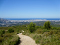
From Aubagne or Les Camoins, follow the D44 to the junction with the Clinique Saint-Michel. Turn right or left depending on which direction you’re coming from to join the Chemin de Ruissatel. Follow it to the end to reach a large, shaded car park: please note, the road is very narrow with difficult passing points in places.
(S/E) Continue to the junction with the Chemin de la Font de Mai.
PR® yellow and blue signposting
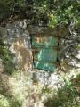
Turn left and follow the road until it becomes completely unpaved. Go through a forest gate, then immediately turn onto the track on the right which leads to a shaded crossroads where there is an old stone well.
PR® yellow markings
(1) Before reaching the well, turn left onto a path. After a few wide hairpin bends, the path turns decisively northwards and climbs straight up the very steep slope. Pass the first electricity pylon and carry on to the next one, where you’ll emerge onto a stony track (signposted).
(2) Turn right. Continue to the junction with another track running across.
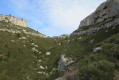
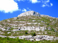
(3) Continue to the right. Stay on the track, avoiding the awkward steep section that cuts across several bends. With the summit of Garlaban in your sights, make your way to the Col de Garlaban.
No signposting
(4) Leave the track by veering right through the shaded area to reach a small wayside shrine, at the foot of which the path leading to the summit begins. Reach the foot of a rocky outcrop which you must go round to the right: a commemorative plaque fixed to the rock face serves as a landmark.
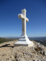
(5) A tricky junction: leave the path on your left (cairn) – which you’ll take on the descent – and continue in the same direction over unstable, steep, stony ground. Reach the Croix de Garlaban, which marks the summit.
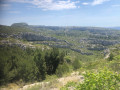
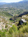
(6) “Take in the exceptional 360° panorama: Marseille, the Aubagne basin, Sainte-Victoire, the Chaîne de l’Étoile and, on a clear day, the peaks of the Mercantour to the east and the Canigou to the west!”
Follow the same route back as on the way up until you reach the cairn.
(5) Head straight along the path, which eventually leads onto a wider cross-country track after a steep descent. Turn right and continue for about 250 metres.
(7) A tricky junction: look out for a partially collapsed cairn on the left-hand side of the path, with a stone on top bearing a very old blue mark. Turn left onto a path leading to another cairn in much better condition than the previous one; at this point, turn left. After a short section where you’ll need to use your hands to climb down, continue to the junction with the Sentier des Dansaïres (wooden signpost marked ‘L’Antique’).
(8) Turn right. The very stony path, which has a few sections over rocky slabs, requires caution and makes for rather laborious going. You’ll reach an inverted Y-shaped junction with a rock bearing the inscription ‘Déviation Garlaban’. This junction is visible on the map when zoomed in closely.
YellowPR® signposting
Continue straight ahead. Walk alongside a high dry-stone wall on your right-hand side until you reach another junction.
No markings
(9) Take a sharp right-hand bend. Follow the narrow path which passes a first hut – rather an eyesore in these surroundings – then a second stone hut, before emerging onto a large open area with two fire cisterns on the left. Go straight on, keep to the right at the next junction and begin the steep climb leading to a clearly visible high point. Then continue downhill to reach a large crossroads preceded by several picturesque ruins: fire cisterns are present.
(10) Carry on straight ahead, staying on the same track and ignoring a turn-off on the left leading to Les Gavots. You’ll come out onto the Chemin de la Croix du Garlaban, which is stony at first and then tarmacked. Pass the first private road on the right and carry on to the next one.
(11) Leave the road at a concrete post and turn right onto a path that is very difficult to make out at first; it descends almost directly beneath a power line to join the Impasse du Baou downstream from the Source buildings. Turn left and follow this path to the junction with the Chemin Bec Cornu (fire hydrant and recycling bins).
(12) Turn right. Further on, ignore the Impasse du Grand Duc and head into the woodland, keeping to the left of a fence.
(13) At the corner of the path, leave the tarmac road and turn left onto a track blocked to motor vehicles by a chain. When you come within sight of a rather dilapidated building, turn right just before it.
The path reaches a first junction where you should keep to the right. At the next junction, marked by a wooden post, go straight on and then turn sharply left at a small wooden sign bearing the inscription ‘Fin de dérogation’. You’ll come out onto a very recently laid concrete track; follow it to the left until you reach a crossroads.
(14) Keep to the right to reach the eco-museum and its refreshment kiosk, which is open during the high season. Walk past the building, then turn sharply left onto a shaded path which leads shortly afterwards to a large, tree-lined area (with a vegetable patch on the left-hand side).
Carry on straight ahead. Immediately afterwards, turn right, following the wooden sign marked ‘César Antoine’. The uphill path runs parallel to the Chemin de la Font de Mai, which is a few metres to the left, before eventually joining it. Continue to the right, then turn left at the first junction to return to the car park (S/E).

 Visorando Member

 Moderate

 Easy