Country:
 City:


Car park: Espace Ti Lokorn.
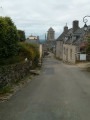
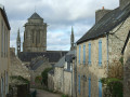
(S/E) On leaving the car park, turn right, walk past Espace Ti Lokorn and then the library. At the glassworks, turn left onto the Venelle des Templiers.
GR®38: red and white markings
Follow this small, uphill road which runs alongside the cemetery.
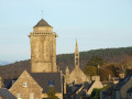
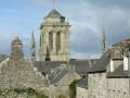
(1) At the top, turn right to enter the grounds of the Manoir de Kerguénolé, from where you’ll have a breathtaking view of Locronan. Cross this communal land and, at the exit, follow the small road leading uphill to the left (an ancient Roman road).
Unmarked
(2) Turn left onto a straight, stony track that climbs straight ahead. This is the Chemin des Carrières. After a descent, veer to the right.
GR®38: red and white markings
(3) At the next three-way junction, turn left following the markings. Continue along this path at the edge of the woodland, overlooking the campsite below on your left.
At the next fork, continue to the right, ignoring the path coming up from the left from the campsite. Continue along this rutted track until you reach the junction with a small road at a place called Coat Beuliec, marked by a small wayside cross. Turn left onto the road and follow it for about ten metres.
No signposting
(4) Follow this small road to the left as it climbs straight up towards the summit of the Locronan mountain. At the junction with the road branching off to the left (sign for the campsite, 300 m), walk a few metres to the left to enjoy a sweeping view of Douarnenez Bay and Ménez Hom. Continue uphill to reach the site of the Chapelle ar Sonj (Chapel of Remembrance), a major centre of the Tromenie tradition.
(5) Enter the enclosure, passing by the stone pulpit dating from 1887. The chapel is usually closed, but a heart-shaped peephole allows you to glimpse the interior, including a lovely modern stained-glass window by Bazaine. There’s a beautiful view over the Porzay plain and it’s a lovely spot for a break.
On leaving, continue to the left until you reach the end of the road (small parking area).
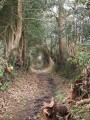
(6) Turn right and head into the woods (large aerial on the left), following the widest path which descends gently amongst the moss-covered oak bushes.
This path is somewhat eroded in places and requires a degree of caution. Always stay on the main path.
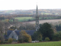
Above a field, you’ll come to an even wider path (with a view of the chapel) and follow this path, using the bell tower as a landmark.
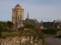
Enter the enclosure to walk round this imposing chapel with its calvary, at the base of which stands a statue of Saint Thélau (or Théleau) on a stag.
(7) Leave the enclosure (chain) and join the small road, which you follow to the right. Pass the turn-off for the hamlet of La Boissière and reach a fork in the road.
GR®38: red and white markings
(8) Turn right at the sign for Ty Conan and follow this road uphill. Pass the hamlet on your right and carry on. The gradient becomes steeper. Walk alongside a coniferous woodland (PEFC-certified forest sign). Continue along the same road, as the route shown on the IGN map leading to Coat Forestier is no longer accurate, and reach the crossroads at Coat Beuliec.
Off the marked route
(4) Turn left and follow the small road as it descends steadily. Pass a water reservoir on the right and reach a crossroads where Croaz Kében is situated, an unmissable landmark on the Tromenie de Locronan route.
(9) Turn right and head down this ancient Roman road. Pass the Chemin des Carrières, which you took on the way there, and reach a fork in the road.
GR®38: red and white markings
At an old wooden bench, turn left downhill and emerge onto a small open space with a bench.
Turn right, go through the wooden gate (sign prohibiting horses) and head down this gullied sunken path called Venelle Leur ar Person, which runs alongside a property wall on your left. You’ll reach a street; note the imposing stone building on your right. Continue along the path, which turns left.
At the end of the path, follow the road straight ahead, which bends first to the left then to the right, and leads into Rue du Prieuré, the main street of Locronan.
Unmarked
(10) Turn left, then follow the Route de Gorréquer on the left, which leads to the D63, the road to Quimper. Cross with extreme caution and continue along the wide path opposite until you reach a fork facing a path between fields.
Mountain bike signpost 7–8
At the signpost, veer right, continue along the tarmac track to Park Tri Horn and join the small road leading to the Bois du Névet. Follow this road to the left (speed limit 50 km/h), passing the Latitude Ouest hotel. Ignore two roads on the right and proceed to the barrier marking the entrance to the woods. There is a car park on the left-hand side.
Take the main lane (Hent Kreiz), pass the forester’s cottage and, about ten metres further on, turn right onto the path that leads into the woodland. At the first junction (not shown on the map), turn right towards the edge of the woodland, marked by a wire fence. Continue, keeping the wire fence on your right, until you reach the junction with theGR®38.
“No signposting” (theGR® route is no longer up to date)
(11) Turn right through the gap in the wire fence and continue towards the houses at Plas ar Lochou. At the crossroads, carry on along the small road that climbs towards the D7: panoramic views of Douarnenez Bay and Ménez Hom.
Cross this departmental road with extreme caution and continue almost directly opposite along the white track towards Kermenguy Farm on your left. Reach a junction and continue straight ahead along a dirt track below a plastics factory. Pass the large Kerbléon livestock farm on your left, cross Rodou Glaz Farm and join a small road.
(12) First turn right then left and continue along the tree-lined track. Ignore a track on the right, pass a small stone cross and follow the access road to the sewage treatment plant (Chemin de Parc Ar Fouenec) straight on until you reach another junction.
(13) Turn left, leaving theGR® to continue to the right, pass through the hamlet of Goulit ar Guer (where some lovely restoration work is under way) and head up towards the Croaz Troyout cross. Turn right onto a path running along the edge of the fields, ignoring a path on the right. Shortly afterwards, you’ll see the large farmhouse at Prad Treanna on your left, along with its access road, before reaching the D63.
(14) Cross this county road with care and continue straight ahead along the track which crosses a small road near a new cross, Croaz Ruz. Follow the sunken lane, the Chemin du Créach, and you’ll reach the hamlet of the same name. Turn right onto the small road leading to Kervavarn Farm.
(15) Take the path on the right which goes round this farm and continue along the sunken lane (I have never actually seen the menhir shown on the map). At the crossroads, turn right and continue along the path nestled between the fields. Cut across a small road and, opposite, take the path which runs behind the houses in the hamlet known as Le Styvel. Follow the track to the left towards the D7.
(16) Cross this road with care and head uphill along the path which continues as a street. At the junction with the Chemin de Kervelec, turn right and continue for about 50 metres until you reach a side path.
(17) Turn left onto this small path, cross the Vieille Route de Plonévez and continue along the path opposite, which leads onto Rue Moal. On this street, note the layout of two houses which were originally intended to form a single dwelling: they share a common doorframe. Head down to the right towards the wayside cross, then turn left towards the Chapel of Notre-Dame de Bonne Nouvelle and the Saint-Eutrope Fountain, which is next to a washhouse.
(18) Take the stony path that climbs up behind the chapel, ignore the path you come across on the right and you’ll end up in a narrow alleyway. Turn left into the street that runs between the school on the right and a beautiful property on the left, leading out onto Locronan’s central square.
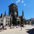
(19) Turn right, walk past the imposing porch of Saint-Ronan’s Church (open to visitors) and turn left twice onto the path between the church and the cemetery. Cross a street and continue straight ahead, walking past the post office.
(20) Turn right onto the footpath that runs alongside the car park reserved for town hall users and, at the end, turn right to reach the glassworks. Turn left, walk past the library and then L’Espace Ti Lokorn, where the starting point car park is located (S/E).


 Visorando Member

 Easy