Grand Crêt via the Combe à Fournier

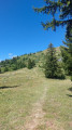
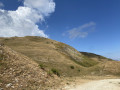
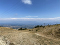
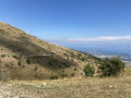
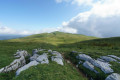
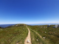
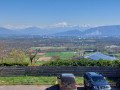
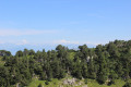
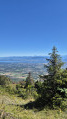
This walk offers stunning views of Lake Geneva and the Alps in the first part, followed by views of the Jura Mountains. You can also start from the Catheline cable car.

Details

25037172
Creation:
Last update:
Last review:
  • Walking
    Activity: Walking
  • ↔
    Distance: 6.11 mi
  • ◔
    Average duration: 4h 05 
  • ▲
    Difficulty: Moderate

  • ⚐
    Back to start: Yes
  • ↗
    Ascent: + 1,430 ft
  • ↘
    Descent: - 1,430 ft

  • ▲
    Highest point: 5,581 ft
  • ▼
    Lowest point: 4,239 ft

Photos

Description of the walk

Park your car in the car park at the Fierney cable car station, which is open at weekends in summer and on certain weekdays (check the website). Take this cable car.

(S/E) Head north-east as you leave the top station. Follow the path which climbs gently; then, at the first fork, turn left to climb towards the Col de Crozet.

(1) Turn left to pass under the power line and the Les Bergers chairlift. Continue along the Chemin de la Ramaz.

(2) 50 m before a log bridge, leave the forest track and turn right, heading uphill towards Montoiseau (note: the path is not very visible). You’ll reach the top station of the Les Bergers chairlift, where a picnic bench offers your first view of Lake Geneva and the Pays de Gex.

(3) Head gently downhill to the left, bypassing the water source on the right, then turn almost directly opposite into the Combe à Fournier. You’ll see yellow markings on small posts and the remains of blue markings: follow this path, which climbs gently up the side of the valley. Then turn right to walk alongside a stone wall until you reach the Asters and Anémones ski runs.

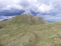
(4) Turn left immediately to climb towards the Grand Crêt along a well-marked path. Once at the summit, continue along the ridge path to join the GR® de la GTJ (GR®509).

(5) Turn right straight away to head down towards the Catheline cable car, following the GR®.

(6) Leave the GR® and take the PR® (yellow markings) which branches off to the right. Stay on level ground to reach the Catheline cable car. You can enjoy the view of the Jura mountain range.

(7) Once you reach the Catheline cable car, ignore thefirst path running alongside the ski lift; head slightly uphill to the right onto thesecond path on the right, towards the Col de Crozet, then continue to the right towards the orientation table.

(8) Take a few minutes to have a look at the orientation table, which offers breathtaking views of the Alps and Mont Blanc. Then head down towards the Fierney cable car.

(1) Carry on straight ahead to reach the cable car’s top station (S/E).

Waypoints

  1. S/E : mi 0 - alt. 4,239 ft - Fierney Cable Car
  2. 1 : mi 0.79 - alt. 4,541 ft - Junction of the circular loop
  3. 2 : mi 1.11 - alt. 4,747 ft - Turn right at the fork
  4. 3 : mi 1.67 - alt. 5,180 ft - Picnic table
  5. 4 : mi 2.23 - alt. 5,292 ft - Junction with the ridge trail
  6. 5 : mi 2.87 - alt. 5,518 ft - Sous les Crêts - Grand+Crêt (Sergy)
  7. 6 : mi 3.47 - alt. 5,144 ft - GR/PR junction
  8. 7 : mi 4.25 - alt. 4,744 ft - Catheline Cable Car
  9. 8 : mi 4.61 - alt. 4,872 ft - Orientation table - Col de Crozet
  10. S/E : mi 6.11 - alt. 4,239 ft - Fierney cable car

Notes

Toilets are available at the Catheline and Fierney cable car stations.

This route passes through multiple protected areas, which may be subject to special regulations:

Always be cautious and plan ahead when you're outdoors. Visorando and the author of this route cannot be held responsible for any accidents occurring on this route.

The GR® and PR® markings are the intellectual property of the Fédération Française de Randonnée Pédestre.

Reviews and comments

4 / 5
Based on 2 reviews

Reliability of the description
3.5 / 5
Ease of following the route
3.5 / 5
Route interest
5 / 5
couagga
couagga

Overall rating : 4 / 5

Date of your route : Aug 07, 2026
Reliability of the description : ★★★☆☆ Average
Ease of following the route : ★★★★☆ Good
Route interest : ★★★★★ Very good
Very busy route : No

A really lovely walk we did on 7 August 2026!

There were two of us hikers of average ability, and the route was just right for us. By the end of the route, we’d covered 10.2 km; I think we must have strayed from the route whilst following the yellow markings without realising it, as we found our way back onto it quite easily.

As for other people: we didn’t come across anyone between points 1 and 3, and just a few walkers between points 3 and 5. However, the section on the GR between points 5 and 6 was quite busy. Between points 6 and 8, there were a few walkers, but nothing more.

Regarding the route:

For point 2, you must turn left 50 metres before the Canadian crossing, following the yellow markings. Your route will be slightly off the Visorando route, but this path – although a bit challenging because it’s quite steep (manageable if you take a few breaks) – is well worth the detour; it’s absolutely stunning.

Between point 5 and point 6, the path is quite steep; it’s a descent with lots of stones, on which you can sometimes twist your ankles. It’s doable, but the length of the path means you’re very glad to reach the end of it.

We didn’t encounter any particular difficulties for the rest of the way; I’d just say that once you reach point 7, you need to take the middle path, which goes more or less straight on after the gate. Leave the path furthest to the left and the one furthest to the right, and take the one in between.

The walk takes you across both sides of the mountain; the paths are sometimes grassy or earthen, sometimes lined with stones, which makes for a very varied landscape. The views are magnificent. We highly recommend this route!

Machine-translated

User 13835781

Overall rating : 4 / 5

Date of your route : Jun 21, 2025
Reliability of the description : ★★★★☆ Good
Ease of following the route : ★★★☆☆ Average
Route interest : ★★★★★ Very good
Very busy route : No

Did this hike the day before yesterday.
A very beautiful loop.
A good walker can complete it in 2.5 hours.
Some information about what has changed:

At point 2, the path that climbs to the right towards Montoiseau is now clearly visible, but it is 50 metres BEFORE the cattle grid.

At point 3, go down slightly to the left (actually, it's almost straight ahead) and leave a small water source on your left. Then, the entrance to the trail that branches off to the left into the Combe a Fournier is very well marked with small yellow posts all the way to Grand Crêt (ignore the old blue markings).

At point 7, there are two paths leading off to the right. Don't take the one furthest to the right along the ski lift, but the other one.

The rest is fairly straightforward, but don't do what I did and try to do the hike without at least looking at the route on the map first to get a general idea of the trail. The description alone is not enough.

Enjoy the walk!

Machine-translated

Other walks in the area

For more walks, use our search engine .

The GPS track and description are the property of this route's author. Please do not copy them without permission.