Th58jardin

 Visorando Member
 Premium user
 Sign up:
Published route(s)
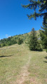
 Grand Crêt via the Combe à Fournier
 6.11 mi
 +1,430 ft
 -1,430 ft
 4h 05
4h 05
 Moderate
 Departure from Crozet (Ain)
This walk offers stunning views of Lake Geneva and the Alps in the first part, followed by views of the Jura Mountains. You can also start from the Catheline cable car.
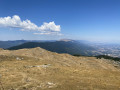
Pierre à Fromage via the Crêt de la Goutte
 5.39 mi
+1,591 ft
-1,585 ft
3h 50
Moderate
Departure from Confort (Ain)
5.39 mi
+1,591 ft
-1,585 ft
3h 50
Moderate
Departure from Confort (Ain)
A family hike offering views of the Mont Blanc massif and the Pays de Gex
 Difficult