Gousseauville – Longroy via the forest

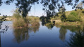
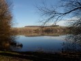
If you love the forest and walks by the water’s edge, come and recharge your batteries in this soothing natural setting. There are plenty of benches waiting for you by the water’s edge.

Details

9985336
Creation:
Last update:
Last review:
  • Walking
    Activity: Walking
  • ↔
    Distance: 5.15 mi
  • ◔
    Average duration: 2h 40 
  • ▲
    Difficulty: Easy

  • ⚐
    Back to start: Yes
  • ↗
    Ascent: + 354 ft
  • ↘
    Descent: - 335 ft

  • ▲
    Highest point: 390 ft
  • ▼
    Lowest point: 66 ft
  • ⚐ Country: France
  • ⚐ City: Incheville (76117)
  • ⚑
    Start/End: N 50.001455° / E 1.519554°
  • ❏
    IGN map(s): Ref. 2108OT
  • Hour-by-hour weather

Photos

Description of the walk

Park on Rue Alphonse Daudet, along the pavement (a quiet little street).

(S/E) Exit on the church side and walk back up Rue Alphonse Daudet. Cross Rue Alfred de Musset (D49), go up Rue Georges Sand opposite and continue alongside the cemetery. Carry on straight along the path for 100 m. Turn left. Don’t miss the path on the right 60 m further on.

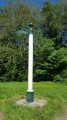
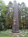
(1) Turn right, continue climbing along a sunken track to the edge of the forest (380 m) and follow it to the left to join a path. Pass a track on your right and carry on to the Rond de Nemours (photo attached).

(2) Turn immediately left onto the track (Route Adélaïde). After a wide right-hand bend downhill, don’t miss a small path on the left.

(3) Follow it down. After 300 m, the path joins a track; take this track to the left at the hairpin bend. Follow this track downhill for about 1,000 m and turn onto the path on the right, just before the forest gate on the Chemin Vide Bouteille.

(4) In front of Longroy Town Hall, take the road leading down to the left to reach the junction with Rue Georges Clemenceau. Turn right for 60 m, then left into Rue de la Libération.

(5) Cross the railway line. Cross the bridge over the Bresle, which takes you from the department of Seine-Maritime into the Somme.

(6) Turn left immediately and go under the gantry to reach the path along the ponds known as the “Chemin entre Verre et Mer”. Continue straight ahead on the tarmac surface until you see a bridge on your left.

(7) Cross this bridge and turn right. Continue on to cross another bridge on the right and finally a last bridge on the left.

(8) On the left, cross the railway line and turn right to rejoin Rue Alphonse Daudet (S/E).

Waypoints

  1. S/E : mi 0 - alt. 66 ft - Gousseauville – Rue Alphonse Daudet
  2. 1 : mi 0.27 - alt. 151 ft - Turn right at the fork
  3. 2 : mi 1.02 - alt. 377 ft - Rond de Nemours
  4. 3 : mi 1.86 - alt. 374 ft - Path leading down to the left
  5. 4 : mi 3.47 - alt. 157 ft - Longroy Town Hall
  6. 5 : mi 3.71 - alt. 82 ft - Railway line
  7. 6 : mi 3.78 - alt. 79 ft - Swing set
  8. 7 : mi 4.55 - alt. 72 ft - First bridge
  9. 8 : mi 5.03 - alt. 66 ft - On the left, railway line
  10. S/E : mi 5.15 - alt. 66 ft - Gousseauville, Rue Alphonse Daudet

Notes

Wear sturdy shoes and avoid rainy weather.
The path is not suitable for pushchairs

Worth a visit

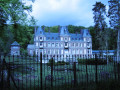
Unique accommodation on the water at Les Ecuries du Lieu-Dieu.
Boating on the ponds.
Le Tréport, 15 km away: its beach and harbours (commercial, fishing and marina).
Eu, 10 km away, a royal town: Château Louis-Philippe.

Reviews and comments

4.2 / 5
Based on 3 reviews

Reliability of the description
4 / 5
Ease of following the route
4.3 / 5
Route interest
4.3 / 5
Jean Paul
Jean Paul

Overall rating : 3.3 / 5

Date of your route : Jul 07, 2022
Reliability of the description : ★★☆☆☆ Disappointing
Ease of following the route : ★★★☆☆ Average
Route interest : ★★★★★ Very good
Very busy route : No

The route should be tackled in the opposite direction, otherwise there is a steep climb from the start up to the top of the forest. The starting point is the Longroy car park, just before the level crossing (marked No. 6 on the map).

Machine-translated

Yves Verhaeghe
Yves Verhaeghe

Overall rating : 4.7 / 5

Date of your route : Feb 14, 2022
Reliability of the description : ★★★★★ Very good
Ease of following the route : ★★★★★ Very good
Route interest : ★★★★☆ Good
Very busy route : Yes

A varied and enjoyable route.

Machine-translated

gargouilledelarando
gargouilledelarando

Overall rating : 4.7 / 5

Date of your route : Aug 19, 2021
Reliability of the description : ★★★★★ Very good
Ease of following the route : ★★★★★ Very good
Route interest : ★★★★☆ Good
Very busy route : No

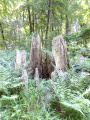
A pleasant walk with soothing scenery, particularly in the wooded section. No significant difficulties.

Watch out for mud if the weather is wet.

Machine-translated

Other walks in the area

For more walks, use our search engine .

The GPS track and description are the property of this route's author. Please do not copy them without permission.