Country:
 City:


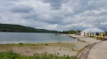
To park, once you reach Incheville, take Rue Maurice Maillard to the right of the church. Cross the railway line and turn right onto Rue Mozart. Walk past the tennis courts and football pitches (you can park here). Pass the motorhome car park and, 50 metres further on before the bridge, turn right. There is a car park a little further on, along with some picnic tables.
(S/E) Head towards Rue Mozart on the left, walking past the football pitches and tennis courts. At the end of the street, turn left onto Rue Maurice Maillard, cross the railway line and continue to the roundabout by the church. Go round the roundabout and take Rue Pierre et Marie Curie opposite, for about 200 metres.
(1) At the third street on the right, turn into Rue Jules Renard. At the end of the street, turn left onto Rue Jean De La Fontaine. At the junction, turn right into Rue de l’Égalité.
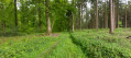
(2) Go straight on, past the cemetery, and continue straight on along the path that climbs into the forest.
Leave the path on your left and carry on straight through the woods. The path is circular and curves to the left. Stay on this path.
(3) At the end of the path, take the main road on the left (Route Louise). Follow the road and, at the junction with Route Saint-Martin, turn left. Please note: take the small path to the right of the main road. Follow this small path to the end.
(4) At the junction with a main track, continue along the track opposite and follow it straight on. At the end, turn right (Route Fernandine) and go to the end of the track just before the gate.
(5) At the barrier, follow the path on the left which runs almost parallel to the tarmac road. Follow the path until it joins a road and continue to the junction with the D58. Take the path opposite which goes uphill, and follow it to the end. At the junction, turn left and follow the D126 on the right-hand side for about 100 m.
(6) Take the path on the right and walk along the edge of the forest. At the T-junction, take the path on the left (yellow markings), which descends quite steeply after 100 m to join the D126 at the ‘Hêtre des Princes’ signpost.
(7) Turn left onto the “Route Adélaïde” path, signposted by the post, leaving the D126 and the C4 on your left. The path climbs to the left and curves in a wide S-shape.
(8) After the sweeping S-bend, at the junction, take the path on the left which runs diagonally and descends to a road. Follow the path which immediately turns right again.
(9) Pass the pumping station on your right and continue along the track which follows the high-voltage power line, then passes underneath it. Stay on this main track (Route Adélaïde) until you reach the Poteau du Rond De Nemours signpost.
(10) At the post, take the path straight ahead (still Route Adélaïde) and continue along this path, which makes a wide circular loop to the right. After about 1,300 m, turn onto the small path that descends at an acute angle towards the bottom of the valley (be careful not to take the path descending at a right angle).
(11) At the bottom of the gully, take a sharp left-hand bend and follow this wide path to the D49 (Route d’Eu). Follow the D49 to the right for 100 m, cross the road (be careful – there is a lot of traffic) to rejoin the path that crosses the railway line. After the railway line, turn left to reach a field.
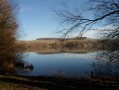
(12) Turn right at the footbridge and head towards the ponds. Turn left (alternative route: see Practical Information). Walk alongside the pond until you reach a footbridge over the Bresle on the left.
(13) Cross the footbridge and follow the path on the right which runs alongside the railway line on your left. At the end of the path, turn left and cross the railway line. At the junction, turn right onto Rue Alphonse Daudet and follow it to the end.
(14) Turn right onto Rue Madame de Sévigné, cross the railway line and head towards the ponds via the small path on the left.
(15) Walk alongside the ponds on the right or left and return to the car park at the Salle Polyvalente J. Anquetil (S/E).

 Visorando Member

 Easy